Chest opened
+${chestReward.xp} XP
Explorer
NOUVEAU ×${chestReward.collectible.quantity}
tapez pour fermer
Chest locked

Open chests in the app

Around Us is built for your phone — chests unlock when you walk, explore and capture nearby places.

Enable Location

We need your location to show you interesting places around you

Discover nearby places

Find interesting locations and hidden gems around you

Precise directions

Get accurate directions and distances to places

Your location is never shared with other users. It's only used when you tap the location button.

Log in to your account

Start exploring — it's free

Trusted by 72,876 travelers worldwide

Continue with Google
Continue with Apple
or

We will send you a code to connect

By continuing, you accept our Terms and Conditions and our Privacy Policy

Check your inbox

We've sent a pincode in your inbox. Please enter the code below.

Pueblo Del Rio
Discussion Reviews Photo
7.8k Popularity

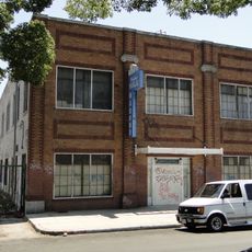
Pueblo Del Rio, Public housing development in Central-Alameda, Los Angeles, US.

Pueblo Del Rio is a residential development with multiple apartment buildings arranged around community spaces and green areas. The site includes a recreation center and sits near several schools that serve the neighborhood.

The development was built in 1941 to house factory workers and military veterans during a time of housing shortage. It represented a modern approach to providing affordable homes for working families.

The neighborhood was designed by prominent architects who shaped how residents experience their homes and shared spaces. Their work created a distinct character that still defines daily life here.

The neighborhood is walkable and provides easy access to nearby schools and community facilities throughout the grounds. Visitors can move through the various residential areas at their own pace to experience the layout.

The development is notable for having families live there across multiple generations since its founding. This makes it an unusual example of long-term community roots in an urban setting.

The community of curious travelers

AroundUs brings together thousands of curated places, local tips, and hidden gems, enriched daily by 60,000 contributors worldwide.

Start exploring
GPS coordinates
33.99439,-118.24275
Latest update
December 10, 2025 15:46
Around this place
Los Angeles Memorial Coliseum
United States of America

Los Angeles Memorial Coliseum

4.7 km
Wrigley Field
United States of America

Wrigley Field

2.6 km
California Science Center
United States of America

California Science Center

4.7 km
Galen Center
United States of America

Galen Center

4.6 km
Atchison, Topeka and Santa Fe Railway 3751
United States of America

Atchison, Topeka and Santa Fe Railway 3751

3 km
Exposition Park
United States of America

Exposition Park

4.7 km
United States of America

South Central Farm

1.6 km
Dunbar Hotel
United States of America

Dunbar Hotel

1.8 km
King Estates
United States of America

King Estates

4.5 km
Sears, Roebuck & Company Mail Order Building
United States of America

Sears, Roebuck & Company Mail Order Building

3.8 km
Coca-Cola Building
United States of America

Coca-Cola Building

3.8 km
California African American Museum
United States of America

California African American Museum

4.5 km
Exposition Park Rose Garden
United States of America

Exposition Park Rose Garden

4.6 km
28th Street YMCA
United States of America

28th Street YMCA

2.8 km
Wallis Annenberg Building
United States of America

Wallis Annenberg Building

4.4 km
Fire Station No. 30, Engine Company No. 30
United States of America

Fire Station No. 30, Engine Company No. 30

3.8 km
27th Street Historic District
United States of America

27th Street Historic District

3 km
Ralph J. Bunche House
United States of America

Ralph J. Bunche House

2 km
Lincoln Theatre
United States of America

Lincoln Theatre

3.1 km
Space Shuttle Endeavour
United States of America

Space Shuttle Endeavour

4.6 km
52nd Place Historic District
United States of America

52nd Place Historic District

1.8 km
Punchbowl Formation
United States of America

Punchbowl Formation

4 km
Roosevelt Building
United States of America

Roosevelt Building

2.9 km
Prince Hall Masonic Temple
United States of America

Prince Hall Masonic Temple

1.4 km
Bethlehem Baptist Church
United States of America

Bethlehem Baptist Church

652 m
Widney Hall
United States of America

Widney Hall

4.7 km
Golden State Mutual Life Insurance Building
United States of America

Golden State Mutual Life Insurance Building

1.8 km
John Muir Branch Library
United States of America

John Muir Branch Library

4.8 km
Show the full map
Reviews
Share your experience

No review yet

Discussions
Start a discussion...

No discussion yet

« Pueblo Del Rio - Public housing development in Central-Alameda, Los Angeles, US » is provided by Around Us (aroundus.com). Images and texts are derived from Wikimedia project under a Creative Commons license. You are allowed to copy, distribute, and modify copies of this page, under the conditions set by the license, as long as this note is clearly visible.

Discover hidden gems everywhere you go!

From secret cafés to breathtaking viewpoints, skip the crowded tourist spots and find places that match your style. Our app makes it easy with voice search, smart filtering, route optimization, and insider tips from travelers worldwide. Download now for the complete mobile experience.

Around Us App Screenshot

A unique approach to discovering new places

Le Figaro

All the places worth exploring

France Info

A tailor-made excursion in just a few clicks

20 Minutes

Around Us
Travel Guide & Maps
Download

Send to your phone

QR Code
1

Open the camera app on your mobile.

2

Point at the QR code with your camera. A notification will appear.

3

Tap the notification to open the link.