Enable Location

We need your location to show you interesting places around you

Discover nearby places

Find interesting locations and hidden gems around you

Precise directions

Get accurate directions and distances to places

Your location is never shared with other users. It's only used when you tap the location button.

San Diego–Coronado Bridge

Log in to your account

Start exploring — it's free

Trusted by 61,993 travelers worldwide

Continue with Google
Continue with Apple
or

We will send you a code to connect

By continuing, you accept our Terms and Conditions and our Privacy Policy

Check your inbox

We've sent a pincode in your inbox. Please enter the code below.

San Diego–Coronado Bridge

San Diego–Coronado Bridge, Road bridge in San Diego Bay, United States.

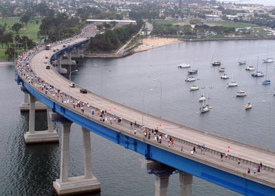
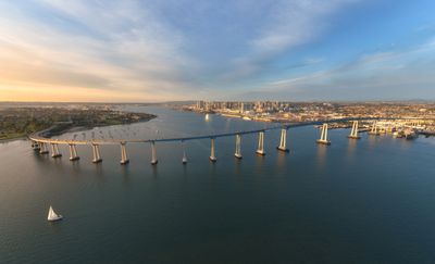
The San Diego–Coronado Bridge is a road bridge in San Diego Bay that features five lanes and follows a sweeping curved path from shore to shore. The prestressed concrete construction rises 61 meters (200 feet) above the water to allow large Navy vessels to pass beneath.

This bridge opened to traffic on August 3, 1969, replacing the ferry service that had connected the two shores. A toll system was in place for drivers entering Coronado until 2002, when it was removed.

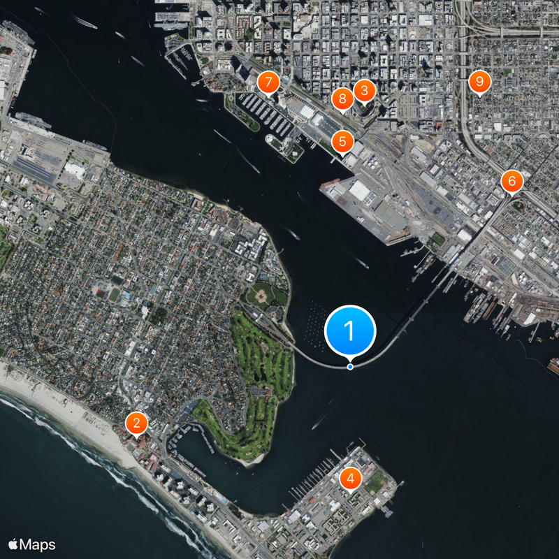
At the southern entrance to Coronado, the blue arch shape of this structure reminds visitors how much the island access changed life for residents. Today commuters and visitors cross this link daily, while military personnel from the base use it as a direct route to their ships.

The roadway follows a wide curve, so drivers can view the bay from shifting angles as they cross. Cyclists and pedestrians are not permitted on this bridge, so access is limited to cars and buses.

This structure climbs at a grade of about 4.67 percent, then executes an 80-degree turn before descending to the opposite shore. The box girder construction technique used here represented one of the longest spans of its kind worldwide at the time of completion.

The community of curious travelers

AroundUs brings together thousands of curated places, local tips, and hidden gems, enriched daily by 60,000 contributors worldwide.

Start exploring
Location
Inception
August 3, 1969
Official opening
August 3, 1969
Length
3,407 m
Made from material
prestressed concrete
GPS coordinates
32.68650,-117.15830
Latest update
December 13, 2025 18:03
Around this place
Show the full map
« San Diego–Coronado Bridge - Road bridge in San Diego Bay, United States » is provided by Around Us (aroundus.com). Images and texts are derived from Wikimedia project under a Creative Commons license. You are allowed to copy, distribute, and modify copies of this page, under the conditions set by the license, as long as this note is clearly visible.

Discover hidden gems everywhere you go!

From secret cafés to breathtaking viewpoints, skip the crowded tourist spots and find places that match your style. Our app makes it easy with voice search, smart filtering, route optimization, and insider tips from travelers worldwide. Download now for the complete mobile experience.

Around Us App Screenshot

A unique approach to discovering new places

Le Figaro

All the places worth exploring

France Info

A tailor-made excursion in just a few clicks

20 Minutes

Around Us
Travel Guide & Maps
Download

Send to your phone

QR Code
1

Open the camera app on your mobile.

2

Point at the QR code with your camera. A notification will appear.

3

Tap the notification to open the link.