Chest opened
+${chestReward.xp} XP
Explorer
NOUVEAU ×${chestReward.collectible.quantity}
tapez pour fermer
Chest locked

Open chests in the app

Around Us is built for your phone — chests unlock when you walk, explore and capture nearby places.

Enable Location

We need your location to show you interesting places around you

Discover nearby places

Find interesting locations and hidden gems around you

Precise directions

Get accurate directions and distances to places

Your location is never shared with other users. It's only used when you tap the location button.

Log in to your account

Start exploring — it's free

Trusted by 72,980 travelers worldwide

Continue with Google
Continue with Apple
or

We will send you a code to connect

By continuing, you accept our Terms and Conditions and our Privacy Policy

Check your inbox

We've sent a pincode in your inbox. Please enter the code below.

San Rafael Hills
Discussion Reviews Photo
8.8k Popularity

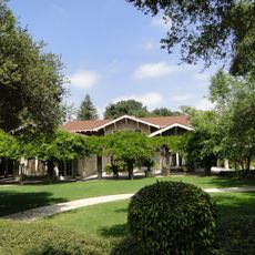
San Rafael Hills, Mountain range in Los Angeles County, California, US.

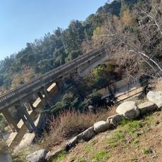
San Rafael Hills is a mountain range in Los Angeles County that runs parallel to the San Gabriel Mountains and reaches about 1,890 feet in elevation. The hills overlook the San Gabriel Valley and form a significant geographic feature in the area.

The Tongva Native Americans lived on these hills for around 8,000 years before Spanish colonizers established Rancho San Rafael in 1784. This land grant marked the shift from indigenous to European control of the area.

The Art Center College of Design sits on the hillside and shapes how the area is used by students and creative projects daily. This presence brings an artistic character to the landscape that residents and visitors notice throughout the year.

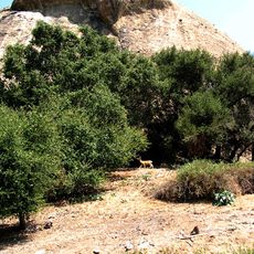
Ernest E. Debs Regional Park provides walking and biking trails in the western section that are easily accessible. Visitors should bring appropriate shoes and water, especially during warmer months.

The northern side holds a large aquifer that draws water from the San Gabriel Valley. This underground system quietly serves the surrounding communities in a way most visitors never realize.

The community of curious travelers

AroundUs brings together thousands of curated places, local tips, and hidden gems, enriched daily by 60,000 contributors worldwide.

Start exploring
Location
GPS coordinates
34.17970,-118.21060
Latest update
December 10, 2025 16:00
Around this place
Rose Bowl
United States of America

Rose Bowl

4.5 km
Gamble House
United States of America

Gamble House

5.6 km
Millard House
United States of America

Millard House

5.2 km
Descanso Gardens
United States of America

Descanso Gardens

2.3 km
Space Flight Operations Facility
United States of America

Space Flight Operations Facility

4.1 km
Alex Theatre
United States of America

Alex Theatre

5.3 km
Museum of Neon Art
United States of America

Museum of Neon Art

5.7 km
Twenty-Five-Foot Space Simulator
United States of America

Twenty-Five-Foot Space Simulator

4.3 km
Kidspace Children's Museum
United States of America

Kidspace Children's Museum

5.1 km
Brookside Golf Course
United States of America

Brookside Golf Course

4.3 km
Catalina Verdugo Adobe
United States of America

Catalina Verdugo Adobe

2 km
Lanterman House
United States of America

Lanterman House

2.8 km
J.W. Schaffer House
United States of America

J.W. Schaffer House

5.3 km
St. Mark's Episcopal Church
United States of America

St. Mark's Episcopal Church

4.5 km
Eagle Rock Community Cultural Center
United States of America

Eagle Rock Community Cultural Center

4.5 km
James Daniel Derby House
United States of America

James Daniel Derby House

2 km
Clark House
United States of America

Clark House

3.3 km
Ard Eevin
United States of America

Ard Eevin

5.5 km
United States of America

Glendale Main Post Office

5.3 km
Park Place-Arroyo Terrace Historic District
United States of America

Park Place-Arroyo Terrace Historic District

5.6 km
Prospect Historic District
United States of America

Prospect Historic District

5.1 km
Louise C. Bentz House
United States of America

Louise C. Bentz House

5.3 km
House at 1015 Prospect Boulevard
United States of America

House at 1015 Prospect Boulevard

4.9 km
Kosy Knook Court
United States of America

Kosy Knook Court

5.7 km
Holly Street Bridge
United States of America

Holly Street Bridge

5.4 km
Reservoir Dogs - Pat and Lorraine's Coffee Shop
United States of America

Reservoir Dogs - Pat and Lorraine's Coffee Shop

5.5 km
Glendale Central Library
United States of America

Glendale Central Library

5.6 km
Eagle Rock
United States of America

Eagle Rock

4.8 km
Show the full map
Reviews
Share your experience

No review yet

Discussions
Start a discussion...

No discussion yet

« San Rafael Hills - Mountain range in Los Angeles County, California, US » is provided by Around Us (aroundus.com). Images and texts are derived from Wikimedia project under a Creative Commons license. You are allowed to copy, distribute, and modify copies of this page, under the conditions set by the license, as long as this note is clearly visible.

Discover hidden gems everywhere you go!

From secret cafés to breathtaking viewpoints, skip the crowded tourist spots and find places that match your style. Our app makes it easy with voice search, smart filtering, route optimization, and insider tips from travelers worldwide. Download now for the complete mobile experience.

Around Us App Screenshot

A unique approach to discovering new places

Le Figaro

All the places worth exploring

France Info

A tailor-made excursion in just a few clicks

20 Minutes

Around Us
Travel Guide & Maps
Download

Send to your phone

QR Code
1

Open the camera app on your mobile.

2

Point at the QR code with your camera. A notification will appear.

3

Tap the notification to open the link.