San Bernardino

Log in to your account

AroundUs is a community-driven map of interesting places, built by curious explorers like you. It grows with every review, story, and photo you share.
Connect to save your favorite spots, contribute locations, and create personalized routes.
By continuing, you accept our Terms and Conditions and our Privacy Policy
Add to collection
Map
Suggest a change
Share

San Bernardino, County seat in Southern California, United States

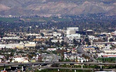
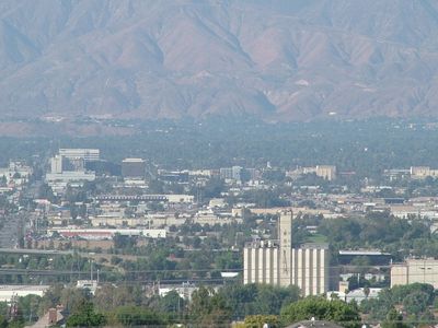
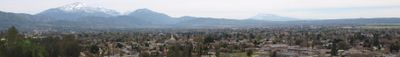
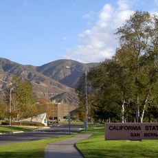
San Bernardino serves as the county seat of San Bernardino County in Southern California, spreading across a wide area between valleys and the foothills of the San Bernardino Mountains. The downtown core clusters around several wide avenues, while residential neighborhoods stretch outward in every direction toward dry hills to the north.

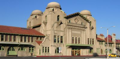
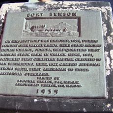
Mexican authorities granted José del Carmen Lugo permission to settle on the land in 1839, which led to the founding of Rancho San Bernardino. The city was later established again in 1854 and grew during the 19th century into a major rail junction between Los Angeles and the eastern United States.

The San Bernardino International Airport Truck Trail draws hikers from across the region who meet on weekends to walk toward the surrounding mountains. The historic district around Court Street comes alive monthly during the local market, when residents gather to shop and eat together.

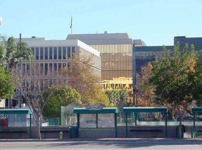
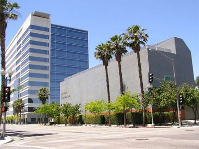
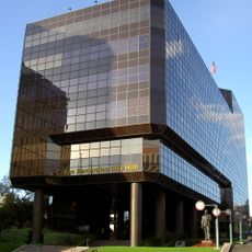
Most government offices and public facilities are located downtown along West Third Street and Arrowhead Avenue, where the bus terminal is also situated. Visitors planning to explore the area should keep in mind the warm weather and dry summers that last from May through October.

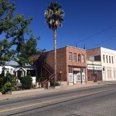
Aquifers beneath the city provide much of its water supply, while many neighboring cities rely entirely on external sources. Route 66 once passed directly through the heart of town, leaving behind several preserved motels and diners from the 1940s and 1950s along Foothill Boulevard.

Location: San Bernardino County

Inception: 1854

Elevation above the sea: 321 m

Shares border with: Rialto

Website: https://ci.san-bernardino.ca.us

GPS coordinates: 34.12944,-117.29306

Latest update: December 3, 2025 08:01

Around this place
Show the full map
Jurupa Oak
United States of America

Jurupa Oak

14 km
Glen Helen Amphitheater
United States of America

Glen Helen Amphitheater

13.1 km
Morey Mansion
United States of America

Morey Mansion

12.8 km
San Timoteo Canyon
United States of America

San Timoteo Canyon

13.7 km
Glen Helen Regional Park
United States of America

Glen Helen Regional Park

13.7 km
Devil Canyon
United States of America

Devil Canyon

8.6 km
San Bernardino County Court House
United States of America

San Bernardino County Court House

2.7 km
Slover Mountain
United States of America

Slover Mountain

8.4 km
Barton Villa
United States of America

Barton Villa

11.4 km
Redlands Santa Fe Depot District
United States of America

Redlands Santa Fe Depot District

12.9 km
A. K. Smiley Public Library
United States of America

A. K. Smiley Public Library

13.1 km
Fiesta Village Family Fun Park
United States of America

Fiesta Village Family Fun Park

8.9 km
Smiley Park Historic District
United States of America

Smiley Park Historic District

13.5 km
First Christian Church of Rialto
United States of America

First Christian Church of Rialto

7.6 km
Colton Carnegie Library
United States of America

Colton Carnegie Library

7.3 km
Monument Peak
United States of America

Monument Peak

14.1 km
Santos Manuel Student Union
United States of America

Santos Manuel Student Union

6.4 km
Beverly Ranch
United States of America

Beverly Ranch

13.6 km
Norman F. Feldheym Library
United States of America

Norman F. Feldheym Library

2.2 km
Fort Benson
United States of America

Fort Benson

7.6 km
San Bernardino Valley Water Conservation Demonstration Garden
United States of America

San Bernardino Valley Water Conservation Demonstration Garden

6.6 km
Highland Historic District
United States of America

Highland Historic District

7.8 km
Fontana Farms Company Ranch House, Camp No. 1
United States of America

Fontana Farms Company Ranch House, Camp No. 1

14.2 km
Aquatic Center
United States of America

Aquatic Center

16 km
San Dimas Experimental Forest
United States of America

San Dimas Experimental Forest

15.4 km
Lincoln Memorial Shrine
United States of America

Lincoln Memorial Shrine

13.2 km
San Bernardino History and Railroad Museum
United States of America

San Bernardino History and Railroad Museum

3.2 km
Rathaus von San Bernardino
United States of America

Rathaus von San Bernardino

2.8 km
Show the full map

Reviews

Visited this place? Tap the stars to rate it and share your experience / photos with the community! Try now! You can cancel it anytime.

« San Bernardino - County seat in Southern California, United States » is provided by Around Us (aroundus.com). Images and texts are derived from Wikimedia project under a Creative Commons license. You are allowed to copy, distribute, and modify copies of this page, under the conditions set by the license, as long as this note is clearly visible.

Discover hidden gems everywhere you go!

From secret cafés to breathtaking viewpoints, skip the crowded tourist spots and find places that match your style. Our app makes it easy with voice search, smart filtering, route optimization, and insider tips from travelers worldwide. Download now for the complete mobile experience.

Around Us App Screenshot

A unique approach to discovering new places

Le Figaro

All the places worth exploring

France Info

A tailor-made excursion in just a few clicks

20 Minutes