Enable Location

We need your location to show you interesting places around you

Discover nearby places

Find interesting locations and hidden gems around you

Precise directions

Get accurate directions and distances to places

Your location is never shared with other users. It's only used when you tap the location button.

Log in to your account

Start exploring — it's free

Trusted by 63,409 travelers worldwide

Continue with Google
Continue with Apple
or

We will send you a code to connect

By continuing, you accept our Terms and Conditions and our Privacy Policy

Check your inbox

We've sent a pincode in your inbox. Please enter the code below.

Bunker Hill
Discussion Reviews Photo
1.4k Popularity

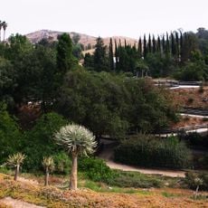
Bunker Hill, Residential cliff in San Bernardino, United States.

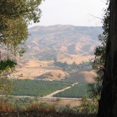
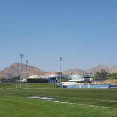
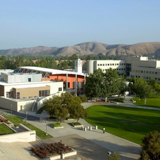
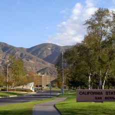
Bunker Hill is a cliff formation that stretches through the San Bernardino Valley College grounds, creating a visible ridge across the landscape. The slope forms a distinctive geographical feature that divides and shapes the surrounding terrain.

The site once held Politana, the first Spanish settlement in the San Bernardino Valley, which functioned as a mission chapel and supply station. This location marked the beginning of European presence in the valley.

Native Guachama Indians inhabited the bluff region before European settlers established their presence in the San Bernardino Valley.

The site is primarily significant as part of the local landscape and water infrastructure in the valley. The location is accessible during daylight hours and situated near college grounds and residential areas.

The tilted rock layers beneath Bunker Hill prevent groundwater from flowing toward the Pacific Ocean and instead create a natural water reservoir. This geological feature makes the formation especially valuable for the region's water supply.

The community of curious travelers

AroundUs brings together thousands of curated places, local tips, and hidden gems, enriched daily by 60,000 contributors worldwide.

Start exploring
Location
GPS coordinates
34.08444,-117.30917
Latest update
December 14, 2025 16:46
Around this place
Mission Inn
United States of America

Mission Inn

12.7 km
United States of America

Jurupa Oak

9.5 km
Morey Mansion
United States of America

Morey Mansion

10.6 km
San Timoteo Canyon
United States of America

San Timoteo Canyon

11.4 km
Riverside Fox Theater
United States of America

Riverside Fox Theater

12.7 km
Harada House
United States of America

Harada House

12.4 km
University of California, Riverside Citrus Variety Collection
United States of America

University of California, Riverside Citrus Variety Collection

12.3 km
Riverside International Automotive Museum
United States of America

Riverside International Automotive Museum

9.7 km
Riverside Municipal Auditorium
United States of America

Riverside Municipal Auditorium

12.7 km
University of California, Riverside Botanic Gardens
United States of America

University of California, Riverside Botanic Gardens

12.6 km
San Bernardino County Court House
United States of America

San Bernardino County Court House

2.9 km
Slover Mountain
United States of America

Slover Mountain

3.7 km
UCR Soccer Stadium
United States of America

UCR Soccer Stadium

12.1 km
Barton Villa
United States of America

Barton Villa

9.4 km
Redlands Santa Fe Depot District
United States of America

Redlands Santa Fe Depot District

12 km
A. K. Smiley Public Library
United States of America

A. K. Smiley Public Library

12 km
Smiley Park Historic District
United States of America

Smiley Park Historic District

12.3 km
First Christian Church of Rialto
United States of America

First Christian Church of Rialto

5.9 km
Colton Carnegie Library
United States of America

Colton Carnegie Library

2.2 km
Rosa Parks Memorial Building
United States of America

Rosa Parks Memorial Building

2.9 km
Santos Manuel Student Union
United States of America

Santos Manuel Student Union

10.9 km
Beverly Ranch
United States of America

Beverly Ranch

12 km
Norman F. Feldheym Library
United States of America

Norman F. Feldheym Library

3.1 km
Fort Benson
United States of America

Fort Benson

3.2 km
San Bernardino Valley Water Conservation Demonstration Garden
United States of America

San Bernardino Valley Water Conservation Demonstration Garden

11.1 km
Highland Historic District
United States of America

Highland Historic District

10.5 km
Fontana Farms Company Ranch House, Camp No. 1
United States of America

Fontana Farms Company Ranch House, Camp No. 1

12.2 km
Lincoln Memorial Shrine
United States of America

Lincoln Memorial Shrine

12.1 km
Show the full map
Reviews
Share your experience

No review yet

Discussions
Start a discussion...

No discussion yet

« Bunker Hill - Residential cliff in San Bernardino, United States » is provided by Around Us (aroundus.com). Images and texts are derived from Wikimedia project under a Creative Commons license. You are allowed to copy, distribute, and modify copies of this page, under the conditions set by the license, as long as this note is clearly visible.

Discover hidden gems everywhere you go!

From secret cafés to breathtaking viewpoints, skip the crowded tourist spots and find places that match your style. Our app makes it easy with voice search, smart filtering, route optimization, and insider tips from travelers worldwide. Download now for the complete mobile experience.

Around Us App Screenshot

A unique approach to discovering new places

Le Figaro

All the places worth exploring

France Info

A tailor-made excursion in just a few clicks

20 Minutes

Around Us
Travel Guide & Maps
Download

Send to your phone

QR Code
1

Open the camera app on your mobile.

2

Point at the QR code with your camera. A notification will appear.

3

Tap the notification to open the link.