Chest opened
+${chestReward.xp} XP
Explorer
NOUVEAU ×${chestReward.collectible.quantity}
tapez pour fermer
Chest locked

Open chests in the app

Around Us is built for your phone — chests unlock when you walk, explore and capture nearby places.

Enable Location

We need your location to show you interesting places around you

Discover nearby places

Find interesting locations and hidden gems around you

Precise directions

Get accurate directions and distances to places

Your location is never shared with other users. It's only used when you tap the location button.

Glamis

Log in to your account

Start exploring — it's free

Trusted by 72,882 travelers worldwide

Continue with Google
Continue with Apple
or

We will send you a code to connect

By continuing, you accept our Terms and Conditions and our Privacy Policy

Check your inbox

We've sent a pincode in your inbox. Please enter the code below.

Discussion Reviews 1 Photos
26.3k Popularity

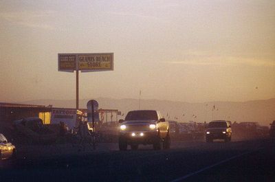
Glamis, Unincorporated community in Imperial County, California, United States.

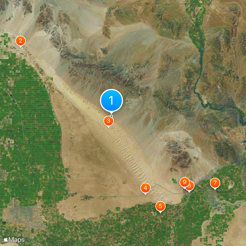
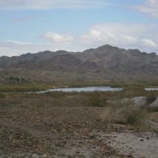
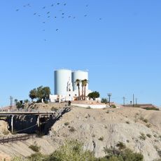
Glamis is a small settlement near the Algodones Dunes in Imperial County, California. The community sits along California State Route 78 and serves as an access point to the Imperial Sand Dunes Recreation Area, with local facilities including the Glamis Store and Boardmanville Trading Post.

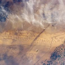
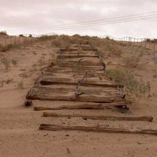
The place developed in the early 1900s around a Southern Pacific Railroad station. Its post office operated intermittently between 1886 and 1923, showing how important the area was as a transportation hub.

The name originates from Glamis Castle in Scotland, a location made famous through William Shakespeare's theatrical work Macbeth.

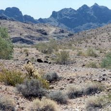
Visit during cooler months, as summer heat can be intense in this desert location. Fill up your fuel tank before arriving since facilities are limited and you will be far from the coast or large cities.

The area around this settlement is home to the Mesquite Mine, which extracts gold and contributes to the local economy. Right next to it sits the Mesquite Regional Landfill, which processes waste from Los Angeles County via rail transport.

The community of curious travelers

AroundUs brings together thousands of curated places, local tips, and hidden gems, enriched daily by 60,000 contributors worldwide.

Start exploring
Location
GPS coordinates
32.99750,-115.07194
Latest update
December 20, 2025 15:18
Around this place
Salvation Mountain
United States of America

Salvation Mountain

47 km
Algodones Dunes
United States of America

Algodones Dunes

4.5 km
Old Plank Road
United States of America

Old Plank Road

34.9 km
Alamo Canal
Mexico

Alamo Canal

44.4 km
Ocean To Ocean Bridge
United States of America

Ocean To Ocean Bridge

52.1 km
Yuma Crossing
United States of America

Yuma Crossing

52.1 km
Andrade Port of Entry
United States of America

Andrade Port of Entry

44.7 km
Pilot Knob
United States of America

Pilot Knob

42.2 km
Picacho State Recreation Area
United States of America

Picacho State Recreation Area

43.3 km
Cibola National Wildlife Refuge
United States of America

Cibola National Wildlife Refuge

50 km
Yuma Quartermaster Depot State Historic Park
United States of America

Yuma Quartermaster Depot State Historic Park

51.4 km
Imperial National Wildlife Refuge
United States of America

Imperial National Wildlife Refuge

36.8 km
Little Picacho Wilderness
United States of America

Little Picacho Wilderness

47.4 km
Mission Puerto de Purísima Concepción
United States of America

Mission Puerto de Purísima Concepción

52 km
Brown House
United States of America

Brown House

52.2 km
Masonic Temple
United States of America

Masonic Temple

51.9 km
Methodist Episcopal Church
United States of America

Methodist Episcopal Church

52.2 km
Trigo Mountains Wilderness
United States of America

Trigo Mountains Wilderness

46.7 km
Blaisdell Slow Sand Filter Washing Machine
United States of America

Blaisdell Slow Sand Filter Washing Machine

52.1 km
Southern Pacific Railroad Passenger Coach Car-S.P. X7
United States of America

Southern Pacific Railroad Passenger Coach Car-S.P. X7

51.7 km
Ortiz House
United States of America

Ortiz House

52.1 km
Yuma County Courthouse
United States of America

Yuma County Courthouse

52 km
Jerry Kent House
United States of America

Jerry Kent House

52.2 km
Yuma City Hall
United States of America

Yuma City Hall

52 km
Gandolfo Theatre
United States of America

Gandolfo Theatre

52 km
Brownstetter House
United States of America

Brownstetter House

52.2 km
Caruthers House
United States of America

Caruthers House

52.2 km
Yuma Theater
United States of America

Yuma Theater

52.3 km
Show the full map
Reviews
Share your experience

No review yet

Discussions
Start a discussion...

No discussion yet

« Glamis - Unincorporated community in Imperial County, California, United States » is provided by Around Us (aroundus.com). Images and texts are derived from Wikimedia project under a Creative Commons license. You are allowed to copy, distribute, and modify copies of this page, under the conditions set by the license, as long as this note is clearly visible.

Discover hidden gems everywhere you go!

From secret cafés to breathtaking viewpoints, skip the crowded tourist spots and find places that match your style. Our app makes it easy with voice search, smart filtering, route optimization, and insider tips from travelers worldwide. Download now for the complete mobile experience.

Around Us App Screenshot

A unique approach to discovering new places

Le Figaro

All the places worth exploring

France Info

A tailor-made excursion in just a few clicks

20 Minutes

Around Us
Travel Guide & Maps
Download

Send to your phone

QR Code
1

Open the camera app on your mobile.

2

Point at the QR code with your camera. A notification will appear.

3

Tap the notification to open the link.