Enable Location

We need your location to show you interesting places around you

Discover nearby places

Find interesting locations and hidden gems around you

Precise directions

Get accurate directions and distances to places

Your location is never shared with other users. It's only used when you tap the location button.

Cibola National Wildlife Refuge

Log in to your account

Start exploring — it's free

Trusted by 61,990 travelers worldwide

Continue with Google
Continue with Apple
or

We will send you a code to connect

By continuing, you accept our Terms and Conditions and our Privacy Policy

Check your inbox

We've sent a pincode in your inbox. Please enter the code below.

Cibola National Wildlife Refuge

Cibola National Wildlife Refuge, Wildlife refuge in Imperial County and La Paz County, United States.

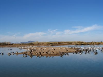
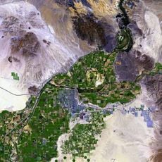
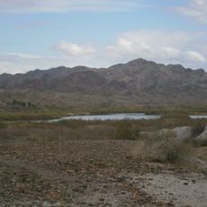
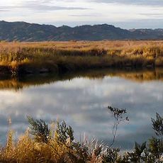
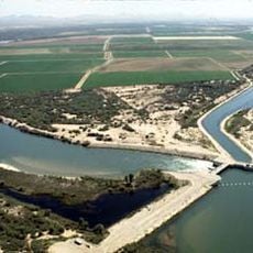
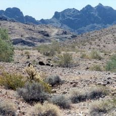
Cibola National Wildlife Refuge is a protected area along the Colorado River spanning several thousand acres with river channels, wetlands, and desert habitat types. The refuge lies straddling the Arizona-California border and contains various environments that change with the seasons.

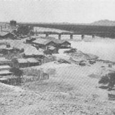
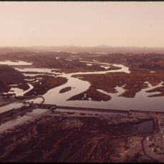
The refuge was established in 1964 to restore wetlands and backwaters of the Colorado River following modifications made by federal water management agencies. Its creation addressed the need to protect natural habitats from ongoing river development and water management projects.

This location serves as a vital resting point along the Pacific Flyway migration route, drawing waterfowl that rely on these protected waters during their seasonal journeys. Visitors often see large flocks pausing to feed and rest on their way between their breeding and wintering grounds.

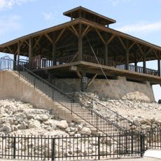
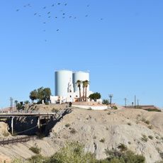
The refuge is accessible from Blythe, California and Yuma, Arizona and offers free entry for all visitors. A visitor center operates seasonally, so it helps to check conditions before planning your visit.

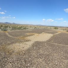
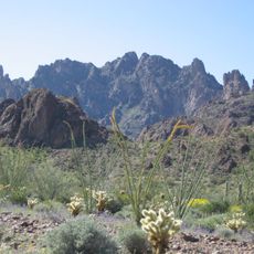
Wildlife here has adapted to extreme conditions with very hot summers and minimal annual rainfall in this harsh desert setting. These adaptations allow the species to survive and thrive despite the challenging Sonoran Desert environment.

The community of curious travelers

AroundUs brings together thousands of curated places, local tips, and hidden gems, enriched daily by 60,000 contributors worldwide.

Start exploring
Location
Location
Inception
1964
GPS coordinates
33.31170,-114.68900
Latest update
December 11, 2025 18:08
Around this place
Yuma Territorial Prison
United States of America

Yuma Territorial Prison

65.5 km
Algodones Dunes
United States of America

Algodones Dunes

53.9 km
Blythe Intaglios
United States of America

Blythe Intaglios

56.2 km
Ironwood State Prison
United States of America

Ironwood State Prison

35.6 km
All-American Canal
United States of America

All-American Canal

52.6 km
Chuckawalla Valley State Prison
United States of America

Chuckawalla Valley State Prison

34.7 km
Hi Jolly Monument
United States of America

Hi Jolly Monument

57.5 km
Kofa National Wildlife Refuge
United States of America

Kofa National Wildlife Refuge

64.9 km
Ocean To Ocean Bridge
United States of America

Ocean To Ocean Bridge

65.3 km
Yuma Crossing
United States of America

Yuma Crossing

65.3 km
Pilot Knob
United States of America

Pilot Knob

64.8 km
Picacho State Recreation Area
United States of America

Picacho State Recreation Area

32.8 km
Yuma Quartermaster Depot State Historic Park
United States of America

Yuma Quartermaster Depot State Historic Park

65.4 km
Imperial National Wildlife Refuge
United States of America

Imperial National Wildlife Refuge

25 km
Little Picacho Wilderness
United States of America

Little Picacho Wilderness

42.9 km
Imperial Reservoir
United States of America

Imperial Reservoir

52 km
Mission Puerto de Purísima Concepción
United States of America

Mission Puerto de Purísima Concepción

65.1 km
Fort Tyson
United States of America

Fort Tyson

58.6 km
Blythe Intake
United States of America

Blythe Intake

49.4 km
Masonic Temple
United States of America

Masonic Temple

65.6 km
Trigo Mountains Wilderness
United States of America

Trigo Mountains Wilderness

15.8 km
Blaisdell Slow Sand Filter Washing Machine
United States of America

Blaisdell Slow Sand Filter Washing Machine

65.4 km
Southern Pacific Railroad Passenger Coach Car-S.P. X7
United States of America

Southern Pacific Railroad Passenger Coach Car-S.P. X7

65.3 km
Yuma County Courthouse
United States of America

Yuma County Courthouse

65.7 km
Yuma City Hall
United States of America

Yuma City Hall

65.6 km
Gandolfo Theatre
United States of America

Gandolfo Theatre

65.7 km
Yuma Theater
United States of America

Yuma Theater

65.8 km
Blythe-Ehrenberg Suspension Bridge
United States of America

Blythe-Ehrenberg Suspension Bridge

35.4 km
Show the full map
« Cibola National Wildlife Refuge - Wildlife refuge in Imperial County and La Paz County, United States » is provided by Around Us (aroundus.com). Images and texts are derived from Wikimedia project under a Creative Commons license. You are allowed to copy, distribute, and modify copies of this page, under the conditions set by the license, as long as this note is clearly visible.

Discover hidden gems everywhere you go!

From secret cafés to breathtaking viewpoints, skip the crowded tourist spots and find places that match your style. Our app makes it easy with voice search, smart filtering, route optimization, and insider tips from travelers worldwide. Download now for the complete mobile experience.

Around Us App Screenshot

A unique approach to discovering new places

Le Figaro

All the places worth exploring

France Info

A tailor-made excursion in just a few clicks

20 Minutes

Around Us
Travel Guide & Maps
Download

Send to your phone

QR Code
1

Open the camera app on your mobile.

2

Point at the QR code with your camera. A notification will appear.

3

Tap the notification to open the link.