Enable Location

We need your location to show you interesting places around you

Discover nearby places

Find interesting locations and hidden gems around you

Precise directions

Get accurate directions and distances to places

Your location is never shared with other users. It's only used when you tap the location button.

Fort Tyson

Log in to your account

Start exploring — it's free

Trusted by 62,564 travelers worldwide

Continue with Google
Continue with Apple
or

We will send you a code to connect

By continuing, you accept our Terms and Conditions and our Privacy Policy

Check your inbox

We've sent a pincode in your inbox. Please enter the code below.

Fort Tyson

Fort Tyson, Military fort in La Paz County, Arizona.

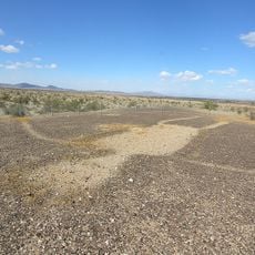
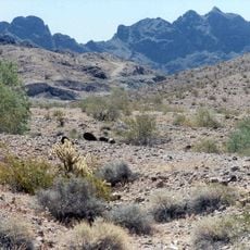
Fort Tyson is a military defensive structure in the desert of west-central Arizona, located near Quartzsite at a historically important location. The structure was built from adobe and wood, modest in size but designed to protect the settlement and its water supply.

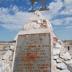
Charles Tyson built the fort in 1856 to protect miners in the region and secure access to water sources. The site played a role in the early phase of American westward expansion and the conflicts that defined that era.

The ruins show how settlers and Indigenous peoples lived alongside each other during westward expansion in the 1800s. This location represents where different ways of life met and shaped the region's early development.

The site is open to visitors and can be explored on foot year-round. Informational markers on location explain the history and help visitors understand the remaining structures.

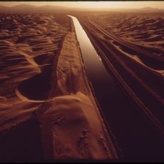
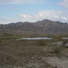
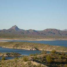
A hand-dug well built in 1864 was located at the site and later became known as Tyson's Well. This water source became essential for travelers crossing the desert and turned the location into a vital stop on desert routes.

The community of curious travelers

AroundUs brings together thousands of curated places, local tips, and hidden gems, enriched daily by 60,000 contributors worldwide.

Start exploring
Location
GPS coordinates
33.66500,-114.22083
Latest update
December 14, 2025 09:44
Around this place
London Bridge
United States of America

London Bridge

90.6 km
Lake Havasu
United States of America

Lake Havasu

92.3 km
Central Arizona Project
United States of America

Central Arizona Project

70 km
Blythe Intaglios
United States of America

Blythe Intaglios

33 km
Colorado River Aqueduct
United States of America

Colorado River Aqueduct

69.7 km
Ironwood State Prison
United States of America

Ironwood State Prison

41.8 km
All-American Canal
United States of America

All-American Canal

90.9 km
Chuckawalla Valley State Prison
United States of America

Chuckawalla Valley State Prison

64.8 km
Hi Jolly Monument
United States of America

Hi Jolly Monument

1.4 km
Kofa National Wildlife Refuge
United States of America

Kofa National Wildlife Refuge

51 km
Alamo Lake State Park
United States of America

Alamo Lake State Park

85.1 km
Buckskin Mountain State Park
United States of America

Buckskin Mountain State Park

66.3 km
Picacho State Recreation Area
United States of America

Picacho State Recreation Area

79.9 km
Cibola National Wildlife Refuge
United States of America

Cibola National Wildlife Refuge

58.6 km
Cattail Cove State Park
United States of America

Cattail Cove State Park

76.5 km
Imperial National Wildlife Refuge
United States of America

Imperial National Wildlife Refuge

77.9 km
Little Picacho Wilderness
United States of America

Little Picacho Wilderness

87 km
Imperial Reservoir
United States of America

Imperial Reservoir

90 km
Bill Williams River National Wildlife Refuge
United States of America

Bill Williams River National Wildlife Refuge

70.4 km
Corn Springs
United States of America

Corn Springs

102.4 km
Turtle Mountains
United States of America

Turtle Mountains

90.4 km
Eagletail Mountains Wilderness
United States of America

Eagletail Mountains Wilderness

80.1 km
Riverside Mountains
United States of America

Riverside Mountains

49.7 km
Blythe Intake
United States of America

Blythe Intake

28.3 km
Trigo Mountains Wilderness
United States of America

Trigo Mountains Wilderness

65.5 km
Alamo Lake
United States of America

Alamo Lake

85.1 km
Bridgewater Links
United States of America

Bridgewater Links

90.1 km
Arizona and California Railroad Bridge
United States of America

Arizona and California Railroad Bridge

55.7 km
Show the full map
« Fort Tyson - Military fort in La Paz County, Arizona » is provided by Around Us (aroundus.com). Images and texts are derived from Wikimedia project under a Creative Commons license. You are allowed to copy, distribute, and modify copies of this page, under the conditions set by the license, as long as this note is clearly visible.

Discover hidden gems everywhere you go!

From secret cafés to breathtaking viewpoints, skip the crowded tourist spots and find places that match your style. Our app makes it easy with voice search, smart filtering, route optimization, and insider tips from travelers worldwide. Download now for the complete mobile experience.

Around Us App Screenshot

A unique approach to discovering new places

Le Figaro

All the places worth exploring

France Info

A tailor-made excursion in just a few clicks

20 Minutes

Around Us
Travel Guide & Maps
Download

Send to your phone

QR Code
1

Open the camera app on your mobile.

2

Point at the QR code with your camera. A notification will appear.

3

Tap the notification to open the link.