Enable Location

We need your location to show you interesting places around you

Discover nearby places

Find interesting locations and hidden gems around you

Precise directions

Get accurate directions and distances to places

Your location is never shared with other users. It's only used when you tap the location button.

Blythe Intaglios

Log in to your account

Join the adventure

Create your free account and start exploring (like 60k+ others)

We will send you a code to connect

or
Continue with Google
Continue with Apple
By continuing, you accept our Terms and Conditions and our Privacy Policy

Check your inbox

We've sent a pincode in your inbox. Please enter the code below.

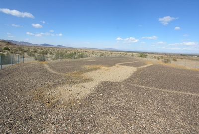
Blythe Intaglios, Ancient Native American geoglyphs near Blythe, United States.

Description

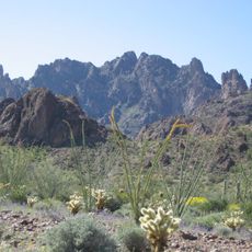
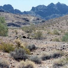
The Blythe Intaglios are prehistoric ground drawings in the desert of Riverside County, California, created by scraping away dark stones to reveal lighter soil beneath. The designs show human figures and animals, with some shapes reaching over 170 feet (52 meters) in length and best viewed from an elevated perspective.

History

A pilot flying between Blythe and Las Vegas spotted the figures in 1932, though they were likely created hundreds of years earlier by indigenous communities. The site later received protection to prevent erosion and damage from vehicles crossing the desert floor.

Culture

The figures represent human and animal shapes created by Native American tribes, reflecting their ceremonial traditions and creation narratives.

Practical

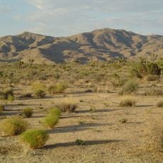
Visitors should drive about 15 miles (24 kilometers) north of Blythe along Intake Boulevard and then follow a dirt road to reach the parking areas. Early morning or late afternoon visits work best to avoid extreme heat, and bringing plenty of water is necessary since no facilities exist on site.

Did you know?

Some figures show life-sized human forms with outstretched arms, possibly representing spiritual beings or mythological characters from indigenous stories. The technique of removing dark desert pavement reveals a lighter pattern that remains visible despite centuries of wind and weather.

Location
GPS coordinates
33.80028,-114.53833
Latest update
December 19, 2025 23:54

AroundUs brings together thousands of curated places, local tips, and hidden gems, enriched daily by 60,000 contributors worldwide. Discover all places nearby (Riverside County).

Around this place
London Bridge
United States of America

London Bridge

76.8 km
Lake Havasu
United States of America

Lake Havasu

77.4 km
Central Arizona Project
United States of America

Central Arizona Project

67.3 km
Colorado River Aqueduct
United States of America

Colorado River Aqueduct

64.1 km
Chuckawalla Valley State Prison
United States of America

Chuckawalla Valley State Prison

43.3 km
Hi Jolly Monument
United States of America

Hi Jolly Monument

31.8 km
Kofa National Wildlife Refuge
United States of America

Kofa National Wildlife Refuge

79.6 km
Buckskin Mountain State Park
United States of America

Buckskin Mountain State Park

62.9 km
Old Woman Mountains Wilderness
United States of America

Old Woman Mountains Wilderness

95.3 km
Picacho State Recreation Area
United States of America

Picacho State Recreation Area

86.5 km
Cibola National Wildlife Refuge
United States of America

Cibola National Wildlife Refuge

56.2 km
Cattail Cove State Park
United States of America

Cattail Cove State Park

70 km
Imperial National Wildlife Refuge
United States of America

Imperial National Wildlife Refuge

80.7 km
Little Picacho Wilderness
United States of America

Little Picacho Wilderness

95.9 km
Bill Williams River National Wildlife Refuge
United States of America

Bill Williams River National Wildlife Refuge

69.5 km
Corn Springs
United States of America

Corn Springs

75.4 km
Turtle Mountains
United States of America

Turtle Mountains

61.3 km
Windsor Beach
United States of America

Windsor Beach

78.5 km
Fort Tyson
United States of America

Fort Tyson

33 km
Riverside Mountains
United States of America

Riverside Mountains

24.8 km
Blythe Intake
United States of America

Blythe Intake

7.9 km
Trigo Mountains Wilderness
United States of America

Trigo Mountains Wilderness

69.4 km
Mohave Canyon
United States of America

Mohave Canyon

94.9 km
Parker Jail
United States of America

Parker Jail

44.9 km
Joshua Tree Wilderness
United States of America

Joshua Tree Wilderness

82.2 km
Bridgewater Links
United States of America

Bridgewater Links

76.4 km
Arizona and California Railroad Bridge
United States of America

Arizona and California Railroad Bridge

45.8 km
Pop Harvy Park splash pad
United States of America

Pop Harvy Park splash pad

44.8 km
Show the full map
« Blythe Intaglios - Ancient Native American geoglyphs near Blythe, United States » is provided by Around Us (aroundus.com). Images and texts are derived from Wikimedia project under a Creative Commons license. You are allowed to copy, distribute, and modify copies of this page, under the conditions set by the license, as long as this note is clearly visible.

Discover hidden gems everywhere you go!

From secret cafés to breathtaking viewpoints, skip the crowded tourist spots and find places that match your style. Our app makes it easy with voice search, smart filtering, route optimization, and insider tips from travelers worldwide. Download now for the complete mobile experience.

Around Us App Screenshot

A unique approach to discovering new places

Le Figaro

All the places worth exploring

France Info

A tailor-made excursion in just a few clicks

20 Minutes

Around Us
Travel Guide & Maps
Download

Send to your phone

QR Code
1

Open the camera app on your mobile.

2

Point at the QR code with your camera. A notification will appear.

3

Tap the notification to open the link.