Chest opened
+${chestReward.xp} XP
Explorer
NOUVEAU ×${chestReward.collectible.quantity}
tapez pour fermer
Chest locked

Open chests in the app

Around Us is built for your phone — chests unlock when you walk, explore and capture nearby places.

Enable Location

We need your location to show you interesting places around you

Discover nearby places

Find interesting locations and hidden gems around you

Precise directions

Get accurate directions and distances to places

Your location is never shared with other users. It's only used when you tap the location button.

Log in to your account

Start exploring — it's free

Trusted by 72,878 travelers worldwide

Continue with Google
Continue with Apple
or

We will send you a code to connect

By continuing, you accept our Terms and Conditions and our Privacy Policy

Check your inbox

We've sent a pincode in your inbox. Please enter the code below.

Palm Walk
Discussion Reviews Photo
2.4k Popularity

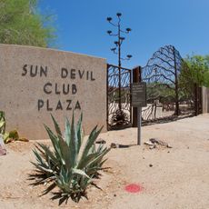
Palm Walk, Pedestrian mall at Arizona State University, US

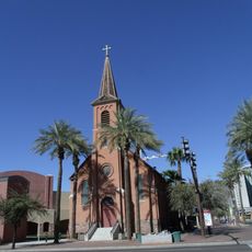
Palm Walk is a pedestrian pathway at Arizona State University that extends for about 0.4 miles and connects the University Bridge with the Student Recreation Complex. The route is lined with date palm trees and links various academic buildings, administrative facilities, and the university library.

The first date palms were planted between 1916 and 1919 under President Arthur John Matthews to enhance the campus grounds. These initial plantings shaped what would become a defining pathway in the university's landscape.

Palm Walk serves as a central gathering space where students meet for outdoor classes and between lectures. The walkway shapes daily campus life and creates a place where the university community connects naturally.

The pathway provides a direct north-south route through campus and is easy to navigate on foot. Visitors should come early morning or late afternoon to avoid the busiest midday foot traffic and heat.

The date palms replanted in 2018 produce fruit used during the university's annual date harvest. This detail connects landscape maintenance with a practical harvest that ties the grounds to campus life.

The community of curious travelers

AroundUs brings together thousands of curated places, local tips, and hidden gems, enriched daily by 60,000 contributors worldwide.

Start exploring
Location
GPS coordinates
33.42020,-111.93270
Latest update
December 13, 2025 11:45
Around this place
Phoenix Zoo
United States of America

Phoenix Zoo

3.9 km
Tempe Town Lake
United States of America

Tempe Town Lake

1.3 km
Tempe Butte
United States of America

Tempe Butte

945 m
Gammage Memorial Auditorium
United States of America

Gammage Memorial Auditorium

662 m
Marquee Theatre
United States of America

Marquee Theatre

2.1 km
Hunt's Tomb
United States of America

Hunt's Tomb

3.7 km
Sandra Day O'Connor House
United States of America

Sandra Day O'Connor House

2.4 km
Arizona State University Art Museum
United States of America

Arizona State University Art Museum

530 m
Hall of Flame Fire Museum
United States of America

Hall of Flame Fire Museum

3.6 km
Niels Petersen House
United States of America

Niels Petersen House

4 km
Old Main
United States of America

Old Main

129 m
Mill Avenue Bridges
United States of America

Mill Avenue Bridges

1.7 km
Arboretum at Arizona State University
United States of America

Arboretum at Arizona State University

672 m
Borden Milk Co. Creamery and Ice Factory
United States of America

Borden Milk Co. Creamery and Ice Factory

1.6 km
Industrial Arts Building
United States of America

Industrial Arts Building

268 m
UP - Salt River Bridge
United States of America

UP - Salt River Bridge

1.8 km
St. Mary's Church-Our Lady of Mount Carmel Catholic Church
United States of America

St. Mary's Church-Our Lady of Mount Carmel Catholic Church

277 m
B. B. Moeur Activity Building
United States of America

B. B. Moeur Activity Building

342 m
President's House
United States of America

President's House

66 m
Matthews Hall
United States of America

Matthews Hall

215 m
Harrington-Birchett House
United States of America

Harrington-Birchett House

406 m
Administration/Science Building
United States of America

Administration/Science Building

72 m
Singh Meadows
United States of America

Singh Meadows

3.3 km
Tempe History Museum
United States of America

Tempe History Museum

3.2 km
Arizona Heritage Center
United States of America

Arizona Heritage Center

2.5 km
Rose Eisendrath House
United States of America

Rose Eisendrath House

2.7 km
Petersen House Museum
United States of America

Petersen House Museum

4 km
Valley Art Theatre
United States of America

Valley Art Theatre

858 m
Show the full map
Reviews
Share your experience

No review yet

Discussions
Start a discussion...

No discussion yet

« Palm Walk - Pedestrian mall at Arizona State University, US » is provided by Around Us (aroundus.com). Images and texts are derived from Wikimedia project under a Creative Commons license. You are allowed to copy, distribute, and modify copies of this page, under the conditions set by the license, as long as this note is clearly visible.

Discover hidden gems everywhere you go!

From secret cafés to breathtaking viewpoints, skip the crowded tourist spots and find places that match your style. Our app makes it easy with voice search, smart filtering, route optimization, and insider tips from travelers worldwide. Download now for the complete mobile experience.

Around Us App Screenshot

A unique approach to discovering new places

Le Figaro

All the places worth exploring

France Info

A tailor-made excursion in just a few clicks

20 Minutes

Around Us
Travel Guide & Maps
Download

Send to your phone

QR Code
1

Open the camera app on your mobile.

2

Point at the QR code with your camera. A notification will appear.

3

Tap the notification to open the link.