Enable Location

We need your location to show you interesting places around you

Discover nearby places

Find interesting locations and hidden gems around you

Precise directions

Get accurate directions and distances to places

Your location is never shared with other users. It's only used when you tap the location button.

Buckeye

Log in to your account

Start exploring — it's free

Trusted by 61,600 travelers worldwide

Continue with Google
Continue with Apple
or

We will send you a code to connect

By continuing, you accept our Terms and Conditions and our Privacy Policy

Check your inbox

We've sent a pincode in your inbox. Please enter the code below.

Buckeye, City center in Maricopa County, United States

Description

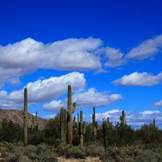
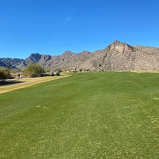
Buckeye is a city in the western part of the Phoenix metro area in Maricopa County, Arizona, positioned at the edge of the Sonora Desert. The settlement spreads over flat, dry land framed by brown mountains to the north and south.

History

The city emerged after a settler group from Iowa arrived in 1877 led by Thomas Newt Clanton. Construction of an irrigation canal between 1884 and 1886 enabled cotton farming and made agriculture the economic core of the community.

Culture

The population of 91,502 residents includes communities from White, Black, Native American, Asian, Pacific Islander, and Hispanic backgrounds living in planned neighborhoods.

Practical

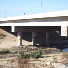
The city sits roughly 30 miles (50 kilometers) west of downtown Phoenix and connects through highways and rural roads. Traffic moves along main roads that pass through residential areas with wide streets and low buildings.

Did you know?

The city recorded the highest population growth rate of all cities in the United States between 2017 and 2021. New housing developments continue to rise on former desert floor, changing the landscape year by year.

Location
Location
Inception
1888
Elevation above the sea
265 m
GPS coordinates
33.37056,-112.59083
Latest update
December 13, 2025 19:19

AroundUs brings together thousands of curated places, local tips, and hidden gems, enriched daily by 60,000 contributors worldwide. Discover all places nearby (Maricopa County).

Around this place
White Tank Mountains
United States of America

White Tank Mountains

22.9 km
White Tank Mountain Regional Park
United States of America

White Tank Mountain Regional Park

24.3 km
Gillespie Dam Highway Bridge
United States of America

Gillespie Dam Highway Bridge

23 km
United States of America

Our Lady of Solitude Monastery

34.3 km
Hassayampa Bridge
United States of America

Hassayampa Bridge

12.4 km
Victory Steps at Verrado
United States of America

Victory Steps at Verrado

17.3 km
Verrado Golf Club- The Victory Course 4242 North Golf Club Drive Buckeye AZ 85396
United States of America

Verrado Golf Club- The Victory Course 4242 North Golf Club Drive Buckeye AZ 85396

18.1 km
United States of America

Powers Butte Wildlife Area

15.2 km
United States of America

Whitetank Mountain Regional Park

24.3 km
United States of America

Tuscany Falls Golf Club

20.8 km
United States of America

The Labrynth

34.4 km
United States of America

Sundance Golf Club

9.2 km
United States of America

Raven Golf Club At Verrado

15.1 km
United States of America

Copper Canyon - Lake/Mountain Course

32.6 km
United States of America

Copper Canyon - Vista/Lake Course

33 km
United States of America

Rhinoceros

25.5 km
United States of America

Primates

25.6 km
United States of America

Victory steps at Verrado

17.3 km
United States of America

Tuscany Falls Golf Club

20.9 km
United States of America

Soaring Eagle Zipline

25.3 km
United States of America

Copper Canyon - Mountain/Vista Course

33 km
United States of America

Pieta

34.3 km
United States of America

Saint Joseph

34.3 km
United States of America

Blessed Mother Mary

34.2 km
United States of America

Battlefield Cross

7 km
United States of America

Statue, Work of art

34.2 km
United States of America

Scenic viewpoint

17.3 km
United States of America

Waterfall

24.7 km
Show the full map
« Buckeye - City center in Maricopa County, United States » is provided by Around Us (aroundus.com). Images and texts are derived from Wikimedia project under a Creative Commons license. You are allowed to copy, distribute, and modify copies of this page, under the conditions set by the license, as long as this note is clearly visible.

Discover hidden gems everywhere you go!

From secret cafés to breathtaking viewpoints, skip the crowded tourist spots and find places that match your style. Our app makes it easy with voice search, smart filtering, route optimization, and insider tips from travelers worldwide. Download now for the complete mobile experience.

Around Us App Screenshot

A unique approach to discovering new places

Le Figaro

All the places worth exploring

France Info

A tailor-made excursion in just a few clicks

20 Minutes

Around Us
Travel Guide & Maps
Download

Send to your phone

QR Code
1

Open the camera app on your mobile.

2

Point at the QR code with your camera. A notification will appear.

3

Tap the notification to open the link.