Chest opened
+${chestReward.xp} XP
Explorer
NOUVEAU ×${chestReward.collectible.quantity}
tapez pour fermer

See the monuments around you in AR Open chests in the app

Around Us is built for your phone — point your camera at the streets and discover the monuments and places around you in augmented reality. Around Us is built for your phone — chests unlock when you walk, explore and capture nearby places.

•

Enable Location

We need your location to show you interesting places around you

Discover nearby places

Find interesting locations and hidden gems around you

Precise directions

Get accurate directions and distances to places

Your location is never shared with other users. It's only used when you tap the location button.

White Tank Mountains

Log in to your account

Start exploring — it's free

Trusted by 92,760 travelers worldwide

Continue with Google
Continue with Apple
or

We will send you a code to connect

By continuing, you accept our Terms and Conditions and our Privacy Policy

Check your inbox

We've sent a pincode in your inbox. Please enter the code below.

White Tank Mountains, Mountain range and summit in Maricopa County, Arizona, United States

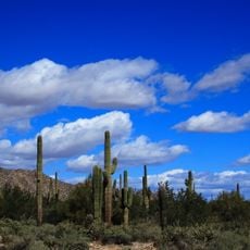
The White Tank Mountains are a mountain range with multiple peaks and canyons stretching across a large area in Maricopa County. The terrain shows varying elevations and narrow valleys with visible white rock formations that shape the entire landscape.

The range rose along a detachment fault about 30 million years ago, in the mid-Tertiary. Eleven archaeological sites within today's park were occupied between 500 and 1100 AD by the Hohokam, who lived near the water-holding tanks and left hundreds of petroglyphs, some over 10,000 years old. Around 1750 the Western Yavapai controlled the area.

The name comes from natural water tanks carved into white rock, which have long drawn people to this dry landscape. As you walk the trails, you notice ancient rock carvings at various spots, showing this area held meaning for the people who lived here.

Hiking is confined to designated trails within the roughly 118.5 km² White Tank Mountain Regional Park. The most-visited route is the 1.4 km Waterfall Trail, which runs through a narrow canyon to a seasonal waterfall that flows after late-summer storms. Flash floods can surge through dry washes and canyons during those storms, so check conditions before entering a canyon.

The range lacks a single dominant summit: it is a series of ridges and canyons, and its highest point, Barry Goldwater Peak, reaches 4,083 feet (1,244 m). The rock is white granite, and the "tanks" are depressions scoured into it near the mountain base by fast-moving floodwater.

The community of curious travelers

AroundUs brings together thousands of curated places, local tips, and hidden gems, enriched daily by 92,760 contributors worldwide.


Start exploring
Location
GPS coordinates
33.57588,-112.57890
Latest update
October 25, 2026 02:14
Around this place
State Farm Stadium
United States of America

State Farm Stadium

18.5 mi
Desert Sky Pavilion
United States of America

Desert Sky Pavilion

21.2 mi
Phoenix Raceway
United States of America

Phoenix Raceway

20.4 mi
Wet'n'Wild Phoenix
United States of America

Wet'n'Wild Phoenix

26.1 mi
Castles N' Coasters
United States of America

Castles N' Coasters

26.5 mi
Wildlife World Zoo
United States of America

Wildlife World Zoo

9.8 mi
White Tank Mountain Regional Park
United States of America

White Tank Mountain Regional Park

1.4 mi
Main Event
United States of America

Main Event

18.8 mi
Phoenix Arizona Temple
United States of America

Phoenix Arizona Temple

24.9 mi
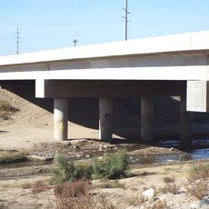
Gillespie Dam Highway Bridge
United States of America

Gillespie Dam Highway Bridge

26.5 mi
Deer Valley Petroglyph Preserve
United States of America

Deer Valley Petroglyph Preserve

26.2 mi
Manistee Ranch
United States of America

Manistee Ranch

23.6 mi
Desert Storm
United States of America

Desert Storm

26.5 mi
Sahuaro Ranch
United States of America

Sahuaro Ranch

22.4 mi
Cartwright Elementary School District
United States of America

Cartwright Elementary School District

23.6 mi
Hassayampa River Preserve
United States of America

Hassayampa River Preserve

26 mi
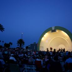
Sun Bowl Amphitheatre
United States of America

Sun Bowl Amphitheatre

16.6 mi
Hassayampa Bridge
United States of America

Hassayampa Bridge

17.8 mi
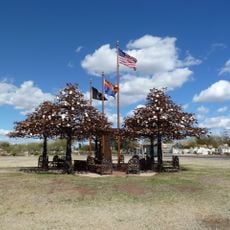
Glendale Veterans War Memorial
United States of America

Glendale Veterans War Memorial

22.6 mi
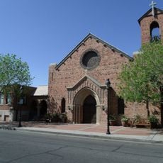
First Methodist Episcopal Church of Glendale
United States of America

First Methodist Episcopal Church of Glendale

22.8 mi
Phoenix Show Palace
United States of America

Phoenix Show Palace

25.8 mi
Sachs-Webster House
United States of America

Sachs-Webster House

24.9 mi
Wigwam Resort
United States of America

Wigwam Resort

14.1 mi
Floralcroft Historic District
United States of America

Floralcroft Historic District

22.7 mi
Sterling Grove Golf Course
United States of America

Sterling Grove Golf Course

8.3 mi
Peoria Theatre
United States of America

Peoria Theatre

19.6 mi
Avon Theatre
United States of America

Avon Theatre

16.4 mi
Glendale Main Library
United States of America

Glendale Main Library

22.6 mi
Show the full map
Reviews
Share your experience

No review yet

Discussions
Start a discussion...

No discussion yet

« White Tank Mountains - Mountain range and summit in Maricopa County, Arizona, United States » is provided by Around Us (aroundus.com). Images and texts are derived from Wikimedia project under a Creative Commons license. You are allowed to copy, distribute, and modify copies of this page, under the conditions set by the license, as long as this note is clearly visible.

Discover hidden gems everywhere you go!

From secret cafés to breathtaking viewpoints, skip the crowded tourist spots and find places that match your style. Our app makes it easy with voice search, smart filtering, route optimization, and insider tips from travelers worldwide. Download now for the complete mobile experience.
Around Us App Screenshot
❝

A unique approach to discovering new places❞

— Le Figaro

❝

All the places worth exploring❞

— France Info

❝

A tailor-made excursion in just a few clicks❞

— 20 Minutes

Around Us
Travel Guide & Maps
Download

Send to your phone

QR Code
1

Open the camera app on your mobile.

2

Point at the QR code with your camera. A notification will appear.

3

Tap the notification to open the link.