Chest opened
+${chestReward.xp} XP
Explorer
NOUVEAU ×${chestReward.collectible.quantity}
tapez pour fermer
Chest locked

Open chests in the app

Around Us is built for your phone — chests unlock when you walk, explore and capture nearby places.

Enable Location

We need your location to show you interesting places around you

Discover nearby places

Find interesting locations and hidden gems around you

Precise directions

Get accurate directions and distances to places

Your location is never shared with other users. It's only used when you tap the location button.

San Pedro River

Log in to your account

Start exploring — it's free

Trusted by 72,879 travelers worldwide

Continue with Google
Continue with Apple
or

We will send you a code to connect

By continuing, you accept our Terms and Conditions and our Privacy Policy

Check your inbox

We've sent a pincode in your inbox. Please enter the code below.

San Pedro River
Discussion Reviews 1 Photos
15k Popularity

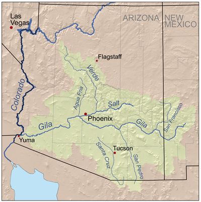
San Pedro River, River corridor in Arizona, United States

The San Pedro River is a waterway that flows northward through Arizona, creating a ribbon of vegetation in the middle of arid terrain. The river connects two distinct desert regions and merges with the Gila River, sustaining dense growth along its banks that contrasts with the dry landscape.

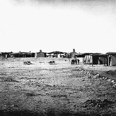
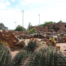
People have lived in this valley for around 10,000 years, first as hunters and later as farmers who built permanent settlements. Various cultures developed irrigation systems and communities along the waterway over thousands of years.

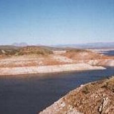
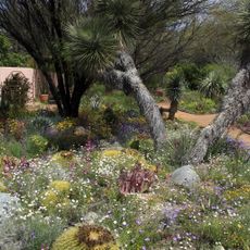
The river corridor draws bird watchers and nature enthusiasts who come to observe the seasonal bird migrations that pass through the valley. The green banks stand out sharply against the surrounding desert landscape, making the waterway a focal point for people seeking shade and wildlife encounters.

The river is accessible at several public access points, especially within the San Pedro Riparian National Conservation Area where visitors can explore on foot. Spring and fall are the busiest seasons for bird watching, when the migration periods bring the most activity to the area.

Unlike most major rivers in the region, this waterway flows freely from Mexico into the United States without any dams interrupting its course. This freedom makes it exceptionally rare among rivers, allowing it to sustain natural freshwater zones in the desert.

The community of curious travelers

AroundUs brings together thousands of curated places, local tips, and hidden gems, enriched daily by 60,000 contributors worldwide.

Start exploring
Location
GPS coordinates
32.98440,-110.78400
Latest update
December 7, 2025 19:32
Around this place
Biosphere 2
United States of America

Biosphere 2

45.6 km
St. Anthony's Greek Orthodox Monastery
United States of America

St. Anthony's Greek Orthodox Monastery

45.2 km
Peppersauce Cave
United States of America

Peppersauce Cave

51.7 km
San Carlos Lake
United States of America

San Carlos Lake

41.5 km
Camp Grant
United States of America

Camp Grant

17.3 km
Boyce Thompson Arboretum
United States of America

Boyce Thompson Arboretum

47.9 km
United States of America

Picketpost Mountain

46.2 km
Oracle State Park
United States of America

Oracle State Park

47.8 km
Besh-Ba-Gowah
United States of America

Besh-Ba-Gowah

44.3 km
Acadia Ranch
United States of America

Acadia Ranch

41.8 km
Globe Downtown Historic District
United States of America

Globe Downtown Historic District

45.7 km
La Casa del High Jinks
United States of America

La Casa del High Jinks

46.2 km
Gila County Courthouse
United States of America

Gila County Courthouse

45.8 km
Our Lady of the Blessed Sacrament Church
United States of America

Our Lady of the Blessed Sacrament Church

46.8 km
Holy Angels Church
United States of America

Holy Angels Church

45.7 km
Gila Valley Bank and Trust Building
United States of America

Gila Valley Bank and Trust Building

45.9 km
Elks Building
United States of America

Elks Building

45.9 km
Winkelman Bridge
United States of America

Winkelman Bridge

1.2 km
Miami Community Church
United States of America

Miami Community Church

46.9 km
Globe Ranger Station
United States of America

Globe Ranger Station

43.8 km
United States Post Office and Courthouse–Globe Main
United States of America

United States Post Office and Courthouse–Globe Main

44.8 km
Besh-Ba-Gowah Museum
United States of America

Besh-Ba-Gowah Museum

44.3 km
Bullion Plaza Cultural Center and Museum
United States of America

Bullion Plaza Cultural Center and Museum

46.5 km
Gila County Historical Museum
United States of America

Gila County Historical Museum

47.3 km
SaddleBrooke One
United States of America

SaddleBrooke One

50.7 km
Coolidge Dam
United States of America

Coolidge Dam

32 km
Pinto Creek Bridge
United States of America

Pinto Creek Bridge

45 km
Kannally Ranch
United States of America

Kannally Ranch

42 km
Show the full map
Reviews
Share your experience

No review yet

Discussions
Start a discussion...

No discussion yet

« San Pedro River - River corridor in Arizona, United States » is provided by Around Us (aroundus.com). Images and texts are derived from Wikimedia project under a Creative Commons license. You are allowed to copy, distribute, and modify copies of this page, under the conditions set by the license, as long as this note is clearly visible.

Discover hidden gems everywhere you go!

From secret cafés to breathtaking viewpoints, skip the crowded tourist spots and find places that match your style. Our app makes it easy with voice search, smart filtering, route optimization, and insider tips from travelers worldwide. Download now for the complete mobile experience.

Around Us App Screenshot

A unique approach to discovering new places

Le Figaro

All the places worth exploring

France Info

A tailor-made excursion in just a few clicks

20 Minutes

Around Us
Travel Guide & Maps
Download

Send to your phone

QR Code
1

Open the camera app on your mobile.

2

Point at the QR code with your camera. A notification will appear.

3

Tap the notification to open the link.