Enable Location

We need your location to show you interesting places around you

Discover nearby places

Find interesting locations and hidden gems around you

Precise directions

Get accurate directions and distances to places

Your location is never shared with other users. It's only used when you tap the location button.

Heroica Nogales

Log in to your account

Start exploring — it's free

Trusted by 67,496 travelers worldwide

Continue with Google
Continue with Apple
or

We will send you a code to connect

By continuing, you accept our Terms and Conditions and our Privacy Policy

Check your inbox

We've sent a pincode in your inbox. Please enter the code below.

Heroica Nogales
Discussion Reviews 6 Photos
71.8k Popularity

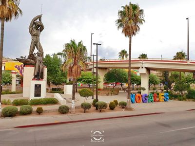
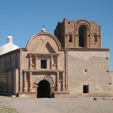
Heroica Nogales, Border municipality in Sonora, Mexico.

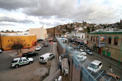
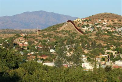
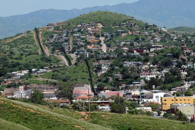
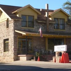
Heroica Nogales is a municipality in the Mexican state of Sonora that sits directly next to its namesake city in Arizona, forming one built-up area across an international line. The streets and neighborhoods run along a valley, where houses and commercial buildings extend right up to the boundary fence on the Mexican side.

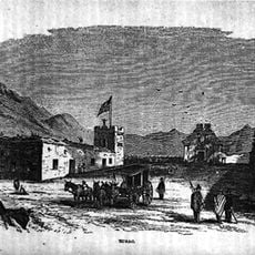
The settlement began in the late 19th century as a trading post near the newly drawn border between Mexico and the United States. A conflict in 1918 prompted both nations to build permanent fencing that has divided the shared urban space ever since.

The name comes from a Spanish word for walnut trees that once grew in the area. Visitors today see shops and markets along the border streets, where locals and travelers from both countries buy goods and Spanish and English are both heard in conversation.

Visitors should carry identification documents because checkpoints are located nearby. The main streets are well marked, but travelers can orient themselves by the boundary fence that always runs to the north.

Many pedestrians cross the boundary daily in both directions to go to work or shop, so long waiting lines often form at the crossings. Some houses on the Mexican side have windows that look directly at the wall and stand only a few meters away from it.

The community of curious travelers

AroundUs brings together thousands of curated places, local tips, and hidden gems, enriched daily by 60,000 contributors worldwide.

Start exploring
Location
Inception
1841
GPS coordinates
31.32583,-110.94583
Latest update
December 13, 2025 17:35
Around this place
Tumacácori National Historical Park
United States of America

Tumacácori National Historical Park

28.8 km
VERITAS
United States of America

VERITAS

38.9 km
Patagonia Lake State Park
United States of America

Patagonia Lake State Park

20.6 km
San Rafael Ranch
United States of America

San Rafael Ranch

31.8 km
Fred Lawrence Whipple Observatory
United States of America

Fred Lawrence Whipple Observatory

40.1 km
Tumacácori Mission
United States of America

Tumacácori Mission

28.9 km
Tubac Presidio State Historic Park
United States of America

Tubac Presidio State Historic Park

33.2 km
Guevavi Mission
United States of America

Guevavi Mission

10.2 km
Nogales-Morley Gate Port of Entry
United States of America

Nogales-Morley Gate Port of Entry

873 m
Tubac Presidio
United States of America

Tubac Presidio

33.3 km
Pete Kitchen Ranch
United States of America

Pete Kitchen Ranch

8.5 km
Calabazas Mission
United States of America

Calabazas Mission

14.2 km
The Little Outfit Schoolhouse
United States of America

The Little Outfit Schoolhouse

40 km
Little Red Schoolhouse
United States of America

Little Red Schoolhouse

9.9 km
Cady Hall
United States of America

Cady Hall

29.9 km
James Finley House
United States of America

James Finley House

27.5 km
United States Post Office and Immigration Station–Nogales Main
United States of America

United States Post Office and Immigration Station–Nogales Main

1.5 km
Old Tubac Schoolhouse
United States of America

Old Tubac Schoolhouse

33.3 km
Santa Cruz County Courthouse
United States of America

Santa Cruz County Courthouse

1.4 km
Sen. James A. Harrison House
United States of America

Sen. James A. Harrison House

1.6 km
US Custom House
United States of America

US Custom House

864 m
W.G. Bowman House
United States of America

W.G. Bowman House

2.1 km
George Dunbar House
United States of America

George Dunbar House

2.1 km
Tubac Presidio State Historic Park
United States of America

Tubac Presidio State Historic Park

33.2 km
Frank F. Cranz House
United States of America

Frank F. Cranz House

1.5 km
Tumacácori Museum
United States of America

Tumacácori Museum

28.7 km
Prima Alta History Museum
United States of America

Prima Alta History Museum

1.1 km
Otero Hall
United States of America

Otero Hall

33.2 km
Show the full map
Reviews
Share your experience

No review yet

Discussions
Start a discussion...

No discussion yet

« Heroica Nogales - Border municipality in Sonora, Mexico » is provided by Around Us (aroundus.com). Images and texts are derived from Wikimedia project under a Creative Commons license. You are allowed to copy, distribute, and modify copies of this page, under the conditions set by the license, as long as this note is clearly visible.

Discover hidden gems everywhere you go!

From secret cafés to breathtaking viewpoints, skip the crowded tourist spots and find places that match your style. Our app makes it easy with voice search, smart filtering, route optimization, and insider tips from travelers worldwide. Download now for the complete mobile experience.

Around Us App Screenshot

A unique approach to discovering new places

Le Figaro

All the places worth exploring

France Info

A tailor-made excursion in just a few clicks

20 Minutes

Around Us
Travel Guide & Maps
Download

Send to your phone

QR Code
1

Open the camera app on your mobile.

2

Point at the QR code with your camera. A notification will appear.

3

Tap the notification to open the link.