Enable Location

We need your location to show you interesting places around you

Discover nearby places

Find interesting locations and hidden gems around you

Precise directions

Get accurate directions and distances to places

Your location is never shared with other users. It's only used when you tap the location button.

Tubac Presidio State Historic Park

Log in to your account

Start exploring — it's free

Trusted by 61,661 travelers worldwide

Continue with Google
Continue with Apple
or

We will send you a code to connect

By continuing, you accept our Terms and Conditions and our Privacy Policy

Check your inbox

We've sent a pincode in your inbox. Please enter the code below.

Tubac Presidio State Historic Park

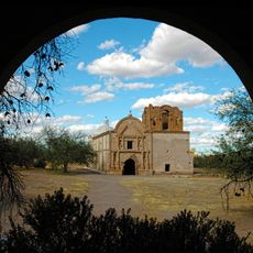
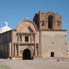
Tubac Presidio State Historic Park, Spanish colonial historic site in Tubac, Arizona, US.

Description

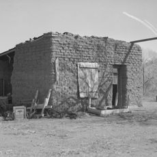
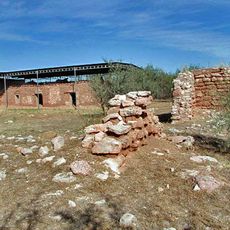
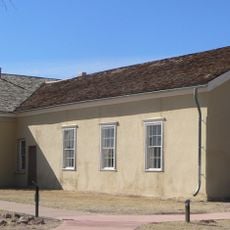
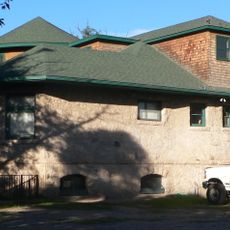
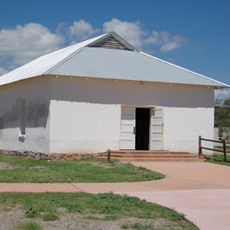
Tubac Presidio State Historic Park is a site containing preserved remains of a colonial military outpost founded in the mid-1700s, with visible foundations and wall sections scattered across the grounds. The visitor center displays Spanish artifacts and indigenous objects found during excavations in the region.

History

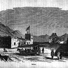
This military settlement was established in 1752 as a defense against Apache raids and other threats to Spanish colonists in the region. The fortified site served as a launching point for major expeditions northward into unexplored territories.

Culture

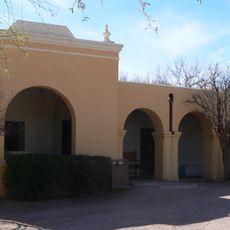
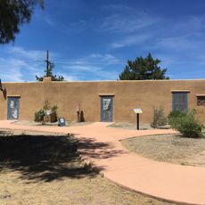
The site holds significance as a center where Spanish colonial life unfolded, with the grounds showing how settlers built homes and conducted daily routines. Walking through reveals the layout of colonial dwellings and the spaces where families gathered.

Practical

The grounds are fairly open and easy to walk through, with marked paths connecting the ruins and visitor center throughout the site. Bring sun protection and water, as shade is limited across most of the property.

Did you know?

This location served as the gathering point for a major expedition that departed northwestward and resulted in the founding of San Francisco. The assembly and departure of hundreds of colonists from this spot made it a critical moment in western expansion.

Operator
Arizona State Parks Board
GPS coordinates
31.61175,-111.04660
Latest update
December 11, 2025 11:00

AroundUs brings together thousands of curated places, local tips, and hidden gems, enriched daily by 60,000 contributors worldwide. Discover all places nearby (Santa Cruz County).

Around this place
Madera Canyon
United States of America

Madera Canyon

17.5 km
Tumacácori National Historical Park
United States of America

Tumacácori National Historical Park

4.9 km
Mount Wrightson
United States of America

Mount Wrightson

21 km
VERITAS
United States of America

VERITAS

11.4 km
MMT Observatory
United States of America

MMT Observatory

17.5 km
Patagonia Lake State Park
United States of America

Patagonia Lake State Park

22.5 km
Fred Lawrence Whipple Observatory
United States of America

Fred Lawrence Whipple Observatory

17.7 km
Tumacácori Mission
United States of America

Tumacácori Mission

4.8 km
Mount Hopkins
United States of America

Mount Hopkins

17.6 km
Guevavi Mission
United States of America

Guevavi Mission

26.3 km
Tucson ring meteorite
United States of America

Tucson ring meteorite

27.6 km
Tubac Presidio
United States of America

Tubac Presidio

44 m
Pete Kitchen Ranch
United States of America

Pete Kitchen Ranch

24.9 km
Calabazas Mission
United States of America

Calabazas Mission

19.6 km
Infrared Optical Telescope Array
United States of America

Infrared Optical Telescope Array

17.7 km
Little Red Schoolhouse
United States of America

Little Red Schoolhouse

29.9 km
Arivaca Schoolhouse
United States of America

Arivaca Schoolhouse

27.2 km
United States Post Office and Immigration Station–Nogales Main
United States of America

United States Post Office and Immigration Station–Nogales Main

32.2 km
Old Tubac Schoolhouse
United States of America

Old Tubac Schoolhouse

29 m
Sen. James A. Harrison House
United States of America

Sen. James A. Harrison House

32.2 km
W.G. Bowman House
United States of America

W.G. Bowman House

31.7 km
San Ignacio Golf Club
United States of America

San Ignacio Golf Club

22.4 km
George Dunbar House
United States of America

George Dunbar House

31.7 km
Tubac Presidio State Historic Park
United States of America

Tubac Presidio State Historic Park

84 m
Frank F. Cranz House
United States of America

Frank F. Cranz House

32 km
Tumacácori Museum
United States of America

Tumacácori Museum

4.9 km
Otero Hall
United States of America

Otero Hall

31 m
Rojas House
United States of America

Rojas House

87 m
Show the full map
« Tubac Presidio State Historic Park - Spanish colonial historic site in Tubac, Arizona, US » is provided by Around Us (aroundus.com). Images and texts are derived from Wikimedia project under a Creative Commons license. You are allowed to copy, distribute, and modify copies of this page, under the conditions set by the license, as long as this note is clearly visible.

Discover hidden gems everywhere you go!

From secret cafés to breathtaking viewpoints, skip the crowded tourist spots and find places that match your style. Our app makes it easy with voice search, smart filtering, route optimization, and insider tips from travelers worldwide. Download now for the complete mobile experience.

Around Us App Screenshot

A unique approach to discovering new places

Le Figaro

All the places worth exploring

France Info

A tailor-made excursion in just a few clicks

20 Minutes

Around Us
Travel Guide & Maps
Download

Send to your phone

QR Code
1

Open the camera app on your mobile.

2

Point at the QR code with your camera. A notification will appear.

3

Tap the notification to open the link.