Santa Cruz County

Log in to your account

AroundUs is a community-driven map of interesting places, built by curious explorers like you. It grows with every review, story, and photo you share.
Connect to save your favorite spots, contribute locations, and create personalized routes.
By continuing, you accept our Terms and Conditions and our Privacy Policy
Add to collection
Map
Suggest a change
Share

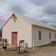
Santa Cruz County, Administrative county in southern Arizona, United States

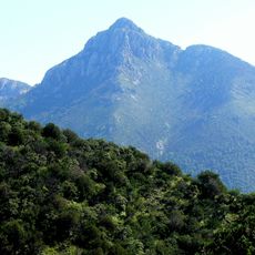
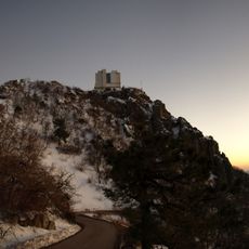
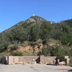
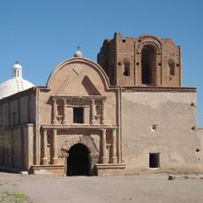
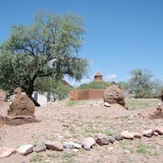
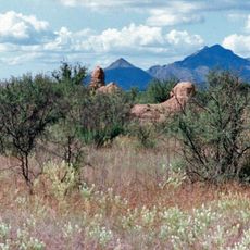
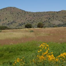
Santa Cruz County spans mountains, valleys, and desert landscapes with diverse terrain throughout the region. The area offers numerous hiking trails and outdoor recreational opportunities across these varied natural environments.

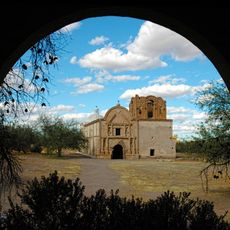
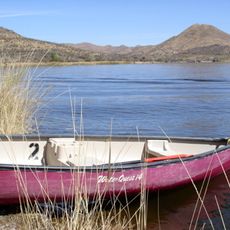
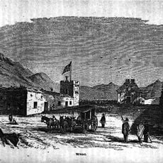
The county was established in 1899 and takes its name from the Santa Cruz River, which has supplied water to settlements for centuries. This river has long been central to human activity in the region.

The region maintains strong ties to Mexican culture through border commerce and a population that speaks both English and Spanish in daily life. This linguistic diversity shapes how communities interact and celebrate together.

Visitors should expect significant temperature swings between day and night, especially in desert areas. Good footwear and plenty of water are important when exploring the varied landscapes.

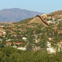
Nogales, a border city within the county, functions as a major international trade hub between the United States and Mexico. Daily traffic of people and goods crosses the border through this central trading route.

Location: Arizona

Inception: 1899

Capital city: Nogales

Elevation above the sea: 1,282 m

Shares border with: Pima County, Cochise County, Heroica Nogales, Santa Cruz, Sáric

Website: https://santacruzcountyaz.gov

GPS coordinates: 31.53333,-110.83333

Latest update: December 6, 2025 22:05

Photos
Around this place
Show the full map
Tumacácori National Historical Park
United States of America

Tumacácori National Historical Park

21 km
Mount Wrightson
United States of America

Mount Wrightson

18.2 km
VERITAS
United States of America

VERITAS

19.4 km
MMT Observatory
United States of America

MMT Observatory

17.9 km
Patagonia Lake State Park
United States of America

Patagonia Lake State Park

4.8 km
San Rafael Ranch
United States of America

San Rafael Ranch

28.9 km
Fred Lawrence Whipple Observatory
United States of America

Fred Lawrence Whipple Observatory

17 km
Fort Buchanan
United States of America

Fort Buchanan

18.3 km
Tumacácori Mission
United States of America

Tumacácori Mission

21 km
Tubac Presidio State Historic Park
United States of America

Tubac Presidio State Historic Park

22 km
Mount Hopkins
United States of America

Mount Hopkins

18 km
Guevavi Mission
United States of America

Guevavi Mission

15.2 km
Tubac Presidio
United States of America

Tubac Presidio

22 km
Pete Kitchen Ranch
United States of America

Pete Kitchen Ranch

18.6 km
Calabazas Mission
United States of America

Calabazas Mission

15 km
Infrared Optical Telescope Array
United States of America

Infrared Optical Telescope Array

18.3 km
The Little Outfit Schoolhouse
United States of America

The Little Outfit Schoolhouse

25 km
Canelo Hills Cienega Reserve
United States of America

Canelo Hills Cienega Reserve

29.3 km
Little Red Schoolhouse
United States of America

Little Red Schoolhouse

16.6 km
Canelo Ranger Station
United States of America

Canelo Ranger Station

30.1 km
Arivaca Schoolhouse
United States of America

Arivaca Schoolhouse

47.4 km
James Finley House
United States of America

James Finley House

14.3 km
United States Post Office and Immigration Station–Nogales Main
United States of America

United States Post Office and Immigration Station–Nogales Main

23.9 km
Old Tubac Schoolhouse
United States of America

Old Tubac Schoolhouse

22.1 km
Santa Cruz County Courthouse
United States of America

Santa Cruz County Courthouse

24.1 km
Sen. James A. Harrison House
United States of America

Sen. James A. Harrison House

23.8 km
US Custom House
United States of America

US Custom House

24.6 km
W.G. Bowman House
United States of America

W.G. Bowman House

23.4 km
Show the full map
Reviews

Visited this place? Tap the stars to rate it and share your experience / photos with the community! Try now! You can cancel it anytime.

Administrative divisions
« Santa Cruz County - Administrative county in southern Arizona, United States » is provided by Around Us (aroundus.com). Images and texts are derived from Wikimedia project under a Creative Commons license. You are allowed to copy, distribute, and modify copies of this page, under the conditions set by the license, as long as this note is clearly visible.

Discover hidden gems everywhere you go!

From secret cafés to breathtaking viewpoints, skip the crowded tourist spots and find places that match your style. Our app makes it easy with voice search, smart filtering, route optimization, and insider tips from travelers worldwide. Download now for the complete mobile experience.

Around Us App Screenshot

A unique approach to discovering new places

Le Figaro

All the places worth exploring

France Info

A tailor-made excursion in just a few clicks

20 Minutes