Canelo Hills Cienega Reserve

Log in to your account

AroundUs is a community-driven map of interesting places, built by curious explorers like you. It grows with every review, story, and photo you share.
Connect to save your favorite spots, contribute locations, and create personalized routes.
Continue with Google
Continue with Apple
Continue with X
Continue with Facebook
Continue with email
By continuing, you accept our Terms and Conditions and our Privacy Policy
Create an account
Add to collection
Map
Suggest a change
Share

Canelo Hills Cienega Reserve, Protected wetland reserve in Santa Cruz County, United States

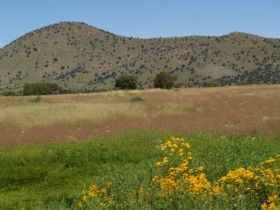
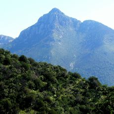
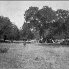
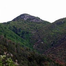
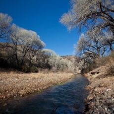
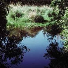
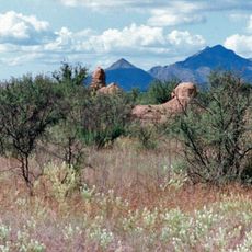
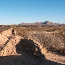
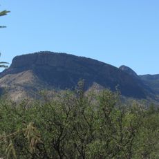
Canelo Hills Cienega Reserve is a 260-acre protected area featuring rare cienega wetlands, black oak forests, and Arizona fescue grasslands spread across the eastern Canelo Hills. The varied habitats create a mosaic where alkaline wetland zones border forested slopes and open meadows.

The Nature Conservancy purchased this land from the Knipes family in 1969, establishing the foundation for this protected site. The area received designation as a National Natural Landmark in 1974, securing its status as an important conservation area.

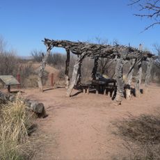
The reserve serves as a place where people learn about Arizona's rare wetland ecosystems through hands-on field study and observation. Local groups and researchers actively work here to understand and protect species found nowhere else in the region.

The site sits southeast of Sonoita and is most accessible during fair weather conditions. Visitors should prepare for walking through natural habitats and bring sturdy footwear and water.

The reserve is home to the rare Canelo ladies tresses orchid and two native fish species: the Gila chub and Gila sucker. These three species are difficult to find elsewhere in Arizona, making this a remarkable location for naturalists.

Location: Santa Cruz County

Inception: 1969

GPS coordinates: 31.56220,-110.52600

Latest update: December 9, 2025 20:23

Photos
Around this place
Fort Huachuca
United States of America

Fort Huachuca

16.7 km
Kartchner Caverns State Park
United States of America

Kartchner Caverns State Park

35 km
Empire Ranch
United States of America

Empire Ranch

27.2 km
Mount Wrightson
United States of America

Mount Wrightson

34 km
MMT Observatory
United States of America

MMT Observatory

36.8 km
Patagonia Lake State Park
United States of America

Patagonia Lake State Park

32 km
Coronado National Memorial
United States of America

Coronado National Memorial

33.9 km
San Rafael Ranch
United States of America

San Rafael Ranch

24.6 km
Fred Lawrence Whipple Observatory
United States of America

Fred Lawrence Whipple Observatory

35.9 km
Fort Buchanan
United States of America

Fort Buchanan

20.2 km
Miller Peak
United States of America

Miller Peak

29.1 km
Murray Springs Clovis Site
United States of America

Murray Springs Clovis Site

32.9 km
San Pedro Riparian National Conservation Area
United States of America

San Pedro Riparian National Conservation Area

37.5 km
Mount Hopkins
United States of America

Mount Hopkins

36.8 km
Las Cienegas National Conservation Area
United States of America

Las Cienegas National Conservation Area

25.7 km
Guevavi Mission
United States of America

Guevavi Mission

39.6 km
Presidio Santa Cruz de Terrenate
United States of America

Presidio Santa Cruz de Terrenate

37.1 km
Apache Peak
United States of America

Apache Peak

30.6 km
Infrared Optical Telescope Array
United States of America

Infrared Optical Telescope Array

36.9 km
Brown Canyon Ranch
United States of America

Brown Canyon Ranch

23.8 km
The Little Outfit Schoolhouse
United States of America

The Little Outfit Schoolhouse

8.7 km
Hereford Arizona Observatory
United States of America

Hereford Arizona Observatory

30 km
Little Red Schoolhouse
United States of America

Little Red Schoolhouse

38.2 km
Canelo Ranger Station
United States of America

Canelo Ranger Station

1.5 km
James Finley House
United States of America

James Finley House

20.3 km
Coronado cave
United States of America

Coronado cave

34.4 km
Kinjockity Ranch
United States of America

Kinjockity Ranch

34.9 km
Fairbank Railroad Bridge
United States of America

Fairbank Railroad Bridge

36.5 km
Show the full map
Reviews

Visited this place? Tap the stars to rate it and share your experience / photos with the community! Try now! You can cancel it anytime.

« Canelo Hills Cienega Reserve - Protected wetland reserve in Santa Cruz County, United States » is provided by Around Us (aroundus.com). Images and texts are derived from Wikimedia project under a Creative Commons license. You are allowed to copy, distribute, and modify copies of this page, under the conditions set by the license, as long as this note is clearly visible.

Discover hidden gems everywhere you go!

From secret cafés to breathtaking viewpoints, skip the crowded tourist spots and find places that match your style. Our app makes it easy with voice search, smart filtering, route optimization, and insider tips from travelers worldwide. Download now for the complete mobile experience.

Around Us App Screenshot

A unique approach to discovering new places

Le Figaro

All the places worth exploring

France Info

A tailor-made excursion in just a few clicks

20 Minutes