Enable Location

We need your location to show you interesting places around you

Discover nearby places

Find interesting locations and hidden gems around you

Precise directions

Get accurate directions and distances to places

Your location is never shared with other users. It's only used when you tap the location button.

San Pedro Riparian National Conservation Area

Log in to your account

Start exploring — it's free

Trusted by 65,828 travelers worldwide

Continue with Google
Continue with Apple
or

We will send you a code to connect

By continuing, you accept our Terms and Conditions and our Privacy Policy

Check your inbox

We've sent a pincode in your inbox. Please enter the code below.

San Pedro Riparian National Conservation Area
Discussion Reviews 1 Photos
4.7k Popularity

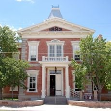
San Pedro Riparian National Conservation Area, National conservation area in Cochise County, Arizona.

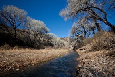
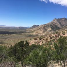
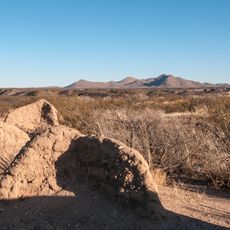
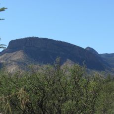
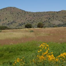
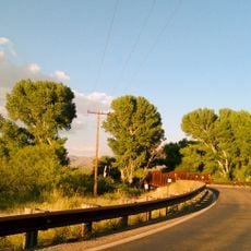
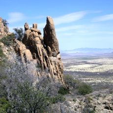
San Pedro Riparian National Conservation Area is a federally protected zone along the San Pedro River in southern Arizona, running through dry desert terrain. The river creates a green corridor of cottonwood and willow trees that stands out sharply against the surrounding dry land.

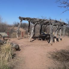
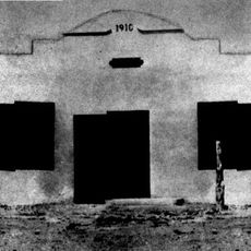
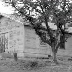
The San Pedro River valley has been home to human communities for thousands of years, as shown by archaeological sites scattered throughout the land. In the 18th century, Spanish forces built a military outpost along the river, leaving behind the ruins that visitors can still walk through today.

The ruins of Presidio Santa Cruz de Terrenate, an 18th-century Spanish colonial fort, are still standing inside the area. Stone foundations and adobe walls remain visible, giving visitors a direct sense of what life along this frontier once looked like.

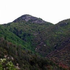
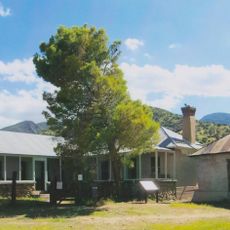
Several marked trails follow the river and cross into the surrounding desert, so it is easy to explore on foot at your own pace. The San Pedro House visitor center is a good starting point for picking up maps and getting oriented before heading out.

The San Pedro River is one of the few rivers in the American Southwest that still flows freely without a dam blocking it. This makes it one of the most important corridors for migratory birds traveling between Mexico and the northern United States.

The community of curious travelers

AroundUs brings together thousands of curated places, local tips, and hidden gems, enriched daily by 60,000 contributors worldwide.

Start exploring
Location
Inception
1988
GPS coordinates
31.58290,-110.13100
Latest update
March 3, 2026 08:14
Around this place
Fort Huachuca
United States of America

Fort Huachuca

21 km
Kartchner Caverns State Park
United States of America

Kartchner Caverns State Park

35 km
Bird Cage Theatre
United States of America

Bird Cage Theatre

15.7 km
Coronado National Memorial
United States of America

Coronado National Memorial

29.3 km
Miller Peak
United States of America

Miller Peak

26.2 km
Schieffelin Hall
United States of America

Schieffelin Hall

15.8 km
Tombstone Courthouse
United States of America

Tombstone Courthouse

15.5 km
Murray Springs Clovis Site
United States of America

Murray Springs Clovis Site

4.8 km
Tombstone Historic District
United States of America

Tombstone Historic District

15.7 km
Presidio Santa Cruz de Terrenate
United States of America

Presidio Santa Cruz de Terrenate

19.8 km
Apache Peak
United States of America

Apache Peak

39 km
Gleeson Jail
United States of America

Gleeson Jail

33.1 km
Brown Canyon Ranch
United States of America

Brown Canyon Ranch

19.9 km
Bisbee Historic District
United States of America

Bisbee Historic District

25.8 km
The Little Outfit Schoolhouse
United States of America

The Little Outfit Schoolhouse

43.1 km
Hereford Arizona Observatory
United States of America

Hereford Arizona Observatory

17.7 km
Canelo Hills Cienega Reserve
United States of America

Canelo Hills Cienega Reserve

37.5 km
Phelps Dodge General Office Building
United States of America

Phelps Dodge General Office Building

25.9 km
St. Patrick's Roman Catholic Church
United States of America

St. Patrick's Roman Catholic Church

25.1 km
Canelo Ranger Station
United States of America

Canelo Ranger Station

36.7 km
Coronado cave
United States of America

Coronado cave

28.6 km
Bisbee Residential Historic District
United States of America

Bisbee Residential Historic District

25 km
Bisbee Woman's Club Clubhouse
United States of America

Bisbee Woman's Club Clubhouse

25.8 km
Kinjockity Ranch
United States of America

Kinjockity Ranch

23.5 km
Castle Rock
United States of America

Castle Rock

25.6 km
Hereford Road Bridge
United States of America

Hereford Road Bridge

16.2 km
Fairbank Railroad Bridge
United States of America

Fairbank Railroad Bridge

17.5 km
Cochise Trail
United States of America

Cochise Trail

40.1 km
Show the full map
Reviews
Share your experience

No review yet

Discussions
Start a discussion...

No discussion yet

« San Pedro Riparian National Conservation Area - National conservation area in Cochise County, Arizona » is provided by Around Us (aroundus.com). Images and texts are derived from Wikimedia project under a Creative Commons license. You are allowed to copy, distribute, and modify copies of this page, under the conditions set by the license, as long as this note is clearly visible.

Discover hidden gems everywhere you go!

From secret cafés to breathtaking viewpoints, skip the crowded tourist spots and find places that match your style. Our app makes it easy with voice search, smart filtering, route optimization, and insider tips from travelers worldwide. Download now for the complete mobile experience.

Around Us App Screenshot

A unique approach to discovering new places

Le Figaro

All the places worth exploring

France Info

A tailor-made excursion in just a few clicks

20 Minutes

Around Us
Travel Guide & Maps
Download

Send to your phone

QR Code
1

Open the camera app on your mobile.

2

Point at the QR code with your camera. A notification will appear.

3

Tap the notification to open the link.