Enable Location

We need your location to show you interesting places around you

Discover nearby places

Find interesting locations and hidden gems around you

Precise directions

Get accurate directions and distances to places

Your location is never shared with other users. It's only used when you tap the location button.

Apache Peak

Log in to your account

Join the adventure

Create your free account and start exploring (like 60k+ others)

We will send you a code to connect

or
Continue with Google
Continue with Apple
By continuing, you accept our Terms and Conditions and our Privacy Policy

Check your inbox

We've sent a pincode in your inbox. Please enter the code below.

Apache Peak

Apache Peak, Mountain summit in Cochise County, Arizona, US

Description

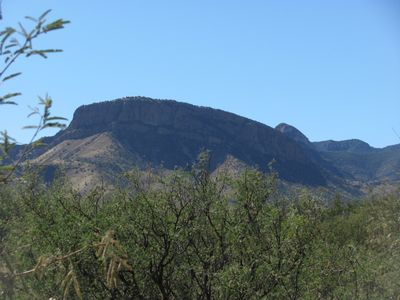
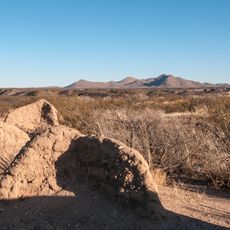
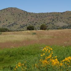
Apache Peak is a mountain summit in the Whetstone Mountains of Arizona that reaches about 7,700 feet elevation. The terrain features exposed rock faces and gradual vegetation changes as elevation increases, creating distinct zones of desert and adapted plants.

History

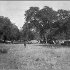
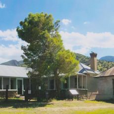
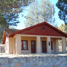
The mountain stands in Coronado National Forest, an area where indigenous peoples moved through the landscape for centuries before modern settlement arrived. This region has shifted between periods of use and abandonment over time.

Culture

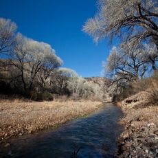
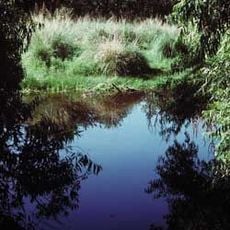
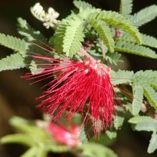
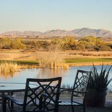
The mountain environment supports diverse plant communities, from desert floor species to higher elevation vegetation adapted to mountain conditions.

Practical

Two main hiking routes lead to the summit with solid elevation gain and rocky terrain that requires careful footwork. Plan to start early and bring plenty of water, as the exposed sections offer little shade and heat builds through the day.

Did you know?

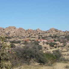
The mountain maintains a prominence of 2,886 feet above the surrounding landscape, making it visible from multiple vantage points across Cochise County.

Location
GPS coordinates
31.82481,-110.42896
Latest update
December 13, 2025 11:47

AroundUs brings together thousands of curated places, local tips, and hidden gems, enriched daily by 60,000 contributors worldwide. Discover all places nearby (Arizona).

Around this place
Fort Huachuca
United States of America

Fort Huachuca

30.9 km
Kartchner Caverns State Park
United States of America

Kartchner Caverns State Park

7.9 km
Bird Cage Theatre
United States of America

Bird Cage Theatre

36.7 km
Empire Ranch
United States of America

Empire Ranch

20.6 km
Texas Canyon
United States of America

Texas Canyon

41.1 km
Colossal Cave
United States of America

Colossal Cave

32.9 km
Fort Buchanan
United States of America

Fort Buchanan

32.2 km
Schieffelin Hall
United States of America

Schieffelin Hall

36.5 km
Tombstone Courthouse
United States of America

Tombstone Courthouse

36.3 km
Murray Springs Clovis Site
United States of America

Murray Springs Clovis Site

36.9 km
San Pedro Riparian National Conservation Area
United States of America

San Pedro Riparian National Conservation Area

39 km
Las Cienegas National Conservation Area
United States of America

Las Cienegas National Conservation Area

17.3 km
Tombstone Historic District
United States of America

Tombstone Historic District

36.5 km
Presidio Santa Cruz de Terrenate
United States of America

Presidio Santa Cruz de Terrenate

23 km
Amerind Foundation
United States of America

Amerind Foundation

41.2 km
Brown Canyon Ranch
United States of America

Brown Canyon Ranch

41 km
Ciénega Bridge
United States of America

Ciénega Bridge

29.9 km
The Little Outfit Schoolhouse
United States of America

The Little Outfit Schoolhouse

39.2 km
Canelo Hills Cienega Reserve
United States of America

Canelo Hills Cienega Reserve

30.6 km
United States of America

Mae West Peaks

42.2 km
Canelo Ranger Station
United States of America

Canelo Ranger Station

31.5 km
Benson Railroad Historic District
United States of America

Benson Railroad Historic District

20.5 km
Apache Powder Historic Residential District
United States of America

Apache Powder Historic Residential District

20 km
Programa de las Leguminosas del Desierto
United States of America

Programa de las Leguminosas del Desierto

39.3 km
San Pedro Golf Course
United States of America

San Pedro Golf Course

22 km
Marsh Station Bridge
United States of America

Marsh Station Bridge

29.9 km
Fairbank Railroad Bridge
United States of America

Fairbank Railroad Bridge

24.5 km
San Pedro River Railroad Bridge
United States of America

San Pedro River Railroad Bridge

21.1 km
Show the full map
« Apache Peak - Mountain summit in Cochise County, Arizona, US » is provided by Around Us (aroundus.com). Images and texts are derived from Wikimedia project under a Creative Commons license. You are allowed to copy, distribute, and modify copies of this page, under the conditions set by the license, as long as this note is clearly visible.

Discover hidden gems everywhere you go!

From secret cafés to breathtaking viewpoints, skip the crowded tourist spots and find places that match your style. Our app makes it easy with voice search, smart filtering, route optimization, and insider tips from travelers worldwide. Download now for the complete mobile experience.

Around Us App Screenshot

A unique approach to discovering new places

Le Figaro

All the places worth exploring

France Info

A tailor-made excursion in just a few clicks

20 Minutes

Around Us
Travel Guide & Maps
Download

Send to your phone

QR Code
1

Open the camera app on your mobile.

2

Point at the QR code with your camera. A notification will appear.

3

Tap the notification to open the link.