Enable Location

We need your location to show you interesting places around you

Discover nearby places

Find interesting locations and hidden gems around you

Precise directions

Get accurate directions and distances to places

Your location is never shared with other users. It's only used when you tap the location button.

Tombstone Historic District

Log in to your account

Start exploring — it's free

Trusted by 62,158 travelers worldwide

Continue with Google
Continue with Apple
or

We will send you a code to connect

By continuing, you accept our Terms and Conditions and our Privacy Policy

Check your inbox

We've sent a pincode in your inbox. Please enter the code below.

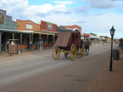
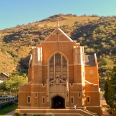
Tombstone Historic District, Historic district in Tombstone, Arizona, US.

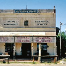
Tombstone Historic District is a downtown area with preserved buildings from the 1880s mining settlement, showing how streets and structures were organized during rapid growth. The buildings reflect architectural styles common to frontier mining towns of that era.

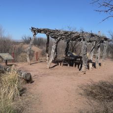
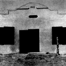
The area became a booming town after silver was discovered in 1877, growing rapidly within a few years. Major fires in 1881 destroyed many original wooden buildings, but survivors today show what the early town looked like.

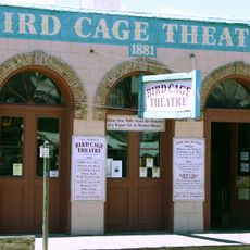
Entertainment venues like the Bird Cage Theatre and Crystal Palace Saloon served as gathering spots where miners and merchants met after work. These places reveal how people spent leisure time in a rough mining settlement.

Walking paths take you through the district to visit different buildings and sites at your own pace. The cooler months are best for exploring on foot, as summer heat can be intense.

The O.K. Corral site, where a famous gunfight happened in 1881, sits at the heart of the district and draws many visitors. This single event made Tombstone known worldwide and remains the main reason people visit.

The community of curious travelers

AroundUs brings together thousands of curated places, local tips, and hidden gems, enriched daily by 60,000 contributors worldwide.

Start exploring
Location
GPS coordinates
31.71250,-110.06639
Latest update
December 12, 2025 07:56
Around this place
Fort Huachuca
United States of America

Fort Huachuca

32.1 km
Kartchner Caverns State Park
United States of America

Kartchner Caverns State Park

30 km
Bird Cage Theatre
United States of America

Bird Cage Theatre

148 m
Schieffelin Hall
United States of America

Schieffelin Hall

117 m
Tombstone Courthouse
United States of America

Tombstone Courthouse

246 m
Murray Springs Clovis Site
United States of America

Murray Springs Clovis Site

19.1 km
San Pedro Riparian National Conservation Area
United States of America

San Pedro Riparian National Conservation Area

15.7 km
Presidio Santa Cruz de Terrenate
United States of America

Presidio Santa Cruz de Terrenate

13.5 km
Amerind Foundation
United States of America

Amerind Foundation

37.1 km
Apache Peak
United States of America

Apache Peak

36.5 km
Gleeson Jail
United States of America

Gleeson Jail

22.6 km
Brown Canyon Ranch
United States of America

Brown Canyon Ranch

34.4 km
Bisbee Historic District
United States of America

Bisbee Historic District

33.3 km
Hereford Arizona Observatory
United States of America

Hereford Arizona Observatory

33.2 km
Phelps Dodge General Office Building
United States of America

Phelps Dodge General Office Building

33.4 km
St. Patrick's Roman Catholic Church
United States of America

St. Patrick's Roman Catholic Church

32.8 km
Bisbee Residential Historic District
United States of America

Bisbee Residential Historic District

32.8 km
Bisbee Woman's Club Clubhouse
United States of America

Bisbee Woman's Club Clubhouse

33.5 km
United States of America

Our Lady of Victory Catholic Church

31.5 km
Pearce General Store
United States of America

Pearce General Store

31.5 km
Benson Railroad Historic District
United States of America

Benson Railroad Historic District

35.8 km
Apache Powder Historic Residential District
United States of America

Apache Powder Historic Residential District

35.9 km
San Pedro Golf Course
United States of America

San Pedro Golf Course

36.2 km
Castle Rock
United States of America

Castle Rock

33.2 km
Hereford Road Bridge
United States of America

Hereford Road Bridge

30.8 km
Fairbank Railroad Bridge
United States of America

Fairbank Railroad Bridge

12.3 km
San Pedro River Railroad Bridge
United States of America

San Pedro River Railroad Bridge

34.5 km
Cochise Trail
United States of America

Cochise Trail

24.5 km
Show the full map
« Tombstone Historic District - Historic district in Tombstone, Arizona, US » is provided by Around Us (aroundus.com). Images and texts are derived from Wikimedia project under a Creative Commons license. You are allowed to copy, distribute, and modify copies of this page, under the conditions set by the license, as long as this note is clearly visible.

Discover hidden gems everywhere you go!

From secret cafés to breathtaking viewpoints, skip the crowded tourist spots and find places that match your style. Our app makes it easy with voice search, smart filtering, route optimization, and insider tips from travelers worldwide. Download now for the complete mobile experience.

Around Us App Screenshot

A unique approach to discovering new places

Le Figaro

All the places worth exploring

France Info

A tailor-made excursion in just a few clicks

20 Minutes

Around Us
Travel Guide & Maps
Download

Send to your phone

QR Code
1

Open the camera app on your mobile.

2

Point at the QR code with your camera. A notification will appear.

3

Tap the notification to open the link.