Enable Location

We need your location to show you interesting places around you

Discover nearby places

Find interesting locations and hidden gems around you

Precise directions

Get accurate directions and distances to places

Your location is never shared with other users. It's only used when you tap the location button.

Presidio Santa Cruz de Terrenate

Log in to your account

Start exploring — it's free

Trusted by 61,961 travelers worldwide

Continue with Google
Continue with Apple
or

We will send you a code to connect

By continuing, you accept our Terms and Conditions and our Privacy Policy

Check your inbox

We've sent a pincode in your inbox. Please enter the code below.

Presidio Santa Cruz de Terrenate

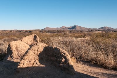
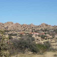
Presidio Santa Cruz de Terrenate, Spanish colonial archaeological site near Tombstone, Arizona, US

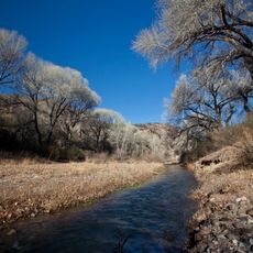
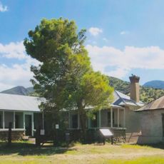
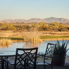
Presidio Santa Cruz de Terrenate is a Spanish colonial fortress whose adobe walls and foundations remain on a bluff overlooking the San Pedro River. The site preserves the layout of different structures that made up this military installation on the northern frontier.

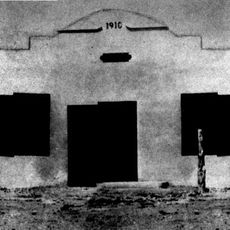
The fortress was founded in 1775 under King Charles III of Spain to protect the northern frontier from Apache raids. This military installation represented Spain's strategy for defending its remote colonial territory.

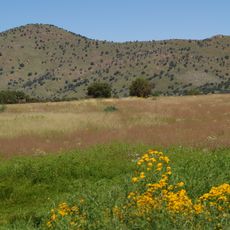
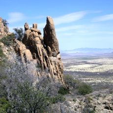
The site reflects multiple periods of settlement visible in its remains, from Indigenous communities to Spanish military occupation. Walking through the ruins, you can sense how different peoples used this location at different times along the river.

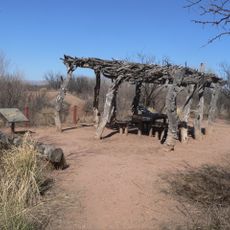
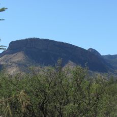
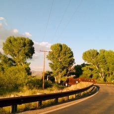
The site is accessible via a walking trail that passes interpretive signs explaining the history and layout. Visit during cooler months since the location is open and exposed to the sun.

Excavations between 2007 and 2010 revealed evidence of three separate settlement periods stacked on top of each other, from Sobaipuri and Hohokam to earlier Archaic cultures. This shows how the same location held value for different peoples across thousands of years.

The community of curious travelers

AroundUs brings together thousands of curated places, local tips, and hidden gems, enriched daily by 60,000 contributors worldwide.

Start exploring
GPS coordinates
31.75018,-110.20208
Latest update
December 12, 2025 12:02
Around this place
Fort Huachuca
United States of America

Fort Huachuca

25.8 km
The Thing?
United States of America

The Thing?

39.8 km
Kartchner Caverns State Park
United States of America

Kartchner Caverns State Park

16.8 km
Bird Cage Theatre
United States of America

Bird Cage Theatre

13.7 km
Texas Canyon
United States of America

Texas Canyon

35.4 km
Schieffelin Hall
United States of America

Schieffelin Hall

13.5 km
Tombstone Courthouse
United States of America

Tombstone Courthouse

13.3 km
Murray Springs Clovis Site
United States of America

Murray Springs Clovis Site

20.1 km
San Pedro Riparian National Conservation Area
United States of America

San Pedro Riparian National Conservation Area

19.8 km
Las Cienegas National Conservation Area
United States of America

Las Cienegas National Conservation Area

38.3 km
Tombstone Historic District
United States of America

Tombstone Historic District

13.5 km
Amerind Foundation
United States of America

Amerind Foundation

34.9 km
Apache Peak
United States of America

Apache Peak

23 km
Gleeson Jail
United States of America

Gleeson Jail

35.4 km
Brown Canyon Ranch
United States of America

Brown Canyon Ranch

32.1 km
Hereford Arizona Observatory
United States of America

Hereford Arizona Observatory

33.3 km
Canelo Hills Cienega Reserve
United States of America

Canelo Hills Cienega Reserve

37.1 km
United States of America

Mae West Peaks

39.7 km
Canelo Ranger Station
United States of America

Canelo Ranger Station

37.1 km
United States of America

Our Lady of Victory Catholic Church

39.8 km
Pearce General Store
United States of America

Pearce General Store

39.9 km
Benson Railroad Historic District
United States of America

Benson Railroad Historic District

25.9 km
Apache Powder Historic Residential District
United States of America

Apache Powder Historic Residential District

25.8 km
San Pedro Golf Course
United States of America

San Pedro Golf Course

26.7 km
Hereford Road Bridge
United States of America

Hereford Road Bridge

35.9 km
San Pedro River Railroad Bridge
United States of America

San Pedro River Railroad Bridge

24.9 km
Fairbank Railroad Bridge
United States of America

Fairbank Railroad Bridge

2.3 km
Cochise Trail
United States of America

Cochise Trail

28 km
Show the full map
« Presidio Santa Cruz de Terrenate - Spanish colonial archaeological site near Tombstone, Arizona, US » is provided by Around Us (aroundus.com). Images and texts are derived from Wikimedia project under a Creative Commons license. You are allowed to copy, distribute, and modify copies of this page, under the conditions set by the license, as long as this note is clearly visible.

Discover hidden gems everywhere you go!

From secret cafés to breathtaking viewpoints, skip the crowded tourist spots and find places that match your style. Our app makes it easy with voice search, smart filtering, route optimization, and insider tips from travelers worldwide. Download now for the complete mobile experience.

Around Us App Screenshot

A unique approach to discovering new places

Le Figaro

All the places worth exploring

France Info

A tailor-made excursion in just a few clicks

20 Minutes

Around Us
Travel Guide & Maps
Download

Send to your phone

QR Code
1

Open the camera app on your mobile.

2

Point at the QR code with your camera. A notification will appear.

3

Tap the notification to open the link.