Enable Location

We need your location to show you interesting places around you

Discover nearby places

Find interesting locations and hidden gems around you

Precise directions

Get accurate directions and distances to places

Your location is never shared with other users. It's only used when you tap the location button.

Empire Ranch

Log in to your account

Start exploring — it's free

Trusted by 61,695 travelers worldwide

Continue with Google
Continue with Apple
or

We will send you a code to connect

By continuing, you accept our Terms and Conditions and our Privacy Policy

Check your inbox

We've sent a pincode in your inbox. Please enter the code below.

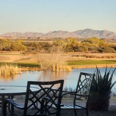
Empire Ranch, Historic cattle ranch in Pima County, Arizona, United States

Description

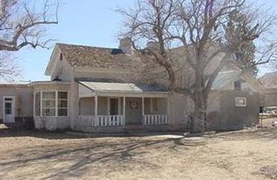
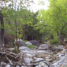
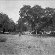
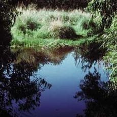
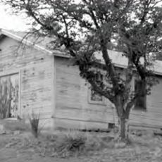
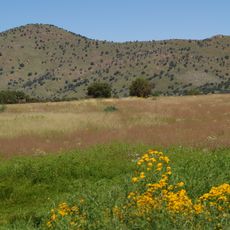
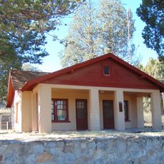
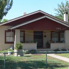
Empire Ranch is a historic cattle ranch in Pima County, Arizona, situated within the Las Cienegas National Conservation Area. The main building contains over 20 rooms built with adobe and wood frame construction, positioned among native grasslands.

History

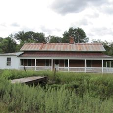
The ranch was purchased in 1876 by Walter Vail and Herbert Hislop and grew from a small holding into a large cattle operation. The property changed hands several times over the following decades, with the buildings repeatedly expanded to meet operational needs.

Culture

The main building shows how western ranch architecture evolved, with spaces organized to reflect the working life of cattle operations and family needs. Visitors can see how adobe and wood construction techniques were combined to create a structure suited to the desert environment.

Practical

The site is open daily from sunrise to sunset and lies near Interstate 10 and Arizona Highway 83 for easy vehicle access. It helps to check ahead for any guided tour options, as access to certain building areas may vary depending on maintenance or special events.

Did you know?

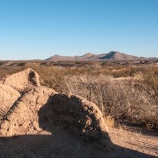
The property contains remnants of silver mining operations that generated supplementary income for the ranch owners in the 1870s. These traces show how early western settlers often combined multiple economic activities to sustain their operations.

Location
GPS coordinates
31.78530,-110.64200
Latest update
December 7, 2025 20:48

AroundUs brings together thousands of curated places, local tips, and hidden gems, enriched daily by 60,000 contributors worldwide. Discover all places nearby (Pima County).

Around this place
Fort Huachuca
United States of America

Fort Huachuca

37.7 km
Kartchner Caverns State Park
United States of America

Kartchner Caverns State Park

28.5 km
Titan Missile Museum
United States of America

Titan Missile Museum

36.2 km
Madera Canyon
United States of America

Madera Canyon

28.8 km
Colossal Cave
United States of America

Colossal Cave

31.2 km
Mount Wrightson
United States of America

Mount Wrightson

21.9 km
VERITAS
United States of America

VERITAS

31.8 km
MMT Observatory
United States of America

MMT Observatory

25.4 km
Patagonia Lake State Park
United States of America

Patagonia Lake State Park

38.2 km
Fred Lawrence Whipple Observatory
United States of America

Fred Lawrence Whipple Observatory

25.2 km
Fort Buchanan
United States of America

Fort Buchanan

15.5 km
Mount Hopkins
United States of America

Mount Hopkins

25.4 km
Las Cienegas National Conservation Area
United States of America

Las Cienegas National Conservation Area

3.5 km
Tucson ring meteorite
United States of America

Tucson ring meteorite

31.5 km
Presidio Santa Cruz de Terrenate
United States of America

Presidio Santa Cruz de Terrenate

41.8 km
Apache Peak
United States of America

Apache Peak

20.6 km
Infrared Optical Telescope Array
United States of America

Infrared Optical Telescope Array

25.3 km
Ciénega Bridge
United States of America

Ciénega Bridge

26.1 km
The Little Outfit Schoolhouse
United States of America

The Little Outfit Schoolhouse

32.9 km
Canelo Hills Cienega Reserve
United States of America

Canelo Hills Cienega Reserve

27.2 km
Canelo Ranger Station
United States of America

Canelo Ranger Station

28.6 km
James Finley House
United States of America

James Finley House

36.2 km
Benson Railroad Historic District
United States of America

Benson Railroad Historic District

38.7 km
San Ignacio Golf Club
United States of America

San Ignacio Golf Club

35.6 km
Apache Powder Historic Residential District
United States of America

Apache Powder Historic Residential District

38.1 km
San Pedro Golf Course
United States of America

San Pedro Golf Course

40.2 km
Marsh Station Bridge
United States of America

Marsh Station Bridge

26.1 km
San Pedro River Railroad Bridge
United States of America

San Pedro River Railroad Bridge

39.7 km
Show the full map
« Empire Ranch - Historic cattle ranch in Pima County, Arizona, United States » is provided by Around Us (aroundus.com). Images and texts are derived from Wikimedia project under a Creative Commons license. You are allowed to copy, distribute, and modify copies of this page, under the conditions set by the license, as long as this note is clearly visible.

Discover hidden gems everywhere you go!

From secret cafés to breathtaking viewpoints, skip the crowded tourist spots and find places that match your style. Our app makes it easy with voice search, smart filtering, route optimization, and insider tips from travelers worldwide. Download now for the complete mobile experience.

Around Us App Screenshot

A unique approach to discovering new places

Le Figaro

All the places worth exploring

France Info

A tailor-made excursion in just a few clicks

20 Minutes

Around Us
Travel Guide & Maps
Download

Send to your phone

QR Code
1

Open the camera app on your mobile.

2

Point at the QR code with your camera. A notification will appear.

3

Tap the notification to open the link.