Enable Location

We need your location to show you interesting places around you

Discover nearby places

Find interesting locations and hidden gems around you

Precise directions

Get accurate directions and distances to places

Your location is never shared with other users. It's only used when you tap the location button.

Miller Peak

Log in to your account

Start exploring — it's free

Trusted by travelers worldwide

Continue with Google
Continue with Apple
or

We will send you a code to connect

By continuing, you accept our Terms and Conditions and our Privacy Policy

Check your inbox

We've sent a pincode in your inbox. Please enter the code below.

Miller Peak

Miller Peak, Mountain summit in Huachuca Mountains, Arizona, US

Description

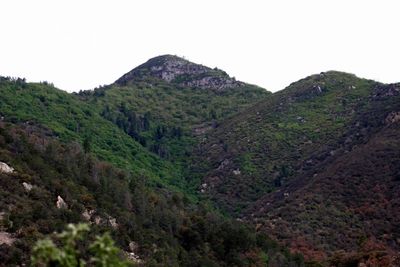
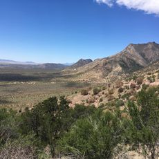
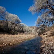
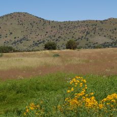
Miller Peak is the highest point in the Huachuca Mountains, rising to 2,879 meters within Coronado National Forest in southeastern Arizona. The summit has rocky terrain and is surrounded by mixed forests of pine and fir trees.

History

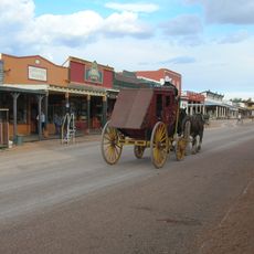
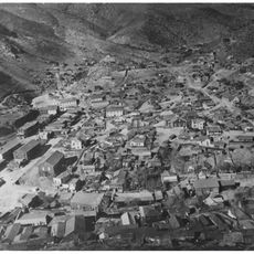
In the late 1800s, the mountain served as a key observation point for US military operations monitoring the Mexican border. The peak held strategic importance during this period of border activity.

Culture

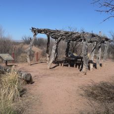
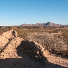
The area around Miller Peak holds traces of Indigenous settlements that shaped this mountain region for thousands of years. These connections to the past remain visible in the landscape today and tie the peak to the people who lived here.

Practical

The hike to the summit is demanding and requires good preparation, especially for carrying enough water and protective gear for changing weather. The trail is well marked throughout but can be slippery and exposed at higher elevations.

Did you know?

A major wildfire in 2011 destroyed large areas of forest around the mountain. Yet satellite images show that nature has since returned, with pine and fir trees regenerating.

Location
Elevation above the sea
2,879 m
GPS coordinates
31.39282,-110.29293
Latest update
December 10, 2025 16:21

AroundUs brings together thousands of curated places, local tips, and hidden gems, enriched daily by 60,000 contributors worldwide. Discover all places nearby (Arizona).

Around this place
Fort Huachuca
United States of America

Fort Huachuca

18.9 km
Bird Cage Theatre
United States of America

Bird Cage Theatre

41.6 km
Coronado National Memorial
United States of America

Coronado National Memorial

5.3 km
San Rafael Ranch
United States of America

San Rafael Ranch

30.7 km
Schieffelin Hall
United States of America

Schieffelin Hall

41.7 km
Tombstone Courthouse
United States of America

Tombstone Courthouse

41.4 km
Murray Springs Clovis Site
United States of America

Murray Springs Clovis Site

22.5 km
San Pedro Riparian National Conservation Area
United States of America

San Pedro Riparian National Conservation Area

26.2 km
Tombstone Historic District
United States of America

Tombstone Historic District

41.6 km
Presidio Santa Cruz de Terrenate
United States of America

Presidio Santa Cruz de Terrenate

40.7 km
Brown Canyon Ranch
United States of America

Brown Canyon Ranch

9 km
Bisbee Historic District
United States of America

Bisbee Historic District

36.4 km
The Little Outfit Schoolhouse
United States of America

The Little Outfit Schoolhouse

29 km
Hereford Arizona Observatory
United States of America

Hereford Arizona Observatory

8.4 km
Canelo Hills Cienega Reserve
United States of America

Canelo Hills Cienega Reserve

29.1 km
Phelps Dodge General Office Building
United States of America

Phelps Dodge General Office Building

36.4 km
St. Patrick's Roman Catholic Church
United States of America

St. Patrick's Roman Catholic Church

35.7 km
Canelo Ranger Station
United States of America

Canelo Ranger Station

27.6 km
James Finley House
United States of America

James Finley House

40 km
Coronado cave
United States of America

Coronado cave

5.5 km
Plaza Juárez
Mexico

Plaza Juárez

45.5 km
Bisbee Residential Historic District
United States of America

Bisbee Residential Historic District

35.5 km
Bisbee Woman's Club Clubhouse
United States of America

Bisbee Woman's Club Clubhouse

36.2 km
Cananea city hall
Mexico

Cananea city hall

45.6 km
Kinjockity Ranch
United States of America

Kinjockity Ranch

6.8 km
Castle Rock
United States of America

Castle Rock

36.1 km
Hereford Road Bridge
United States of America

Hereford Road Bridge

18.3 km
Fairbank Railroad Bridge
United States of America

Fairbank Railroad Bridge

38.7 km
Show the full map
« Miller Peak - Mountain summit in Huachuca Mountains, Arizona, US » is provided by Around Us (aroundus.com). Images and texts are derived from Wikimedia project under a Creative Commons license. You are allowed to copy, distribute, and modify copies of this page, under the conditions set by the license, as long as this note is clearly visible.

Discover hidden gems everywhere you go!

From secret cafés to breathtaking viewpoints, skip the crowded tourist spots and find places that match your style. Our app makes it easy with voice search, smart filtering, route optimization, and insider tips from travelers worldwide. Download now for the complete mobile experience.

Around Us App Screenshot

A unique approach to discovering new places

Le Figaro

All the places worth exploring

France Info

A tailor-made excursion in just a few clicks

20 Minutes

Around Us
Travel Guide & Maps
Download

Send to your phone

QR Code
1

Open the camera app on your mobile.

2

Point at the QR code with your camera. A notification will appear.

3

Tap the notification to open the link.