Enable Location

We need your location to show you interesting places around you

Discover nearby places

Find interesting locations and hidden gems around you

Precise directions

Get accurate directions and distances to places

Your location is never shared with other users. It's only used when you tap the location button.

Log in to your account

Join the adventure

Create your free account and start exploring (like 60k+ others)

We will send you a code to connect

or
Continue with Google
Continue with Apple
By continuing, you accept our Terms and Conditions and our Privacy Policy

Check your inbox

We've sent a pincode in your inbox. Please enter the code below.

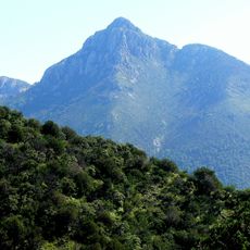
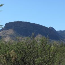
Onyx Cave, National Natural Landmark solutional cave in Santa Rita Mountains, Arizona.

Description

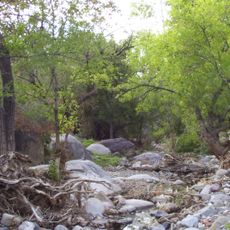
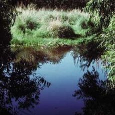
Onyx Cave is a limestone cavern in the Santa Rita Mountains containing passages that stretch roughly half a mile underground, formed over millions of years by water dissolving the rock. The interior displays mineral deposits and rock formations shaped by ongoing geological processes, with the onyx mineral giving the cave its distinctive appearance.

History

The cave formed roughly 300 million years ago when the region was beneath an ancient sea and limestone was deposited as sediment. Mid-twentieth century vandalism caused significant damage to the interior, prompting protective measures to be implemented.

Culture

The cave is named after the glossy onyx mineral visible in its walls, which caught the attention of early visitors. It has become a place where people come to experience underground geology firsthand and appreciate the fragility of natural formations.

Practical

Visit by advance reservation only, with strict guidelines to protect the cave's delicate formations and surfaces. Bring layers of clothing since the underground environment stays significantly cooler than outside, and wear sturdy footwear suitable for walking on uneven cave floors.

Did you know?

Protection came surprisingly late in 1974, after decades of damage from visitors had left lasting marks on walls and formations. This delayed recognition underscores how easily natural wonders can suffer when not guarded from the start.

Location
GPS coordinates
31.71750,-110.76900
Latest update
December 9, 2025 12:26

AroundUs brings together thousands of curated places, local tips, and hidden gems, enriched daily by 60,000 contributors worldwide. Discover all places nearby (Arizona).

Around this place
Titan Missile Museum
United States of America

Titan Missile Museum

30 km
Madera Canyon
United States of America

Madera Canyon

16.6 km
Empire Ranch
United States of America

Empire Ranch

14.2 km
Tumacácori National Historical Park
United States of America

Tumacácori National Historical Park

31.5 km
Mount Wrightson
United States of America

Mount Wrightson

7.9 km
VERITAS
United States of America

VERITAS

18 km
MMT Observatory
United States of America

MMT Observatory

11.5 km
Patagonia Lake State Park
United States of America

Patagonia Lake State Park

26.2 km
Fred Lawrence Whipple Observatory
United States of America

Fred Lawrence Whipple Observatory

11.1 km
Fort Buchanan
United States of America

Fort Buchanan

8.9 km
Tumacácori Mission
United States of America

Tumacácori Mission

31.4 km
Tubac Presidio State Historic Park
United States of America

Tubac Presidio State Historic Park

28.8 km
Mount Hopkins
United States of America

Mount Hopkins

11.4 km
Las Cienegas National Conservation Area
United States of America

Las Cienegas National Conservation Area

17.2 km
Tucson ring meteorite
United States of America

Tucson ring meteorite

23.8 km
Tubac Presidio
United States of America

Tubac Presidio

28.8 km
Apache Peak
United States of America

Apache Peak

34.3 km
Infrared Optical Telescope Array
United States of America

Infrared Optical Telescope Array

11.4 km
The Little Outfit Schoolhouse
United States of America

The Little Outfit Schoolhouse

30.9 km
Canelo Hills Cienega Reserve
United States of America

Canelo Hills Cienega Reserve

28.8 km
Canelo Ranger Station
United States of America

Canelo Ranger Station

30.3 km
James Finley House
United States of America

James Finley House

28.8 km
Old Tubac Schoolhouse
United States of America

Old Tubac Schoolhouse

28.8 km
San Ignacio Golf Club
United States of America

San Ignacio Golf Club

25.7 km
Tubac Presidio State Historic Park
United States of America

Tubac Presidio State Historic Park

28.9 km
Tumacácori Museum
United States of America

Tumacácori Museum

31.5 km
Otero Hall
United States of America

Otero Hall

28.8 km
Rojas House
United States of America

Rojas House

28.8 km
Show the full map
« Onyx Cave - National Natural Landmark solutional cave in Santa Rita Mountains, Arizona » is provided by Around Us (aroundus.com). Images and texts are derived from Wikimedia project under a Creative Commons license. You are allowed to copy, distribute, and modify copies of this page, under the conditions set by the license, as long as this note is clearly visible.

Discover hidden gems everywhere you go!

From secret cafés to breathtaking viewpoints, skip the crowded tourist spots and find places that match your style. Our app makes it easy with voice search, smart filtering, route optimization, and insider tips from travelers worldwide. Download now for the complete mobile experience.

Around Us App Screenshot

A unique approach to discovering new places

Le Figaro

All the places worth exploring

France Info

A tailor-made excursion in just a few clicks

20 Minutes

Around Us
Travel Guide & Maps
Download

Send to your phone

QR Code
1

Open the camera app on your mobile.

2

Point at the QR code with your camera. A notification will appear.

3

Tap the notification to open the link.