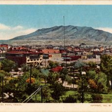
East El Paso, Residential district in El Paso, Texas.
East El Paso is a residential area on the eastern side of El Paso, Texas, made up of neighborhoods like Cielo Vista and Vista Hills that sit north and south of Interstate 10. The area is mostly low-density housing broken up by shopping centers, strip malls, and stretches of commercial road.
The eastern part of El Paso began to fill in after World War II, when housing demand pushed development outward from the city center onto former farmland. The completion of Interstate 10 through this part of the city in the 1960s made the area easier to reach and encouraged further growth.
East El Paso has a strong Mexican-American character that shows up in the food, the shops, and the street signs, many of which are written in both English and Spanish. Local taquerias and panaderías line the main roads and give the area a flavor that feels connected to the nearby border.
A car is the most practical way to get around East El Paso, since the neighborhoods cover a wide area and most destinations are built around parking lots. Walking is easiest near the shopping centers, where sidewalks connect stores and restaurants along the main roads.
Parts of East El Paso fall under the Socorro Independent School District even though they sit within the city limits of El Paso, which means two houses on the same street can belong to different school districts. Families moving to the area often find this overlap unexpected and check district boundaries carefully before choosing a home.
The community of curious travelers
AroundUs brings together thousands of curated places, local tips, and hidden gems, enriched daily by 60,000 contributors worldwide.