Chest opened
+${chestReward.xp} XP
Explorer
NOUVEAU ×${chestReward.collectible.quantity}
tapez pour fermer
Chest locked

Open chests in the app

Around Us is built for your phone — chests unlock when you walk, explore and capture nearby places.

Enable Location

We need your location to show you interesting places around you

Discover nearby places

Find interesting locations and hidden gems around you

Precise directions

Get accurate directions and distances to places

Your location is never shared with other users. It's only used when you tap the location button.

Sierra Blanca

Log in to your account

Start exploring — it's free

Trusted by 72,918 travelers worldwide

Continue with Google
Continue with Apple
or

We will send you a code to connect

By continuing, you accept our Terms and Conditions and our Privacy Policy

Check your inbox

We've sent a pincode in your inbox. Please enter the code below.

Sierra Blanca
Discussion Reviews 1 Photos
22.5k Popularity

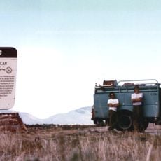
Sierra Blanca, Mountain range in Lincoln and Otero Counties, United States.

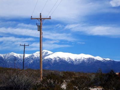
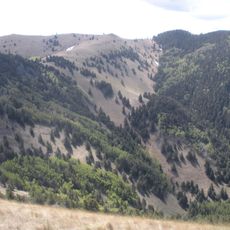
Sierra Blanca is a mountain range in southern New Mexico stretching across Lincoln and Otero Counties, with its highest peak reaching over 11,000 feet. The landscape shows the rugged terrain and rocky formations typical of volcanic mountains in this region.

This range formed millions of years ago through volcanic activity that reshaped the landscape with molten rock and eruptions. The geological events that created it remain visible in the mountain's structure and rock types today.

The southern slopes fall within the Mescalero Apache Reservation, where the summit holds spiritual significance for tribal members. This sacred connection shapes how the land is experienced and treated today.

Accessing the summit requires permission from the Mescalero Apache Tribe, as the upper sections fall within their lands. Trails in the area vary in difficulty, so plan ahead based on your hiking experience and fitness level.

The highest point ranks among the southernmost locations in the continental United States that surpasses the 11,000-foot mark. This geographic distinction makes it noteworthy for both climbers and those studying regional geology.

The community of curious travelers

AroundUs brings together thousands of curated places, local tips, and hidden gems, enriched daily by 60,000 contributors worldwide.

Start exploring
Location
Location
GPS coordinates
33.37437,-105.80882
Latest update
December 20, 2025 16:04
Around this place
Lincoln National Forest
United States of America

Lincoln National Forest

61.4 km
Fort Stanton
United States of America

Fort Stanton

29.7 km
White Oaks
United States of America

White Oaks

42.1 km
Bonito Lake
United States of America

Bonito Lake

11.6 km
Three Rivers Petroglyph Site
United States of America

Three Rivers Petroglyph Site

19.1 km
White Mountain Wilderness
United States of America

White Mountain Wilderness

8.9 km
Fox Cave
United States of America

Fox Cave

27.2 km
Lincoln Historic District
United States of America

Lincoln Historic District

41.8 km
Monjeau Lookout
United States of America

Monjeau Lookout

9.5 km
Fort Stanton – Snowy River Cave National Conservation Area
United States of America

Fort Stanton – Snowy River Cave National Conservation Area

33.5 km
Carrizozo Woman's Club
United States of America

Carrizozo Woman's Club

30.5 km
Wofford Lookout Complex
United States of America

Wofford Lookout Complex

43 km
Old Dowlin Mill
United States of America

Old Dowlin Mill

16 km
Tularosa Original Townsite District
United States of America

Tularosa Original Townsite District

38.6 km
Fort Stanton Museum
United States of America

Fort Stanton Museum

29.6 km
Ruidoso Public Library
United States of America

Ruidoso Public Library

14 km
Spencer Theater for the Performing Arts
United States of America

Spencer Theater for the Performing Arts

20.3 km
Tunstall Store
United States of America

Tunstall Store

41.3 km
Fort Stanton Hospital Administration Building
United States of America

Fort Stanton Hospital Administration Building

29.5 km
Smokey Bear Vista Point
United States of America

Smokey Bear Vista Point

32.5 km
Montano Store
United States of America

Montano Store

41.5 km
Convento
United States of America

Convento

41.4 km
Anderson-Freeman Museum and Visitors Center
United States of America

Anderson-Freeman Museum and Visitors Center

41.5 km
Curry Saloon
United States of America

Curry Saloon

41.1 km
Smokey Bear Interpretive Trail
United States of America

Smokey Bear Interpretive Trail

29 km
Old Lincoln County Courthouse
United States of America

Old Lincoln County Courthouse

41 km
Torreon
United States of America

Torreon

41.4 km
Dr. Woods House
United States of America

Dr. Woods House

41.2 km
Show the full map
Reviews
Share your experience

No review yet

Discussions
Start a discussion...

No discussion yet

« Sierra Blanca - Mountain range in Lincoln and Otero Counties, United States » is provided by Around Us (aroundus.com). Images and texts are derived from Wikimedia project under a Creative Commons license. You are allowed to copy, distribute, and modify copies of this page, under the conditions set by the license, as long as this note is clearly visible.

Discover hidden gems everywhere you go!

From secret cafés to breathtaking viewpoints, skip the crowded tourist spots and find places that match your style. Our app makes it easy with voice search, smart filtering, route optimization, and insider tips from travelers worldwide. Download now for the complete mobile experience.

Around Us App Screenshot

A unique approach to discovering new places

Le Figaro

All the places worth exploring

France Info

A tailor-made excursion in just a few clicks

20 Minutes

Around Us
Travel Guide & Maps
Download

Send to your phone

QR Code
1

Open the camera app on your mobile.

2

Point at the QR code with your camera. A notification will appear.

3

Tap the notification to open the link.