Enable Location

We need your location to show you interesting places around you

Discover nearby places

Find interesting locations and hidden gems around you

Precise directions

Get accurate directions and distances to places

Your location is never shared with other users. It's only used when you tap the location button.

Reserva Natural Laguna de Apoyo

Log in to your account

Start exploring — it's free

Trusted by 61,647 travelers worldwide

Continue with Google
Continue with Apple
or

We will send you a code to connect

By continuing, you accept our Terms and Conditions and our Privacy Policy

Check your inbox

We've sent a pincode in your inbox. Please enter the code below.

Reserva Natural Laguna de Apoyo

Reserva Natural Laguna de Apoyo, Protected volcanic lake area in Masaya and Granada, Nicaragua

Description

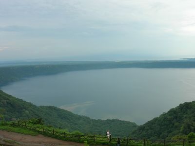
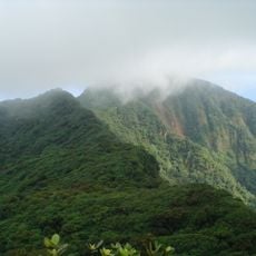
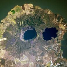
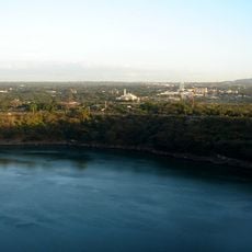
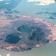
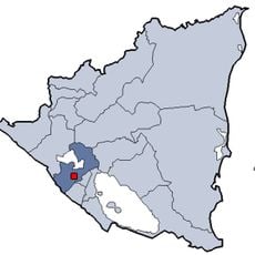
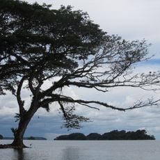
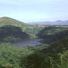
The Reserva Natural Laguna de Apoyo is a circular crater lake that forms the largest volcanic lake in Nicaragua, reaching depths of 176 meters. The basin spans roughly 6 kilometers across and sits between the departments of Masaya and Granada, framed by steep green slopes.

History

The water body formed roughly 23,000 years ago following the eruption of the Pre-Apoyo Volcano, which created the current crater structure. The eruption left behind a stable basin that filled with water and became one of the region's most distinctive geographic features.

Culture

The lake served as a center for fishing and spiritual practices among indigenous communities, who left petroglyphs along its shores as records of their beliefs. These ancient marks still stand as evidence of the deep connection between people and this water.

Practical

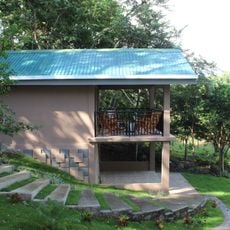
Visitors can swim, scuba dive, and kayak here, with access via an unpaved road from kilometer 37 of the Masaya-Granada highway. It is wise to bring sturdy shoes since paths to the water can be uneven, and the easiest access occurs during drier months.

Did you know?

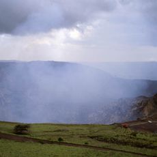
Volcanic gases still escape at certain spots in the lake and create natural hot springs, particularly when water levels reach their peak. This underground activity reminds visitors that the water sits within an active volcanic system.

Elevation above the sea
70 m
GPS coordinates
11.92200,-86.02900
Latest update
December 6, 2025 16:02

AroundUs brings together thousands of curated places, local tips, and hidden gems, enriched daily by 60,000 contributors worldwide. Discover all places nearby (Nicaragua).

Nicaragua: active volcanoes, tropical beaches, islands of Lake Nicaragua, colonial architecture, natural reserves

Nicaragua offers a diverse and lively nature. You will see still-smoking volcanoes, beaches stretching from the Pacific to the Caribbean, and tropical islands sitting on volcanic lakes. The country also has large natural reserves with thick forests and mangroves along the coasts. Everywhere, paths...

« Reserva Natural Laguna de Apoyo - Protected volcanic lake area in Masaya and Granada, Nicaragua » is provided by Around Us (aroundus.com). Images and texts are derived from Wikimedia project under a Creative Commons license. You are allowed to copy, distribute, and modify copies of this page, under the conditions set by the license, as long as this note is clearly visible.

Discover hidden gems everywhere you go!

From secret cafés to breathtaking viewpoints, skip the crowded tourist spots and find places that match your style. Our app makes it easy with voice search, smart filtering, route optimization, and insider tips from travelers worldwide. Download now for the complete mobile experience.

Around Us App Screenshot

A unique approach to discovering new places

Le Figaro

All the places worth exploring

France Info

A tailor-made excursion in just a few clicks

20 Minutes

Around Us
Travel Guide & Maps
Download

Send to your phone

QR Code
1

Open the camera app on your mobile.

2

Point at the QR code with your camera. A notification will appear.

3

Tap the notification to open the link.