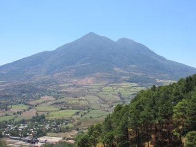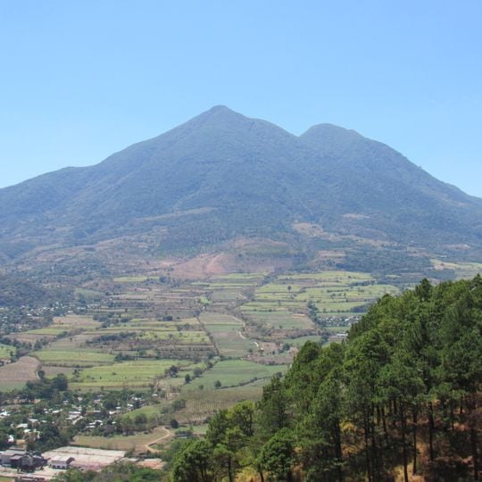
San Vicente, Stratovolcano in San Vicente Department, El Salvador.
San Vicente is a stratovolcano with two distinct summits rising 2,173 meters high. The mountain forms part of the Central American Volcanic Arc and shapes El Salvador's landscape with its recognizable form.
No eruption of San Vicente is recorded in written sources; the last significant one occurred more than 1,700 years ago, and at least once a large section of the volcano collapsed in a massive landslide. In pre-Columbian times Pipil and Nonualco peoples visited it to hunt and to collect obsidian for tools. From the 19th century investors bought land on its slopes for coffee, and in the 1970s and 1980s it served as a base area for the FPL guerrilla.
The name Chichontepec comes from Nahuat and refers to the two summits, said to resemble a woman's breasts; historian Jorge Lardé y Larín argued the name was invented by Manuel Fernández in an 1869 work. In the 16th century the mountain was called Iztepec, "mountain of obsidian", and in the 17th century Zacatecoluca. Pipil Nahua and Nonualco peoples came here to hunt and gather obsidian for tools.
The two summits lie in Guadalupe and Tepetitán (San Vicente department) and Zacatecoluca and San Juan Nonualco (La Paz), about 60 km east of San Salvador. Hot springs and fumaroles sit on the northern and western flanks, and mud fumaroles lie northeast at 820 m in a 180 m ravine. The northern base holds the "los infiernillos de Agua Agria" springs, which release sulfuric vapors.
The volcano has no recorded eruption; its last significant one was over 1,700 years ago. On August 9, 1995, Aviateca Flight 901 crashed into the mountain, killing all 65 people on board.
The community of curious travelers
AroundUs brings together thousands of curated places, local tips, and hidden gems, enriched daily by 92,813 contributors worldwide.