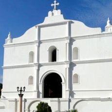
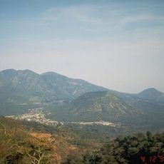
San Vicente, District and city in southern El Salvador
San Vicente is a district and city located at an elevation of approximately 1,280 feet (390 meters) above sea level in the southern region of El Salvador, serving as an administrative and cultural center.
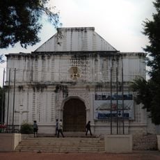
The city of San Vicente was founded on December 26, 1635, by fifty Spanish families under the shade of a historic Tempisque tree that still exists today in the area.
San Vicente hosts monthly gastronomic fairs at Cañas Park that showcase regional foods, artisanal crafts, and traditional music, reflecting the city's deep-rooted culinary and artistic heritage throughout the year.
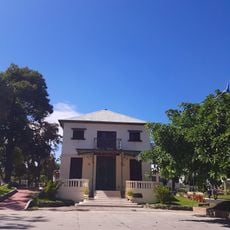
The central park in San Vicente functions as a social gathering spot and venue for local markets, concerts, and cultural exhibitions, making it accessible for visitors seeking authentic community experiences.
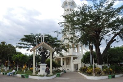
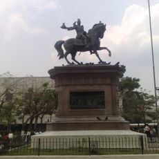
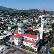
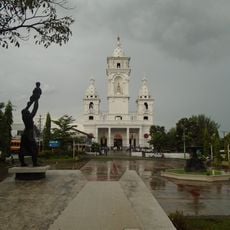
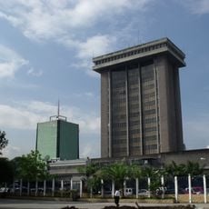
The Tower of San Vicente, designed by French architect Eugenio Basilio Crepiat and located in Cañas Park, was repaired after earthquake damage in 2001 and continues to serve as a focal point for local celebrations.
Location: Southern San Vicente
Inception: December 26, 1635
Elevation above the sea: 390 m
GPS coordinates: 13.64332,-88.78364
Latest update: November 28, 2025 15:19
El Salvador presents a collection of places where history, nature, and culture meet. The country is shaped by volcanic landscapes, clear lakes, and Pacific beaches that blend with archaeological sites from pre-Columbian times. Visitors can explore ancient Maya temples like Tazumal and Joya de Cerén,...
Puerta del Diablo
44 km
National Palace
44.6 km
San Vicente
7.9 km
National Theatre of El Salvador
44.4 km
Ilopango
28.4 km
Catedral Metropolitana del Divino Salvador del Mundo
44.5 km
Iglesia El Rosario
44.2 km
Museo de la Fuerza Armada de El Salvador
44.5 km
Plaza Gerardo Barrios
44.5 km
Cerro San Jacinto
42 km
Tecapa
34.9 km
Volcán de Usulután
42.3 km
Iglesia de María Auxiliadora
44.9 km
Monumento a la Paz
44.1 km
Taburete
35.4 km
Casa de las Academias
45.1 km
Catedral de Zacatecoluca
17.6 km
Monumento Cristo de La Paz
44.1 km
Estadio Antonio Toledo Valle
16.7 km
Potonico
37.6 km
Cuscatlán Bridge
23.7 km
Government Center Tower
45.3 km
Centro Cívico Cultural Legislativo
45.3 km
Apastepeque
8.4 km
Saint Sebastian Analco Church
17.8 km
El Tigre
43.3 km
Civic Center Cultural Legislative CCCL
45.3 km
Iglesia de Nuestra Señora del Pilar
181 mVisited this place? Tap the stars to rate it and share your experience / photos with the community! Try now! You can cancel it anytime.
Discover hidden gems everywhere you go!
From secret cafés to breathtaking viewpoints, skip the crowded tourist spots and find places that match your style. Our app makes it easy with voice search, smart filtering, route optimization, and insider tips from travelers worldwide. Download now for the complete mobile experience.
A unique approach to discovering new places❞
— Le Figaro
All the places worth exploring❞
— France Info
A tailor-made excursion in just a few clicks❞
— 20 Minutes