Altos de Campana National Park

Log in to your account

AroundUs is a community-driven map of interesting places, built by curious explorers like you. It grows with every review, story, and photo you share.
Connect to save your favorite spots, contribute locations, and create personalized routes.
Continue with Google
Continue with Apple
Continue with X
Continue with Facebook
Continue with email
By continuing, you accept our Terms and Conditions and our Privacy Policy
Create an account

Altos de Campana National Park

Add to collection
Map
Suggest a change
Share

Altos de Campana National Park, National park in Panamá Oeste and Coclé Provinces, Panama.

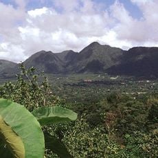
Altos de Campana is a protected forest area in Panamá Oeste and Coclé provinces spanning volcanic terrain with multiple forest ecosystems at different elevations. The highest point, Cerro Campana peak, reaches 850 meters and overlooks humid tropical forests that shift into cooler mountain vegetation zones.

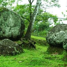
The area became Panama's first national park in 1966, protecting geological evidence from an ancient volcanic eruption. The landscape still bears traces of this distant event and shows how nature reshaped itself in the aftermath.

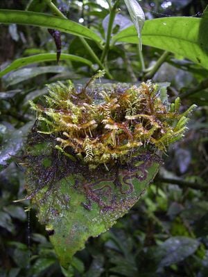
The park serves as a refuge for rare animal species found nowhere else, including the golden frog that locals recognize as a symbol of these forests. Visitors encounter these creatures in their natural surroundings and understand why this place matters for protecting wildlife.

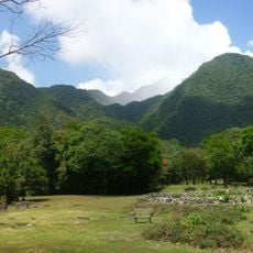
The park sits roughly 50 kilometers west of Panama City along the Interamerican Highway and is relatively easy to reach. The Sendero La Cruz trail takes visitors through different forest layers, making it possible to explore the varying ecosystems in one outing.

The park is home to the violet-bellied hummingbird, a striking species visitors can spot during the right season while exploring the trails. This bird diversity is one reason birdwatchers find the place especially rewarding.

Location: Panamá Oeste Province

Location: Coclé Province

Inception: 1966

GPS coordinates: 8.71372,-79.95284

Latest update: December 6, 2025 16:03

Photos
Panama off the main routes

Panama offers much more than its famous canal. The places in this collection show the country's range and variety. In the west, mountain landscapes and volcanoes rise above the land. Volcan Baru offers views of both oceans on clear days. Along the coasts, islands sit with tropical beaches and coral...

Reviews

Visited this place? Tap the stars to rate it and share your experience / photos with the community! Try now! You can cancel it anytime.

« Altos de Campana National Park - National park in Panamá Oeste and Coclé Provinces, Panama » is provided by Around Us (aroundus.com). Images and texts are derived from Wikimedia project under a Creative Commons license. You are allowed to copy, distribute, and modify copies of this page, under the conditions set by the license, as long as this note is clearly visible.

Discover hidden gems everywhere you go!

From secret cafés to breathtaking viewpoints, skip the crowded tourist spots and find places that match your style. Our app makes it easy with voice search, smart filtering, route optimization, and insider tips from travelers worldwide. Download now for the complete mobile experience.

Around Us App Screenshot

A unique approach to discovering new places

Le Figaro

All the places worth exploring

France Info

A tailor-made excursion in just a few clicks

20 Minutes