Enable Location

We need your location to show you interesting places around you

Discover nearby places

Find interesting locations and hidden gems around you

Precise directions

Get accurate directions and distances to places

Your location is never shared with other users. It's only used when you tap the location button.

Taxco de Alarcón

Log in to your account

Start exploring — it's free

Trusted by 62,107 travelers worldwide

Continue with Google
Continue with Apple
or

We will send you a code to connect

By continuing, you accept our Terms and Conditions and our Privacy Policy

Check your inbox

We've sent a pincode in your inbox. Please enter the code below.

Taxco de Alarcón

Taxco de Alarcón, Colonial mining city in Guerrero, Mexico

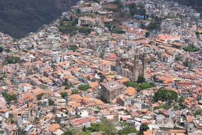
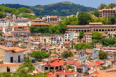
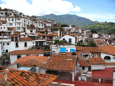
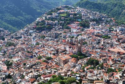
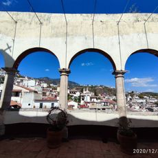
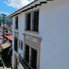
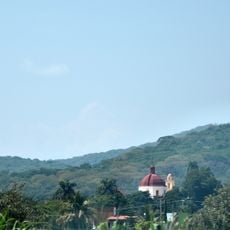
Taxco de Alarcón is a city in Guerrero, Mexico, set in mountainous terrain at 1778 meters elevation. White houses with iron balconies follow the natural lines of the hills, and streets wind between them.

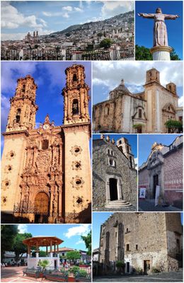
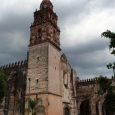
Spanish colonizers established silver mines in the 16th century and transformed the former Tlapanec settlement into a major mining center. Wealth from the mines later enabled the construction of grand churches and buildings.

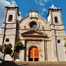
Santa Prisca Church from 1751 shows Mexican Baroque craft with stone carvings, two towers and three interior altars. Around the city silversmiths work in small workshops, continuing techniques passed down through generations.

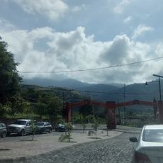
The steep cobblestone streets require comfortable shoes and a slow pace when walking, as many lanes are narrow and winding. Modified Volkswagen Beetle taxis help visitors move between different neighborhoods.

A network of steep cobblestone streets made modified Volkswagen Beetle taxis necessary to navigate the narrow passages between colonial buildings. These small cars can handle the curves and inclines that are too difficult for regular vehicles.

The community of curious travelers

AroundUs brings together thousands of curated places, local tips, and hidden gems, enriched daily by 60,000 contributors worldwide.

Start exploring
Location
Elevation above the sea
1,778 m
GPS coordinates
18.55462,-99.60592
Latest update
December 13, 2025 18:15
« Taxco de Alarcón - Colonial mining city in Guerrero, Mexico » is provided by Around Us (aroundus.com). Images and texts are derived from Wikimedia project under a Creative Commons license. You are allowed to copy, distribute, and modify copies of this page, under the conditions set by the license, as long as this note is clearly visible.

Discover hidden gems everywhere you go!

From secret cafés to breathtaking viewpoints, skip the crowded tourist spots and find places that match your style. Our app makes it easy with voice search, smart filtering, route optimization, and insider tips from travelers worldwide. Download now for the complete mobile experience.

Around Us App Screenshot

A unique approach to discovering new places

Le Figaro

All the places worth exploring

France Info

A tailor-made excursion in just a few clicks

20 Minutes

Around Us
Travel Guide & Maps
Download

Send to your phone

QR Code
1

Open the camera app on your mobile.

2

Point at the QR code with your camera. A notification will appear.

3

Tap the notification to open the link.