Enable Location

We need your location to show you interesting places around you

Discover nearby places

Find interesting locations and hidden gems around you

Precise directions

Get accurate directions and distances to places

Your location is never shared with other users. It's only used when you tap the location button.

Xochimilco

Log in to your account

Start exploring — it's free

Trusted by 62,895 travelers worldwide

Continue with Google
Continue with Apple
or

We will send you a code to connect

By continuing, you accept our Terms and Conditions and our Privacy Policy

Check your inbox

We've sent a pincode in your inbox. Please enter the code below.

Discussion 4.0 1 Reviews 1 Photos
158k Popularity

Xochimilco, Administrative district in southern Mexico City, Mexico

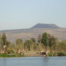
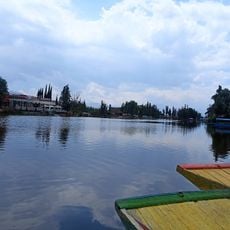
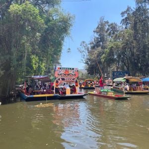
Xochimilco is an administrative district in the southern part of Mexico City, recognized for its network of canals that wind through residential neighborhoods and farmland. The area sits at an elevation of around 2240 meters and features interconnected waterways that form a system stretching over a hundred kilometers, used daily by locals and visited by travelers seeking a different side of the city.

The Xochimilca people founded the settlement in the 10th century and developed a system of floating gardens to farm the swampy terrain. In the early 15th century the area was incorporated into the Aztec empire and maintained its agricultural importance through colonial times into modern Mexico.

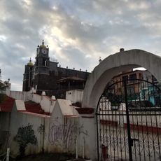
The district maintains 422 annual festivals that combine Catholic and civic traditions, reflecting the strong community bonds among local inhabitants.

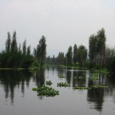
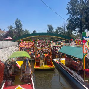
Visitors board flat-bottomed wooden boats at several docking points and travel through the canals past fields and villages. Mornings and weekdays tend to be less crowded and offer a quieter experience on the water.

Small boats with musicians often drift past on the canals and play alongside tourist boats for a fee. Farmers still sell their fresh produce directly from boats to restaurants and markets across the city.

The community of curious travelers

AroundUs brings together thousands of curated places, local tips, and hidden gems, enriched daily by 60,000 contributors worldwide.

Start exploring
Location
Elevation above the sea
2,238 m
Part of
Historic Centre of Mexico City and Xochimilco
GPS coordinates
19.27500,-99.13889
Latest update
December 15, 2025 00:27
Reviews

Real people, real opinions — but not verified.

Visited this place? Tap the stars to rate it and share your experience / photos with the community! Try now! You can cancel it anytime.

vio85
vio85 Jun 17, 2025

This place immerses us in Mexican culture and that is what we sought to experience with my group of friends. 🇲🇽 You can rent a boat with your group and sail while listening to the sounds of the Mariachis! P.S.: It can get very crowded, plan your morning accordingly!

« Xochimilco - Administrative district in southern Mexico City, Mexico » is provided by Around Us (aroundus.com). Images and texts are derived from Wikimedia project under a Creative Commons license. You are allowed to copy, distribute, and modify copies of this page, under the conditions set by the license, as long as this note is clearly visible.

Discover hidden gems everywhere you go!

From secret cafés to breathtaking viewpoints, skip the crowded tourist spots and find places that match your style. Our app makes it easy with voice search, smart filtering, route optimization, and insider tips from travelers worldwide. Download now for the complete mobile experience.

Around Us App Screenshot

A unique approach to discovering new places

Le Figaro

All the places worth exploring

France Info

A tailor-made excursion in just a few clicks

20 Minutes

Around Us
Travel Guide & Maps
Download

Send to your phone

QR Code
1

Open the camera app on your mobile.

2

Point at the QR code with your camera. A notification will appear.

3

Tap the notification to open the link.