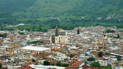
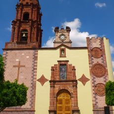
Atotonilco el Alto, Agricultural municipality in Los Altos region, Mexico.
Atotonilco el Alto is a municipality in the Los Altos highlands region, situated on fertile land dedicated to various farming activities. The elevated terrain supports a range of agricultural production throughout the area.
The Purépecha people established the settlement in the late 1400s before the region came under Spanish rule in 1530. This early foundation shaped the community that exists today.
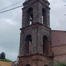
The name comes from Náhuatl and means place of hot waters, while El Alto was added to honor those lost during the 1920s Cristero War. This heritage remains woven into how the community sees itself.
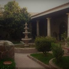
The town is straightforward to explore since it is organized in a compact way, with agricultural lands accessible around it. Visitors should expect hilly terrain that is suitable for walking and getting to know the area on foot.
The area is known for the Don Julio tequila distillery, where visitors can see the entire production process from agave cultivation to bottling. This operation reveals how the region contributes to Mexico's renowned spirits industry.
Location: Atotonilco el Alto Municipality
Elevation above the sea: 1,607 m
GPS coordinates: 20.55056,-102.50417
Latest update: December 7, 2025 09:24
Cathedral of Our Lady of Guadalupe
67.3 km
Lago de Camécuaro National Park
78.3 km
Cathedral Basilica of Our Lady of St. John of the Lakes
79.4 km
El Opeño
71.6 km
Presidente InterContinental Hotel
67.3 km
Edificio Reforma 222 Torre 1
67.3 km
Torre MAPFRE
67.3 km
Hyatt Regency Mexico City
67.3 km
Iglesia de San Miguel Arcángel
54.5 km
Immaculate Conception Cathedral, Zamora de Hidalgo
67.1 km
Torre Lomas
67.3 km
Torre Mural
67.3 km
Reforma 115
67.3 km
Panorama Santa Fe
67.3 km
H2o Santa Fe building
67.3 km
Trióvalo Bernardo Obregón
80.6 km
Church of la Purísima, Yurécuaro
32.7 km
Edificio Punta Poniente
67.3 km
Paragon Santa Fe
67.3 km
Edificio Reforma 90
67.3 km
Punta del Parque Torres A y B
67.3 km
Balneario Rio Verde
60.5 km
Centro Cultural González Gallo
76.4 km
Chapala
76.4 km
Casa del Diezmo
64.1 km
Parroquia de La Inmaculada Concepción
60.3 km
Estacion de tren, Museo de la Estación.
1.4 km
Tren Atotonilco El Alto
2.9 kmVisited this place? Tap the stars to rate it and share your experience / photos with the community! Try now! You can cancel it anytime.
Discover hidden gems everywhere you go!
From secret cafés to breathtaking viewpoints, skip the crowded tourist spots and find places that match your style. Our app makes it easy with voice search, smart filtering, route optimization, and insider tips from travelers worldwide. Download now for the complete mobile experience.
A unique approach to discovering new places❞
— Le Figaro
All the places worth exploring❞
— France Info
A tailor-made excursion in just a few clicks❞
— 20 Minutes