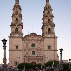
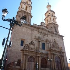
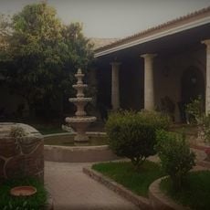
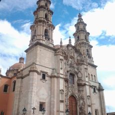
Arandas, Administrative center in Los Altos Sur region, Mexico
Description
Arandas is the administrative center of Arandas Municipality in Jalisco, located at elevations between 2069 and 2262 meters (6,788 and 7,421 feet) in the Los Altos Sur region. The town sits in a highland area with a temperate climate and serves as the central hub for surrounding communities.
History
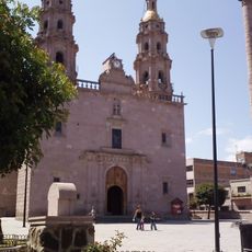
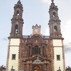
The area originated from a settlement called Santa María de Guadalupe de los Aranda founded in 1761, named after one of the founding families of the region. This long history shaped the local identity and structure of the present-day administrative center.
Culture
The town has deep roots in mezcal production, with distilleries and small producers throughout the region creating this traditional Mexican spirit using local agave plants. Walking through the streets, you notice the craft and pride locals take in this ancestral trade.
Practical
The best time to visit is during drier months when roads are easily accessible and the weather remains mild. The town center is walkable, with most services located close together in the central area.
Did you know?
In 1976, the International Astronomical Union named a Martian crater after the town, recognizing its scientific and cultural significance. This rare honor connects a small Mexican village permanently with the cosmos.
AroundUs brings together thousands of curated places, local tips, and hidden gems, enriched daily by 60,000 contributors worldwide. Discover all places nearby (Arandas Municipality).
Templo Expiatorio del Sagrado Corazón de Jesús
83.7 km
Cathedral of Our Lady of Guadalupe
80.6 km
Cathedral Basilica of Our Lady of St. John of the Lakes
60.2 km
Cathedral Basilica of Our Lady of the Light, León
83.4 km
Presidente InterContinental Hotel
80.6 km
Edificio Reforma 222 Torre 1
80.6 km
Torre MAPFRE
80.6 km
Hyatt Regency Mexico City
80.6 km
Iglesia de San Miguel Arcángel
36.7 km
Teatro Doblado
83.5 km
Immaculate Conception Cathedral, Zamora de Hidalgo
80.6 km
Torre Lomas
80.6 km
Torre Mural
80.6 km
Reforma 115
80.6 km
Panorama Santa Fe
80.6 km
H2o Santa Fe building
80.6 km
Church of la Purísima, Yurécuaro
40.9 km
Edificio Punta Poniente
80.6 km
Paragon Santa Fe
80.6 km
Edificio Reforma 90
80.6 km
Punta del Parque Torres A y B
80.6 km
Balneario Rio Verde
59.6 km
Casa del Diezmo
68.5 km
Parroquia de La Inmaculada Concepción
67 km
Museum of the City of Leon
83.4 km
Historic centre of Lagos de Moreno
75.4 km
Teatro del Bicentenario
84.6 km
Estacion de tren, Museo de la Estación.
25.2 kmDiscover hidden gems everywhere you go!
From secret cafés to breathtaking viewpoints, skip the crowded tourist spots and find places that match your style. Our app makes it easy with voice search, smart filtering, route optimization, and insider tips from travelers worldwide. Download now for the complete mobile experience.
A unique approach to discovering new places❞
— Le Figaro
All the places worth exploring❞
— France Info
A tailor-made excursion in just a few clicks❞
— 20 Minutes