Teocaltiche, Colonial municipality in Los Altos de Jalisco, Mexico.
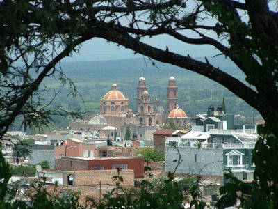
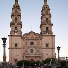
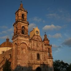
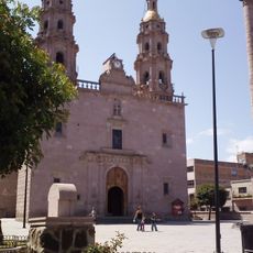
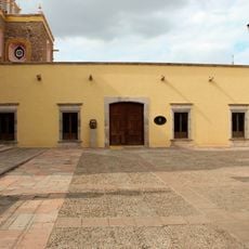
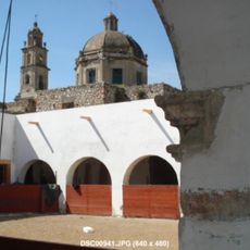
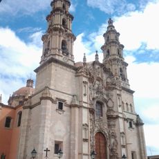
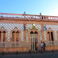
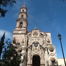
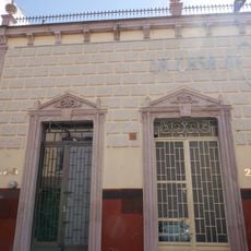
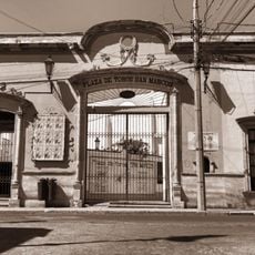
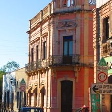
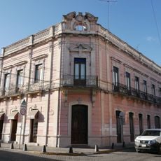
Teocaltiche is a highland municipality in Jalisco situated at roughly 1,773 meters (5,820 feet) elevation across a wide mountain region. The town features traditional colonial-era buildings with stone construction, open plazas, and narrow streets that reflect its historical layout.
The region was originally inhabited by indigenous peoples before Spanish conquistadors arrived in 1530 and brought the area under their control. This moment marked the start of colonial rule and cultural transformation that would shape the territory for centuries to come.
The name comes from Nahuatl and means 'temple' or 'house of the gods', a word choice that reflects the indigenous roots of this highland community. People here continue to use this ancient name as a living connection to their pre-Hispanic past.
The best time to visit is during the dry season when mountain roads are easy to walk and views across the surrounding valleys remain clear. The municipality sits far from major urban centers, so visitors should plan extra time for travel and expect to rely on local transportation options.
The locality is known as 'Chapulin', named after the grasshopper symbol that has shaped community identity for generations. This local emblem appears throughout town celebrations and public gatherings as a mark of local pride.
Location: Teocaltiche
Elevation above the sea: 1,773 m
GPS coordinates: 21.25000,-102.38300
Latest update: December 7, 2025 20:42
Cathedral Basilica of Our Lady of St. John of the Lakes
5.1 km
Parque Rodolfo Landeros
67.5 km
Jardín de San Marcos
70.6 km
Plaza de Toros Monumental de Aguascalientes
70 km
Tsunami
68.2 km
Templo de San Marcos, Aguascalientes
70.5 km
Iglesia de San Miguel Arcángel
24.5 km
El Ocote
60.9 km
Aguascalientes Theatre
68.3 km
Museum of José Guadalupe Posada
70.2 km
Ex-Hacienda de Peñuelas
52.4 kmOvalo Aguascalientes México
53 km
Museo Regional de Aguascalientes
70.7 km
Balneario Rio Verde
52.9 km
Museo de las Ánimas
35 km
Diversx
70.4 km
Historic centre of Lagos de Moreno
27.4 km
RÜIDO
70.7 km
Casa de la calle Venustiano Carranza 306
70.6 km
Municipal cemetery of Encarnación de Díaz
41.6 km
Templo del Señor del Encino, Aguascalientes
70.2 km
Teatro Licenciado José Minero Roque
50.1 km
Lotería Teatro
69.7 km
Casa de Nieto 242
70.6 km
Plaza de Toros San Marcos, Academia taurina del estado
70.6 km
Casa Enrique Osornio Camarena
70.6 km
Casa de la calle Venustiano Carranza 401
70.6 km
CACO: Casa de Animación Cultural Oriente
68.4 kmVisited this place? Tap the stars to rate it and share your experience / photos with the community! Try now! You can cancel it anytime.
Discover hidden gems everywhere you go!
From secret cafés to breathtaking viewpoints, skip the crowded tourist spots and find places that match your style. Our app makes it easy with voice search, smart filtering, route optimization, and insider tips from travelers worldwide. Download now for the complete mobile experience.
A unique approach to discovering new places❞
— Le Figaro
All the places worth exploring❞
— France Info
A tailor-made excursion in just a few clicks❞
— 20 Minutes