Enable Location

We need your location to show you interesting places around you

Discover nearby places

Find interesting locations and hidden gems around you

Precise directions

Get accurate directions and distances to places

Your location is never shared with other users. It's only used when you tap the location button.

Tikal National Park

Log in to your account

Start exploring — it's free

Trusted by 62,114 travelers worldwide

Continue with Google
Continue with Apple
or

We will send you a code to connect

By continuing, you accept our Terms and Conditions and our Privacy Policy

Check your inbox

We've sent a pincode in your inbox. Please enter the code below.

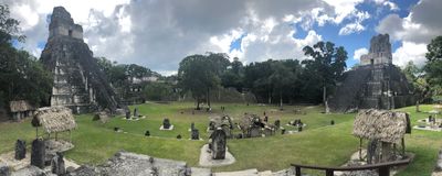
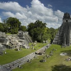
Tikal National Park, National park and Maya archaeological site in Peten, Guatemala

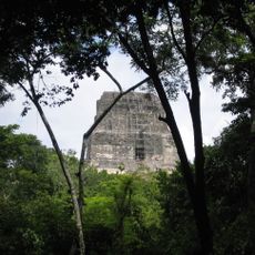
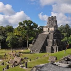
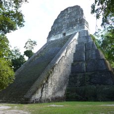
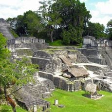
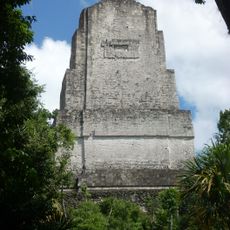
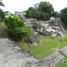
Tikal National Park is a nature reserve and archaeological site in the rainforest of Petén with thousands of masonry structures from ancient times. The site combines dense forest landscape with pyramids, palaces, and smaller structures scattered across different locations.

People settled here around 900 BC and gradually built it into a major center that peaked between the 3rd and 10th centuries. Later the city was abandoned and the forest reclaimed the area until modern rediscovery.

The buildings here show how the Maya organized their city and what skills they had as builders and planners. You can see how different the structures are and what role religious buildings played in daily life.

The area is large and takes time to explore, so arriving early gives you the best light and less crowding during the day. Sturdy footwear and insect protection are essential since you walk through forest terrain.

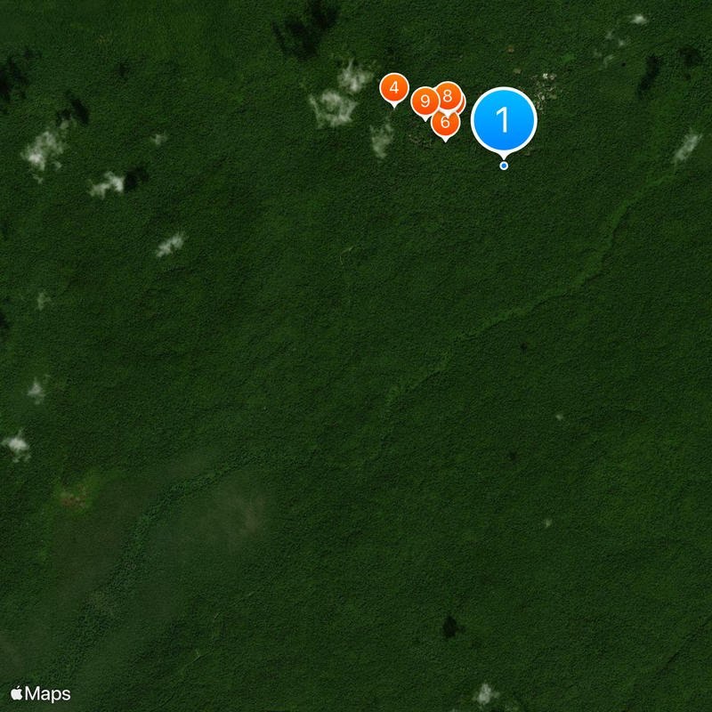
Hidden beneath the tree canopy are countless unseen structures revealed only by modern sensor technology, showing the city was far larger than what you can see walking around. This changes our understanding of how densely populated this place once was.

The community of curious travelers

AroundUs brings together thousands of curated places, local tips, and hidden gems, enriched daily by 60,000 contributors worldwide.

Start exploring
GPS coordinates
17.21667,-89.61667
Latest update
December 20, 2025 02:51
Photo spots in Guatemala

Guatemala offers photographers a mix of pre-Columbian sites, volcanic landscapes, and colonial buildings. The geography ranges from highland towns to rainforests and coastal areas along the Pacific and Caribbean. Ancient Maya temples stand alongside Spanish-era churches, while indigenous markets and...

« Tikal National Park - National park and Maya archaeological site in Peten, Guatemala » is provided by Around Us (aroundus.com). Images and texts are derived from Wikimedia project under a Creative Commons license. You are allowed to copy, distribute, and modify copies of this page, under the conditions set by the license, as long as this note is clearly visible.

Discover hidden gems everywhere you go!

From secret cafés to breathtaking viewpoints, skip the crowded tourist spots and find places that match your style. Our app makes it easy with voice search, smart filtering, route optimization, and insider tips from travelers worldwide. Download now for the complete mobile experience.

Around Us App Screenshot

A unique approach to discovering new places

Le Figaro

All the places worth exploring

France Info

A tailor-made excursion in just a few clicks

20 Minutes

Around Us
Travel Guide & Maps
Download

Send to your phone

QR Code
1

Open the camera app on your mobile.

2

Point at the QR code with your camera. A notification will appear.

3

Tap the notification to open the link.