Enable Location

We need your location to show you interesting places around you

Discover nearby places

Find interesting locations and hidden gems around you

Precise directions

Get accurate directions and distances to places

Your location is never shared with other users. It's only used when you tap the location button.

Grimes County

Log in to your account

Start exploring — it's free

Trusted by 62,486 travelers worldwide

Continue with Google
Continue with Apple
or

We will send you a code to connect

By continuing, you accept our Terms and Conditions and our Privacy Policy

Check your inbox

We've sent a pincode in your inbox. Please enter the code below.

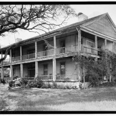
Grimes County, Administrative division in southeastern Texas, United States

Grimes County is an administrative division in southeastern Texas that lies between the Post Oak Belt and Coastal Plain regions. The landscape includes forests, grasslands, and farmland with varying terrain and soil compositions across its area.

The county was established in 1846 from Montgomery County and named after Jesse Grimes, a signer of the Texas Declaration of Independence. Its creation came during the early period of settlement expansion across Texas following independence.

The Bidai people first inhabited this territory, with records of their presence dating back to Spanish documents from the late 1600s. Their settlements shaped the early character of the region before European colonization arrived.

The county is crossed by two major transportation routes: State Highway 90 runs north-south while State Highways 30 and 105 extend east-west through the area. These roads make it easy to drive across different parts and reach various towns and communities.

North American tektites were first discovered in this county in 1936, marking an important geological finding for the continent. These cosmic rocks remain a rare and fascinating aspect of the local natural history.

The community of curious travelers

AroundUs brings together thousands of curated places, local tips, and hidden gems, enriched daily by 60,000 contributors worldwide.

Start exploring
Location
Inception
1846
Capital city
Anderson
Shares border with
Madison County, Walker County, Montgomery County, Waller County, Washington County, Brazos County
GPS coordinates
30.55000,-95.98000
Latest update
December 7, 2025 10:08
Around this place
Kyle Field
United States of America

Kyle Field

35.2 km
George Bush Presidential Library
United States of America

George Bush Presidential Library

36.2 km
United States of America

Texas World Speedway

23.1 km
Olsen Field at Blue Bell Park
United States of America

Olsen Field at Blue Bell Park

35.2 km
Gibbons Creek Reservoir
United States of America

Gibbons Creek Reservoir

11.5 km
Montgomery High School
United States of America

Montgomery High School

30.7 km
Fanthorp Inn State Historic Site
United States of America

Fanthorp Inn State Historic Site

7.5 km
Aggie Doppler Radar
United States of America

Aggie Doppler Radar

35.5 km
Seward Plantation
United States of America

Seward Plantation

42.6 km
Mrs. Sam Houston House
United States of America

Mrs. Sam Houston House

43.4 km
LaSalle Hotel
United States of America

LaSalle Hotel

40.1 km
Saint Anthony's Catholic Church
United States of America

Saint Anthony's Catholic Church

40.2 km
Star of the Republic Museum
United States of America

Star of the Republic Museum

30.2 km
Brazos Valley Museum of Natural History
United States of America

Brazos Valley Museum of Natural History

35.2 km
Temple Freda
United States of America

Temple Freda

40.2 km
R. Q. Astin House
United States of America

R. Q. Astin House

40.5 km
Old Sinclair Station
United States of America

Old Sinclair Station

39.7 km
Chapelton Vineyards

Chapelton Vineyards

37.2 km
Museum of the American G. I.
United States of America

Museum of the American G. I.

22.8 km
Old Baylor Park
United States of America

Old Baylor Park

44.2 km
The Children's Museum of the Brazos Valley
United States of America

The Children's Museum of the Brazos Valley

39 km
ALPHA Academy
United States of America

ALPHA Academy

44.1 km
The Grand Stafford Theater
United States of America

The Grand Stafford Theater

40.1 km
Bryan Ice House
United States of America

Bryan Ice House

40.3 km
Children's Museum
United States of America

Children's Museum

40 km
Minnie Zulch Zimmerman House
United States of America

Minnie Zulch Zimmerman House

40 km
Anderson Historic District
United States of America

Anderson Historic District

7.4 km
Cavitt House
United States of America

Cavitt House

39.3 km
Show the full map
Administrative divisions
« Grimes County - Administrative division in southeastern Texas, United States » is provided by Around Us (aroundus.com). Images and texts are derived from Wikimedia project under a Creative Commons license. You are allowed to copy, distribute, and modify copies of this page, under the conditions set by the license, as long as this note is clearly visible.

Discover hidden gems everywhere you go!

From secret cafés to breathtaking viewpoints, skip the crowded tourist spots and find places that match your style. Our app makes it easy with voice search, smart filtering, route optimization, and insider tips from travelers worldwide. Download now for the complete mobile experience.

Around Us App Screenshot

A unique approach to discovering new places

Le Figaro

All the places worth exploring

France Info

A tailor-made excursion in just a few clicks

20 Minutes

Around Us
Travel Guide & Maps
Download

Send to your phone

QR Code
1

Open the camera app on your mobile.

2

Point at the QR code with your camera. A notification will appear.

3

Tap the notification to open the link.