Enable Location

We need your location to show you interesting places around you

Discover nearby places

Find interesting locations and hidden gems around you

Precise directions

Get accurate directions and distances to places

Your location is never shared with other users. It's only used when you tap the location button.

Spanish Fort

Log in to your account

Start exploring — it's free

Trusted by 62,832 travelers worldwide

Continue with Google
Continue with Apple
or

We will send you a code to connect

By continuing, you accept our Terms and Conditions and our Privacy Policy

Check your inbox

We've sent a pincode in your inbox. Please enter the code below.

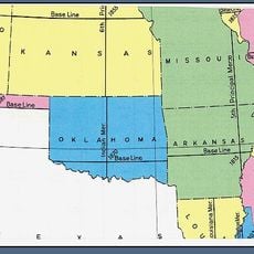
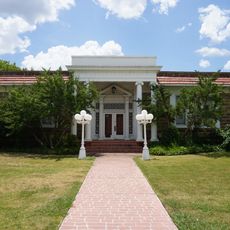
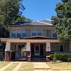
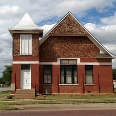
Spanish Fort, city in Texas, United States

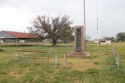
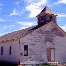
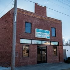
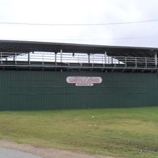
Spanish Fort is an abandoned settlement in Montague County with remains from different periods. The site contains old buildings, a 1936 monument commemorating the Taovaya, and archaeological areas that have revealed artifacts from both the original village and the later American settlement era.

The Taovaya built two villages on opposite banks of the Red River between 1750 and 1757 with fortifications of wooden walls, trenches, and a moat. In 1759, Spanish troops under Colonel Diego Ortiz Parrilla attacked but were forced to retreat after four hours of fighting, demonstrating the settlement's strength.

The Taovaya built a major fortified village here that later European settlers mistook for a Spanish fort, giving the place its name. The original inhabitants maintained trading ties with the French, while the settlement later became a stopping point for cattle drivers moving westward.

The location sits about a mile south of the Red River and is reached via Farm Road 103 in a quiet rural setting. Visitors should expect uneven terrain and abandoned structures, with the 1936 monument serving as a landmark for orientation.

Herman J. Justin opened a boot-making shop here that later moved to Nocona and became one of America's oldest boot manufacturers. This humble beginning in a rural settlement grew into a business that lasted over a century.

The community of curious travelers

AroundUs brings together thousands of curated places, local tips, and hidden gems, enriched daily by 60,000 contributors worldwide.

Start exploring
Location
GPS coordinates
33.95201,-97.62669
Latest update
February 7, 2026 11:01
Around this place
WinStar World Casino
United States of America

WinStar World Casino

50.6 km
Turner Falls
United States of America

Turner Falls

68.7 km
Turner Falls Park
United States of America

Turner Falls Park

69 km
Lake of the Arbuckles
United States of America

Lake of the Arbuckles

76.9 km
Frank Buck Zoo
United States of America

Frank Buck Zoo

57.1 km
Indian meridian
United States of America

Indian meridian

70.9 km
Treasure Valley Casino
United States of America

Treasure Valley Casino

74.8 km
Gold Mountain Casino
United States of America

Gold Mountain Casino

54.3 km
Stonewall Saloon
United States of America

Stonewall Saloon

30.1 km
Border Casino
United States of America

Border Casino

50.7 km
Bethel Missionary Baptist Church
United States of America

Bethel Missionary Baptist Church

61 km
State Highway 79 Bridge at the Red River
United States of America

State Highway 79 Bridge at the Red River

47.6 km
St. Peter's Roman Catholic Church
United States of America

St. Peter's Roman Catholic Church

51.1 km
Irving Baptist Church
United States of America

Irving Baptist Church

40.6 km
Black Theater of Ardmore
United States of America

Black Theater of Ardmore

52.4 km
Ardmore Carnegie Library
United States of America

Ardmore Carnegie Library

51.4 km
Brittain-Garvin House
United States of America

Brittain-Garvin House

68.9 km
First Presbyterian Church
United States of America

First Presbyterian Church

42 km
Locke Field
United States of America

Locke Field

57.5 km
Love County Courthouse
United States of America

Love County Courthouse

46.6 km
H.C. Chrislip House
United States of America

H.C. Chrislip House

69.6 km
Love County Jail and Sheriff's Residence
United States of America

Love County Jail and Sheriff's Residence

46.6 km
Chisholm Trail Heritage Center & Garis Gallery of the American West
United States of America

Chisholm Trail Heritage Center & Garis Gallery of the American West

70.8 km
Brushy Creek Vineyards

Brushy Creek Vineyards

63.4 km
Tales N' Trails Museum
United States of America

Tales N' Trails Museum

19.9 km
Cooke County Courthouse
United States of America

Cooke County Courthouse

57.6 km
State Theater
United States of America

State Theater

57.7 km
Lake Murray State Park
United States of America

Lake Murray State Park

53.1 km
Show the full map
« Spanish Fort - city in Texas, United States » is provided by Around Us (aroundus.com). Images and texts are derived from Wikimedia project under a Creative Commons license. You are allowed to copy, distribute, and modify copies of this page, under the conditions set by the license, as long as this note is clearly visible.

Discover hidden gems everywhere you go!

From secret cafés to breathtaking viewpoints, skip the crowded tourist spots and find places that match your style. Our app makes it easy with voice search, smart filtering, route optimization, and insider tips from travelers worldwide. Download now for the complete mobile experience.

Around Us App Screenshot

A unique approach to discovering new places

Le Figaro

All the places worth exploring

France Info

A tailor-made excursion in just a few clicks

20 Minutes

Around Us
Travel Guide & Maps
Download

Send to your phone

QR Code
1

Open the camera app on your mobile.

2

Point at the QR code with your camera. A notification will appear.

3

Tap the notification to open the link.