Chest opened
+${chestReward.xp} XP
Explorer
NOUVEAU ×${chestReward.collectible.quantity}
tapez pour fermer
Chest locked

Open chests in the app

Around Us is built for your phone — chests unlock when you walk, explore and capture nearby places.

Enable Location

We need your location to show you interesting places around you

Discover nearby places

Find interesting locations and hidden gems around you

Precise directions

Get accurate directions and distances to places

Your location is never shared with other users. It's only used when you tap the location button.

Lower Ninth Ward

Log in to your account

Start exploring — it's free

Trusted by 72,889 travelers worldwide

Continue with Google
Continue with Apple
or

We will send you a code to connect

By continuing, you accept our Terms and Conditions and our Privacy Policy

Check your inbox

We've sent a pincode in your inbox. Please enter the code below.

Discussion Reviews 1 Photos
63.3k Popularity

Lower Ninth Ward, Residential district in New Orleans, United States

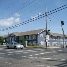
The Lower Ninth Ward is a residential district in New Orleans that stretches along a river bend and is separated from the rest of the city by an industrial canal. The area contains low houses, empty lots, and newly built homes scattered among older structures.

The district formed in 1852 when the city expanded its administrative boundaries and established new wards. Hurricane Katrina flooded the entire area in 2005 and destroyed thousands of homes, leading to a long period of rebuilding.

The name comes from the original division of the city into wards, with number nine marking the area east of the canal. Today the community grows again as people return to streets that slowly fill with new life.

The district can be reached by car or bus and most streets are flat and easy to navigate. Visitors should keep in mind that the area is still rebuilding and some sections remain thinly populated.

Archaeologists found objects from the mid-twentieth century near a former temple site that show how the neighborhood's residents changed over the decades. These finds allow a glimpse into the daily life of past generations.

The community of curious travelers

AroundUs brings together thousands of curated places, local tips, and hidden gems, enriched daily by 60,000 contributors worldwide.

Start exploring
Location
GPS coordinates
29.97030,-90.01280
Latest update
December 13, 2025 18:46
Around this place
New Orleans Mint
United States of America

New Orleans Mint

4.5 km
William Frantz Elementary School
United States of America

William Frantz Elementary School

2.1 km
French Market
United States of America

French Market

4.8 km
Old Ursuline Convent, New Orleans
United States of America

Old Ursuline Convent, New Orleans

4.8 km
Jackson Barracks
United States of America

Jackson Barracks

2.1 km
Danziger Bridge
United States of America

Danziger Bridge

4.5 km
Claiborne Avenue Bridge
United States of America

Claiborne Avenue Bridge

1.3 km
I-10 High Rise Bridge
United States of America

I-10 High Rise Bridge

4 km
Force Headquarters Group
United States of America

Force Headquarters Group

3.2 km
St. Roch Market
United States of America

St. Roch Market

3.8 km
LeBeau Plantation
United States of America

LeBeau Plantation

2.5 km
Iron Rail Book Collective
United States of America

Iron Rail Book Collective

4.5 km
St. Claude Avenue Bridge
United States of America

St. Claude Avenue Bridge

1.6 km
McDonogh 19 Elementary School
United States of America

McDonogh 19 Elementary School

1.1 km
Behrman Stadium
United States of America

Behrman Stadium

3.4 km
Florida Avenue Bridge
United States of America

Florida Avenue Bridge

1.5 km
Almonaster Avenue Bridge
United States of America

Almonaster Avenue Bridge

4 km
St. Vincent De Paul Roman Catholic Church
United States of America

St. Vincent De Paul Roman Catholic Church

3.3 km
Deluge
United States of America

Deluge

4.4 km
U.S. Army Supply Base New Orleans
United States of America

U.S. Army Supply Base New Orleans

2.1 km
Jamnola
United States of America

Jamnola

3.6 km
Lombard Plantation
United States of America

Lombard Plantation

2.6 km
Adolph Meyer School
United States of America

Adolph Meyer School

3.6 km
StudioBE
United States of America

StudioBE

3.4 km
Friscoville Street Historic District
United States of America

Friscoville Street Historic District

2.5 km
Lower Ninth Ward Living Museum
United States of America

Lower Ninth Ward Living Museum

1.1 km
Chalmette Unit of Jean Lafitte National Historical Park
United States of America

Chalmette Unit of Jean Lafitte National Historical Park

3.6 km
House of Dance & Feathers
United States of America

House of Dance & Feathers

950 m
Show the full map
Reviews
Share your experience

No review yet

Discussions
Start a discussion...

No discussion yet

« Lower Ninth Ward - Residential district in New Orleans, United States » is provided by Around Us (aroundus.com). Images and texts are derived from Wikimedia project under a Creative Commons license. You are allowed to copy, distribute, and modify copies of this page, under the conditions set by the license, as long as this note is clearly visible.

Discover hidden gems everywhere you go!

From secret cafés to breathtaking viewpoints, skip the crowded tourist spots and find places that match your style. Our app makes it easy with voice search, smart filtering, route optimization, and insider tips from travelers worldwide. Download now for the complete mobile experience.

Around Us App Screenshot

A unique approach to discovering new places

Le Figaro

All the places worth exploring

France Info

A tailor-made excursion in just a few clicks

20 Minutes

Around Us
Travel Guide & Maps
Download

Send to your phone

QR Code
1

Open the camera app on your mobile.

2

Point at the QR code with your camera. A notification will appear.

3

Tap the notification to open the link.