Chest opened
+${chestReward.xp} XP
Explorer
NOUVEAU ×${chestReward.collectible.quantity}
tapez pour fermer
Chest locked

Open chests in the app

Around Us is built for your phone — chests unlock when you walk, explore and capture nearby places.

Enable Location

We need your location to show you interesting places around you

Discover nearby places

Find interesting locations and hidden gems around you

Precise directions

Get accurate directions and distances to places

Your location is never shared with other users. It's only used when you tap the location button.

Log in to your account

Start exploring — it's free

Trusted by 72,937 travelers worldwide

Continue with Google
Continue with Apple
or

We will send you a code to connect

By continuing, you accept our Terms and Conditions and our Privacy Policy

Check your inbox

We've sent a pincode in your inbox. Please enter the code below.

Fort Beauregard
Discussion Reviews Photo
2.8k Popularity

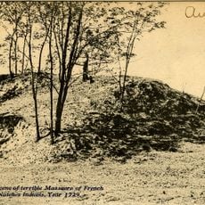
Fort Beauregard, Confederate fort in Harrisonburg, United States

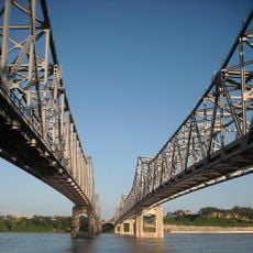
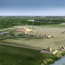
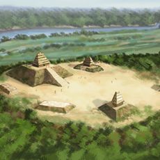
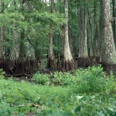
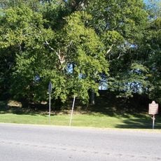
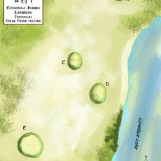
Fort Beauregard is an earthen fortification located on a hill above the Ouachita River in northeastern Louisiana. The structure features gun emplacements and defensive ditches designed to monitor river traffic and control military movements along the waterway.

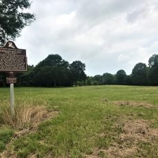
The fort was built in 1862 as part of the southern defensive line along the Ouachita River and was one of four posts guarding that route. It was evacuated in 1863 when military conditions became difficult for Confederate forces.

The site shows how soldiers in the 1860s built river defenses and used strategic positioning to control waterways during conflict. Walking through the grounds reveals the practical thinking behind military fortification design.

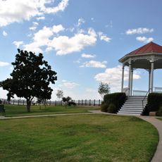
The site sits about half a mile (800 m) north of Harrisonburg in Catahoula Parish and is accessible on foot. Visitors should wear sturdy shoes since the terrain is uneven and the open location offers little shade on sunny days.

In May 1863, the fort came under fire from four Union gunboats commanded by Commodore Selim E. Woodworth in a notable river engagement. This bombardment was part of Union efforts to break Confederate control over the waterway and demonstrated the growing naval superiority of the North.

The community of curious travelers

AroundUs brings together thousands of curated places, local tips, and hidden gems, enriched daily by 60,000 contributors worldwide.

Start exploring
Location
Inception
1862
GPS coordinates
31.77440,-91.82070
Latest update
December 12, 2025 14:22
Around this place
Fort Rosalie
United States of America

Fort Rosalie

45.8 km
Natchez Bluffs and Under-the-Hill Historic District
United States of America

Natchez Bluffs and Under-the-Hill Historic District

44.4 km
Natchez–Vidalia Bridge
United States of America

Natchez–Vidalia Bridge

45 km
Rosalie Mansion
United States of America

Rosalie Mansion

45.8 km
Troyville Earthworks
United States of America

Troyville Earthworks

16.4 km
Frogmore Plantation
United States of America

Frogmore Plantation

24.5 km
Anna Site
United States of America

Anna Site

45.4 km
The Briars
United States of America

The Briars

45.4 km
House on Ellicott's Hill
United States of America

House on Ellicott's Hill

46 km
Bayou Cocodrie National Wildlife Refuge
United States of America

Bayou Cocodrie National Wildlife Refuge

30.6 km
Natchez Museum of African American History and Culture
United States of America

Natchez Museum of African American History and Culture

46.1 km
Commercial Bank and Banker's House
United States of America

Commercial Bank and Banker's House

46 km
Frogmore Mound Site
United States of America

Frogmore Mound Site

23.6 km
DePrato Mounds
United States of America

DePrato Mounds

28.4 km
Peck Mounds
United States of America

Peck Mounds

17 km
William Johnson House
United States of America

William Johnson House

46 km
Smith-Bontura-Evans House
United States of America

Smith-Bontura-Evans House

45.9 km
Clifton Heights Historic District
United States of America

Clifton Heights Historic District

46 km
Spring Ridge Baptist Church
United States of America

Spring Ridge Baptist Church

15.3 km
Waterproof High School
United States of America

Waterproof High School

41.9 km
Van Court Town House
United States of America

Van Court Town House

46 km
Cemetery Bluff District
United States of America

Cemetery Bluff District

46 km
Concordia Parish Courthouse
United States of America

Concordia Parish Courthouse

43.7 km
Schepis Building
United States of America

Schepis Building

43.9 km
Catahoula Parish Courthouse
United States of America

Catahoula Parish Courthouse

301 m
Zappe Boarding House
United States of America

Zappe Boarding House

29.8 km
Winnsboro Commercial Historic District
United States of America

Winnsboro Commercial Historic District

44.4 km
Rosalie Mansion and Gardens
United States of America

Rosalie Mansion and Gardens

45.8 km
Show the full map
Reviews
Share your experience

No review yet

Discussions
Start a discussion...

No discussion yet

« Fort Beauregard - Confederate fort in Harrisonburg, United States » is provided by Around Us (aroundus.com). Images and texts are derived from Wikimedia project under a Creative Commons license. You are allowed to copy, distribute, and modify copies of this page, under the conditions set by the license, as long as this note is clearly visible.

Discover hidden gems everywhere you go!

From secret cafés to breathtaking viewpoints, skip the crowded tourist spots and find places that match your style. Our app makes it easy with voice search, smart filtering, route optimization, and insider tips from travelers worldwide. Download now for the complete mobile experience.

Around Us App Screenshot

A unique approach to discovering new places

Le Figaro

All the places worth exploring

France Info

A tailor-made excursion in just a few clicks

20 Minutes

Around Us
Travel Guide & Maps
Download

Send to your phone

QR Code
1

Open the camera app on your mobile.

2

Point at the QR code with your camera. A notification will appear.

3

Tap the notification to open the link.