Enable Location

We need your location to show you interesting places around you

Discover nearby places

Find interesting locations and hidden gems around you

Precise directions

Get accurate directions and distances to places

Your location is never shared with other users. It's only used when you tap the location button.

Poverty Point Reservoir State Park

Log in to your account

Start exploring — it's free

Trusted by 65,349 travelers worldwide

Continue with Google
Continue with Apple
or

We will send you a code to connect

By continuing, you accept our Terms and Conditions and our Privacy Policy

Check your inbox

We've sent a pincode in your inbox. Please enter the code below.

Poverty Point Reservoir State Park
Discussion Reviews 1 Photos
4k Popularity

Poverty Point Reservoir State Park, Recreation area with 2,700-acre reservoir in Richland Parish, United States

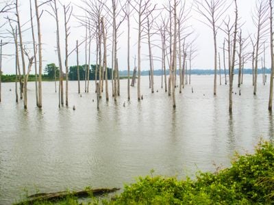
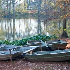
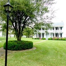
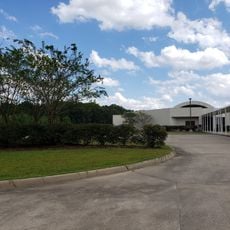
Poverty Point Reservoir State Park is a recreation area in Richland Parish, Louisiana, built around a large reservoir that offers boat launches, a marina with covered slips, and a swimming beach near the town of Delhi. The water sits at the center of the park, surrounded by flat lowland and wetland edges that frame the whole site.

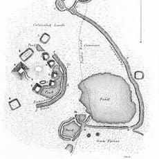
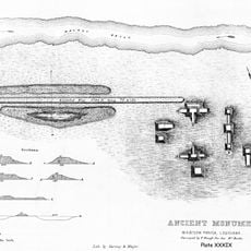
The park opened in 2005 and takes its name from a nearby Native American site that was occupied between 1400 and 700 BC. The reservoir was created by damming Bayou Macon, forming a body of water that did not exist before in this part of Louisiana.

The park sits along the Mississippi Flyway, one of the main migratory bird corridors in North America, where cormorants, bald eagles, ducks, geese, and pelicans rest and move through depending on the season. Birdwatchers can spot different species along the shore and over the water throughout the year.

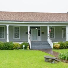
The park offers cabins and campsites for overnight stays, so booking ahead is a good idea, especially during the warmer months when the site gets more visitors. Guests heading to the eastern section near Bayou Macon should read the posted safety notices before exploring that area.

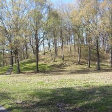
Although the park shares its name with a nearby prehistoric site, the actual Poverty Point World Heritage Site is several miles away and is an entirely separate place with its own facilities. Visitors interested in the archaeology should plan to visit both locations separately, as they have no shared entrance or grounds.

The community of curious travelers

AroundUs brings together thousands of curated places, local tips, and hidden gems, enriched daily by 60,000 contributors worldwide.

Start exploring
Location
GPS coordinates
32.48250,-91.49460
Latest update
March 3, 2026 10:05
Around this place
Poverty Point
United States of America

Poverty Point

18.9 km
Vicksburg Bridge
United States of America

Vicksburg Bridge

58.2 km
Old Vicksburg Bridge
United States of America

Old Vicksburg Bridge

58.4 km
JPS Field at Malone Stadium
United States of America

JPS Field at Malone Stadium

53.9 km
Chennault Aviation and Military Museum
United States of America

Chennault Aviation and Military Museum

52.7 km
Chemin-A-Haut State Park
United States of America

Chemin-A-Haut State Park

57.8 km
United States of America

5th United States Colored Heavy Artillery Regiment

37.4 km
Jordan Mounds
United States of America

Jordan Mounds

30.7 km
Fitzhugh Mounds
United States of America

Fitzhugh Mounds

42.9 km
United States of America

Mott Archaeological Preserve

19.3 km
Crescent Plantation
United States of America

Crescent Plantation

33.5 km
Masur Museum of Art
United States of America

Masur Museum of Art

57.9 km
Hermione
United States of America

Hermione

30.2 km
Scottland Plantation House
United States of America

Scottland Plantation House

29.5 km
Montrose Plantation House
United States of America

Montrose Plantation House

37.8 km
Fiske Theatre
United States of America

Fiske Theatre

43.3 km
Louisiana State Cotton Museum
United States of America

Louisiana State Cotton Museum

46 km
Rose Theatre
United States of America

Rose Theatre

51.3 km
Raffman Site
United States of America

Raffman Site

14 km
Madison Parish Courthouse
United States of America

Madison Parish Courthouse

30 km
Morehouse Parish Courthouse
United States of America

Morehouse Parish Courthouse

51.2 km
Lake Providence Commercial Historic District
United States of America

Lake Providence Commercial Historic District

47 km
Winnsboro Commercial Historic District
United States of America

Winnsboro Commercial Historic District

41.3 km
Vickers House
United States of America

Vickers House

37 km
Joy Theatre
United States of America

Joy Theatre

24.8 km
Mascur Museum
United States of America

Mascur Museum

58.1 km
Princess Theater
United States of America

Princess Theater

41.2 km
African American Museum
United States of America

African American Museum

49.2 km
Show the full map
Reviews
Share your experience

No review yet

Discussions
Start a discussion...

No discussion yet

« Poverty Point Reservoir State Park - Recreation area with 2,700-acre reservoir in Richland Parish, United States » is provided by Around Us (aroundus.com). Images and texts are derived from Wikimedia project under a Creative Commons license. You are allowed to copy, distribute, and modify copies of this page, under the conditions set by the license, as long as this note is clearly visible.

Discover hidden gems everywhere you go!

From secret cafés to breathtaking viewpoints, skip the crowded tourist spots and find places that match your style. Our app makes it easy with voice search, smart filtering, route optimization, and insider tips from travelers worldwide. Download now for the complete mobile experience.

Around Us App Screenshot

A unique approach to discovering new places

Le Figaro

All the places worth exploring

France Info

A tailor-made excursion in just a few clicks

20 Minutes

Around Us
Travel Guide & Maps
Download

Send to your phone

QR Code
1

Open the camera app on your mobile.

2

Point at the QR code with your camera. A notification will appear.

3

Tap the notification to open the link.