Enable Location

We need your location to show you interesting places around you

Discover nearby places

Find interesting locations and hidden gems around you

Precise directions

Get accurate directions and distances to places

Your location is never shared with other users. It's only used when you tap the location button.

Log in to your account

Start exploring — it's free

Trusted by 61,817 travelers worldwide

Continue with Google
Continue with Apple
or

We will send you a code to connect

By continuing, you accept our Terms and Conditions and our Privacy Policy

Check your inbox

We've sent a pincode in your inbox. Please enter the code below.

Pearl River Wildlife Management Area

Pearl River Wildlife Management Area, Protected natural area in Saint Tammany Parish, Louisiana, US

Description

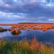
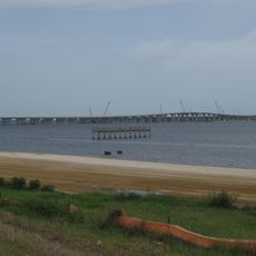
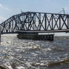
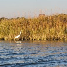
Pearl River Wildlife Management Area is a protected natural area in Saint Tammany Parish, Louisiana, spanning thousands of acres with diverse habitats. The land includes hardwood forests in higher areas, cypress and tupelo swamps in the middle sections, and marshy zones toward the lower parts.

History

The area was established through a major land acquisition initiative that aimed to connect separate protected zones in the region. This effort helped create a larger network of conservation lands and protect important wildlife corridors.

Culture

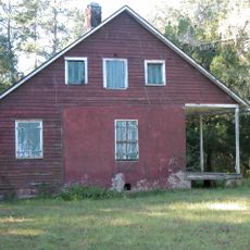
The area holds importance for hunting traditions and fishing communities who have used these waters and forests for generations. Local people practice seasonal hunting and fishing as part of their connection to the landscape.

Practical

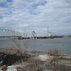
Visitors can stay at Crawford Landing camping facilities and enjoy activities like fishing, crawfishing, and boating on the multiple water bodies throughout the area. Plan visits considering water conditions and seasonal access, as water levels vary throughout the year.

Did you know?

The area contains distinct forest and wetland zones that transition from one to another over short distances, creating a rare variety of habitats in one location. This diversity resulted from deliberately linking separate protected lands into a single connected system.

GPS coordinates
30.30833,-89.67194
Latest update
December 14, 2025 13:05

AroundUs brings together thousands of curated places, local tips, and hidden gems, enriched daily by 60,000 contributors worldwide. Discover all places nearby (United States of America).

Around this place
I-10 Twin Span Bridge
United States of America

I-10 Twin Span Bridge

20.3 km
John C. Stennis Space Center
United States of America

John C. Stennis Space Center

9.2 km
Fort Macomb
United States of America

Fort Macomb

30 km
Fort Pike
United States of America

Fort Pike

17 km
Fontainebleau State Park
United States of America

Fontainebleau State Park

34 km
Gulfport Combat Readiness Training Center
United States of America

Gulfport Combat Readiness Training Center

22.2 km
Maestri Bridge
United States of America

Maestri Bridge

21.3 km
Fort Pike Bridge
United States of America

Fort Pike Bridge

16.3 km
Big Branch Marsh National Wildlife Refuge
United States of America

Big Branch Marsh National Wildlife Refuge

28.5 km
St. Louis Bay Bridge
United States of America

St. Louis Bay Bridge

35.4 km
Crosby Arboretum
United States of America

Crosby Arboretum

21.7 km
Chef Menteur Bridge
United States of America

Chef Menteur Bridge

29.6 km
Francois Cousin House
United States of America

Francois Cousin House

16.2 km
CSX Rigolets Pass Bridge
United States of America

CSX Rigolets Pass Bridge

17.5 km
National Weather Service New Orleans/Baton Rouge, Louisiana
United States of America

National Weather Service New Orleans/Baton Rouge, Louisiana

15.1 km
Bayou Sauvage National Wildlife Refuge
United States of America

Bayou Sauvage National Wildlife Refuge

30.6 km
Camp Salmen House
United States of America

Camp Salmen House

14.8 km
West Rigolets Light
United States of America

West Rigolets Light

16.2 km
CSX Chef Menteur Pass Bridge
United States of America

CSX Chef Menteur Pass Bridge

29.8 km
East Rigolets Light
United States of America

East Rigolets Light

17.2 km
Francois Cousin House
United States of America

Francois Cousin House

25.3 km
Dew Drop Social and Benevolent Hall
United States of America

Dew Drop Social and Benevolent Hall

37.9 km
Lake Borgne Light
United States of America

Lake Borgne Light

25.7 km
Versailles Arms
United States of America

Versailles Arms

37.5 km
Arcade Theatre
United States of America

Arcade Theatre

11.4 km
Rocket Propulsion Test Complex
United States of America

Rocket Propulsion Test Complex

10.2 km
INFINITY Science Center
United States of America

INFINITY Science Center

6.5 km
Rigolets Bridge
United States of America

Rigolets Bridge

16.3 km
Show the full map
« Pearl River Wildlife Management Area - Protected natural area in Saint Tammany Parish, Louisiana, US » is provided by Around Us (aroundus.com). Images and texts are derived from Wikimedia project under a Creative Commons license. You are allowed to copy, distribute, and modify copies of this page, under the conditions set by the license, as long as this note is clearly visible.

Discover hidden gems everywhere you go!

From secret cafés to breathtaking viewpoints, skip the crowded tourist spots and find places that match your style. Our app makes it easy with voice search, smart filtering, route optimization, and insider tips from travelers worldwide. Download now for the complete mobile experience.

Around Us App Screenshot

A unique approach to discovering new places

Le Figaro

All the places worth exploring

France Info

A tailor-made excursion in just a few clicks

20 Minutes

Around Us
Travel Guide & Maps
Download

Send to your phone

QR Code
1

Open the camera app on your mobile.

2

Point at the QR code with your camera. A notification will appear.

3

Tap the notification to open the link.