Enable Location

We need your location to show you interesting places around you

Discover nearby places

Find interesting locations and hidden gems around you

Precise directions

Get accurate directions and distances to places

Your location is never shared with other users. It's only used when you tap the location button.

Ouachita Parish

Log in to your account

Start exploring — it's free

Trusted by 63,328 travelers worldwide

Continue with Google
Continue with Apple
or

We will send you a code to connect

By continuing, you accept our Terms and Conditions and our Privacy Policy

Check your inbox

We've sent a pincode in your inbox. Please enter the code below.

Discussion Reviews 1 Photos
24.3k Popularity

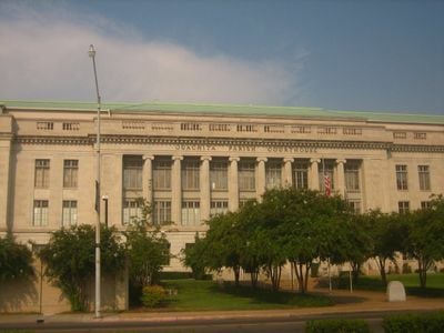
Ouachita Parish, Administrative division in northern Louisiana, US

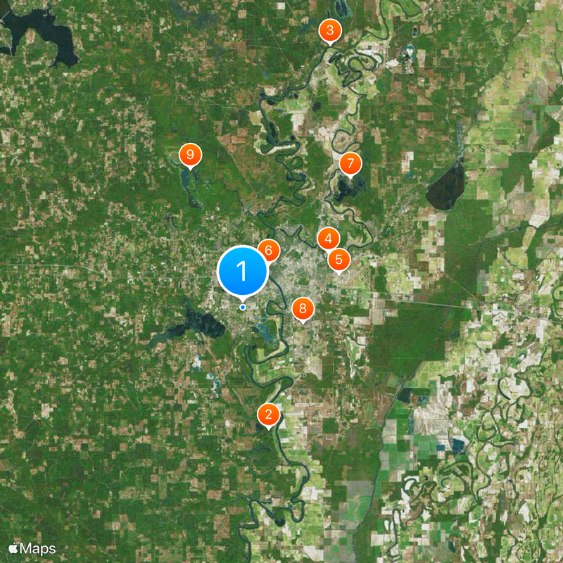
Ouachita Parish is an administrative area in northern Louisiana that encompasses two major population centers, Monroe and West Monroe, separated by the Ouachita River. The region covers a substantial area of land in the state's northeastern section.

The parish was established in 1807 and named after the Ouachita Native American people who originally inhabited the river valley. This naming reflects the indigenous roots that shaped the landscape and culture of the region.

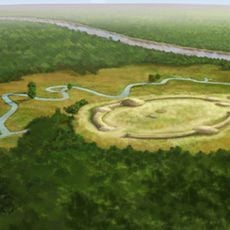
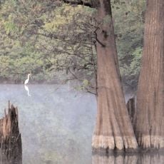
The Watson Brake mound complex within the parish stands as North America's earliest known indigenous earthwork construction, dating from 3500 BCE.

The two main cities are well connected by roads, making it straightforward to navigate the parish. Plan to explore both sides of the river to get a complete sense of the area's geography and communities.

The parish experienced a notable population surge between 1920 and 1930, with an increase of 79 percent due to employment opportunities.

The community of curious travelers

AroundUs brings together thousands of curated places, local tips, and hidden gems, enriched daily by 60,000 contributors worldwide.

Start exploring
Location
Inception
1807
Capital city
Monroe
Shares border with
Union Parish, Morehouse Parish, Richland Parish, Caldwell Parish, Jackson Parish, Lincoln Parish
GPS coordinates
32.48000,-92.16000
Latest update
December 20, 2025 12:50
Around this place
Watson Brake
United States of America

Watson Brake

12.7 km
Bayou Bartholomew
United States of America

Bayou Bartholomew

28.5 km
JPS Field at Malone Stadium
United States of America

JPS Field at Malone Stadium

10.5 km
Chennault Aviation and Military Museum
United States of America

Chennault Aviation and Military Museum

10.5 km
Biedenharn Museum and Gardens
United States of America

Biedenharn Museum and Gardens

5.2 km
United States of America

Black Bayou Lake National Wildlife Refuge

17.4 km
Louisiana Purchase Gardens and Zoo
United States of America

Louisiana Purchase Gardens and Zoo

6.4 km
D'Arbonne National Wildlife Refuge
United States of America

D'Arbonne National Wildlife Refuge

15.2 km
Logtown Plantation
United States of America

Logtown Plantation

17.4 km
Masur Museum of Art
United States of America

Masur Museum of Art

4.7 km
United States of America

Filhiol Mound Site

16.8 km
United States of America

Russell Sage Wildlife Management Area

19 km
United States of America

St. James United Methodist Church

6.1 km
First United Methodist Church
United States of America

First United Methodist Church

4 km
Boscobel Cottage
United States of America

Boscobel Cottage

22.1 km
United States of America

Allen-Barringer House

6.8 km
United States of America

Frenchman’s Bend

20.6 km
United States of America

Roland M. Filhiol House

4.8 km
Historic Biedenharn Home
United States of America

Historic Biedenharn Home

5.2 km
Northeast Louisiana Children's
United States of America

Northeast Louisiana Children's

4.6 km
Mascur Museum
United States of America

Mascur Museum

4.5 km
United States of America

Cheniere Lake

5 km
African American Museum
United States of America

African American Museum

13.5 km
United States of America

Hollands Bluff

17.6 km
United States of America

Country Club Lake

7.4 km
United States of America

Francis Creek Lake

26.7 km
United States of America

Downtown Monroe Historic District

4.7 km
United States of America

Work of art

7.6 km
Show the full map
Reviews
Share your experience

No review yet

Discussions
Start a discussion...

No discussion yet

Administrative divisions
« Ouachita Parish - Administrative division in northern Louisiana, US » is provided by Around Us (aroundus.com). Images and texts are derived from Wikimedia project under a Creative Commons license. You are allowed to copy, distribute, and modify copies of this page, under the conditions set by the license, as long as this note is clearly visible.

Discover hidden gems everywhere you go!

From secret cafés to breathtaking viewpoints, skip the crowded tourist spots and find places that match your style. Our app makes it easy with voice search, smart filtering, route optimization, and insider tips from travelers worldwide. Download now for the complete mobile experience.

Around Us App Screenshot

A unique approach to discovering new places

Le Figaro

All the places worth exploring

France Info

A tailor-made excursion in just a few clicks

20 Minutes

Around Us
Travel Guide & Maps
Download

Send to your phone

QR Code
1

Open the camera app on your mobile.

2

Point at the QR code with your camera. A notification will appear.

3

Tap the notification to open the link.