Watson Brake

Log in to your account

AroundUs is a community-driven map of interesting places, built by curious explorers like you. It grows with every review, story, and photo you share.
Connect to save your favorite spots, contribute locations, and create personalized routes.
Continue with Google
Continue with Apple
Continue with X
Continue with Facebook
Continue with email
By continuing, you accept our Terms and Conditions and our Privacy Policy
Create an account
Add to collection
Map
Suggest a change
Share

Watson Brake, Prehistoric mound complex in Ouachita Parish, United States.

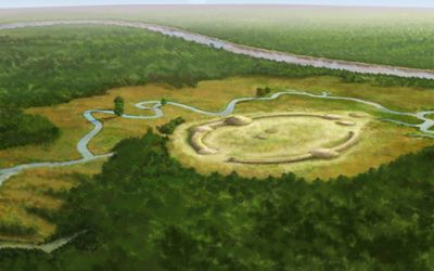
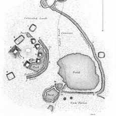
Watson Brake is a prehistoric archaeological site in northern Louisiana consisting of eleven earthen mounds connected by ridges that form an oval pattern approximately 275 meters (900 feet) in diameter. The mounds rise between 1.2 and 7.6 meters (4 and 25 feet) above the surrounding terrain and are positioned in an arrangement that encloses a central open area.

Builders began work on the complex between 3500 and 2800 BCE, creating one of the oldest known monumental earthworks in North America. Archaeologists discovered the site only in 1980 after it lay hidden under dense vegetation for centuries and remained unnoticed for a long time.

The complex belongs to the earliest examples of monumental earthworks on the American continent and shows that settled communities built sophisticated structures over 5,000 years ago. Visitors can still recognize the oval arrangement of the mounds in the landscape, though vegetation and time have altered the original shapes.

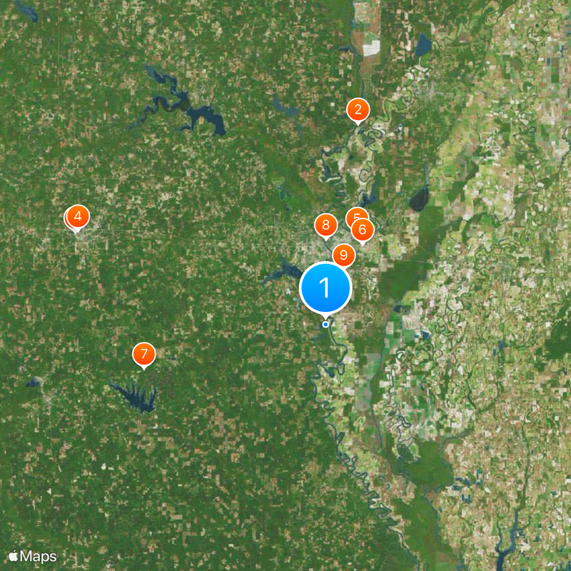
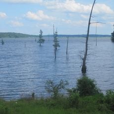
Visits require prior arrangement because part of the terrain is privately owned and can only be entered under specific conditions. The site lies in a wooded area with uneven ground, so sturdy footwear and patience are advisable when exploring the sprawling layout.

Researchers have found that construction activity at the site coincided with El Niño climate events, suggesting that environmental conditions influenced building efforts. This correlation sheds light on the close connection between early societies and the climatic conditions of their surroundings.

Location: Ouachita Parish

Elevation above the sea: 22 m

GPS coordinates: 32.36840,-92.13140

Latest update: December 20, 2025 16:19

Photos
Around this place
Bayou Bartholomew
United States of America

Bayou Bartholomew

40 km
Joe Aillet Stadium
United States of America

Joe Aillet Stadium

52.5 km
Ruston High School
United States of America

Ruston High School

52.1 km
JPS Field at Malone Stadium
United States of America

JPS Field at Malone Stadium

19.1 km
Chennault Aviation and Military Museum
United States of America

Chennault Aviation and Military Museum

17.5 km
Jimmie Davis State Park
United States of America

Jimmie Davis State Park

36.8 km
Biedenharn Museum and Gardens
United States of America

Biedenharn Museum and Gardens

16.8 km
Louisiana Purchase Gardens and Zoo
United States of America

Louisiana Purchase Gardens and Zoo

11.5 km
Jordan Mounds
United States of America

Jordan Mounds

46.5 km
Lake D’Arbonne
United States of America

Lake D’Arbonne

51.6 km
D'Arbonne National Wildlife Refuge
United States of America

D'Arbonne National Wildlife Refuge

27.9 km
Masur Museum of Art
United States of America

Masur Museum of Art

13.4 km
Louisiana Tech University Arboretum
United States of America

Louisiana Tech University Arboretum

51.1 km
Dixie Center for the Arts
United States of America

Dixie Center for the Arts

50.9 km
Rose Theatre
United States of America

Rose Theatre

49.9 km
First Presbyterian Church
United States of America

First Presbyterian Church

50.8 km
First United Methodist Church
United States of America

First United Methodist Church

14.6 km
Morehouse Parish Courthouse
United States of America

Morehouse Parish Courthouse

49.9 km
Boscobel Cottage
United States of America

Boscobel Cottage

9.5 km
Schepis Building
United States of America

Schepis Building

29.7 km
Federal Building
United States of America

Federal Building

50.9 km
Grambling State University Historic District
United States of America

Grambling State University Historic District

57.4 km
Winnsboro Commercial Historic District
United States of America

Winnsboro Commercial Historic District

45 km
Vickers House
United States of America

Vickers House

25.5 km
Historic Biedenharn Home
United States of America

Historic Biedenharn Home

16.8 km
Northeast Louisiana Children's
United States of America

Northeast Louisiana Children's

15.1 km
Mascur Museum
United States of America

Mascur Museum

13.6 km
Princess Theater
United States of America

Princess Theater

45 km
Show the full map
Reviews

Visited this place? Tap the stars to rate it and share your experience / photos with the community! Try now! You can cancel it anytime.

« Watson Brake - Prehistoric mound complex in Ouachita Parish, United States » is provided by Around Us (aroundus.com). Images and texts are derived from Wikimedia project under a Creative Commons license. You are allowed to copy, distribute, and modify copies of this page, under the conditions set by the license, as long as this note is clearly visible.

Discover hidden gems everywhere you go!

From secret cafés to breathtaking viewpoints, skip the crowded tourist spots and find places that match your style. Our app makes it easy with voice search, smart filtering, route optimization, and insider tips from travelers worldwide. Download now for the complete mobile experience.

Around Us App Screenshot

A unique approach to discovering new places

Le Figaro

All the places worth exploring

France Info

A tailor-made excursion in just a few clicks

20 Minutes