Enable Location

We need your location to show you interesting places around you

Discover nearby places

Find interesting locations and hidden gems around you

Precise directions

Get accurate directions and distances to places

Your location is never shared with other users. It's only used when you tap the location button.

Meaher State Park

Log in to your account

Start exploring — it's free

Trusted by 64,473 travelers worldwide

Continue with Google
Continue with Apple
or

We will send you a code to connect

By continuing, you accept our Terms and Conditions and our Privacy Policy

Check your inbox

We've sent a pincode in your inbox. Please enter the code below.

Meaher State Park
Discussion Reviews 1 Photos
4.8k Popularity

Meaher State Park, State park in Spanish Fort, Alabama

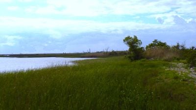
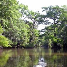
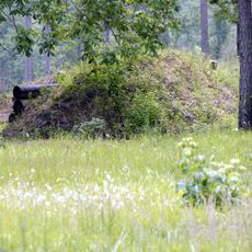
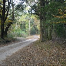
Meaher State Park is a protected area near Spanish Fort, Alabama, sitting along the shore of Mobile Bay and the Blakeley River delta. It covers coastal wetlands, marshes, and wooded sections that support a wide range of native plants and wildlife.

The land once belonged to the Meaher family, timber merchants who donated it to the state of Alabama in 1930. Their gift turned a working piece of coastal land into a public park open to everyone.

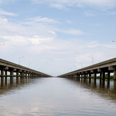
The park sits near Mobile Bay, and local families often come here on weekends to fish from the piers or walk along the water. Birdwatching is common, as the wetlands draw many migratory birds throughout the year.

The park has spaces for RVs, tent camping, and two furnished cabins, so it works for both overnight stays and day visits. Fishing piers are accessible from different points in the park, making it easy to find a spot along the water.

The Meaher family, after whom the park is named, were connected to the Clotilda, the last known ship to bring enslaved people to the United States in 1860. The descendants of those survivors founded Africatown, a community that still exists just a short drive from the park.

The community of curious travelers

AroundUs brings together thousands of curated places, local tips, and hidden gems, enriched daily by 60,000 contributors worldwide.

Start exploring
Location
Inception
1989
GPS coordinates
30.66970,-87.93600
Latest update
March 3, 2026 10:07
Around this place
USS Alabama
United States of America

USS Alabama

7.7 km
USS Drum
United States of America

USS Drum

7.8 km
Battleship Memorial Park
United States of America

Battleship Memorial Park

7.7 km
RSA Battle House Tower
United States of America

RSA Battle House Tower

10.3 km
Mobile-Tensaw River Delta
United States of America

Mobile-Tensaw River Delta

9.4 km
Jubilee Parkway
United States of America

Jubilee Parkway

2.7 km
Fort Charlotte
United States of America

Fort Charlotte

10.2 km
Blakeley
United States of America

Blakeley

8.2 km
Saenger Theatre
United States of America

Saenger Theatre

10.6 km
Statue of Raphael Semmes
United States of America

Statue of Raphael Semmes

10.2 km
Historic Blakeley State Park
United States of America

Historic Blakeley State Park

8.4 km
Old City Hall
United States of America

Old City Hall

10.2 km
Van Antwerp Building
United States of America

Van Antwerp Building

10.4 km
Mobile Government Plaza
United States of America

Mobile Government Plaza

10.4 km
RSA–BankTrust Building
United States of America

RSA–BankTrust Building

10.4 km
Malbis Memorial Church
United States of America

Malbis Memorial Church

8.4 km
Regions Bank Building
United States of America

Regions Bank Building

10.5 km
Gulf Coast Exploreum Science Center
United States of America

Gulf Coast Exploreum Science Center

10.2 km
The Battle House Hotel
United States of America

The Battle House Hotel

10.6 km
Conde-Charlotte House
United States of America

Conde-Charlotte House

10.1 km
Wachovia Building
United States of America

Wachovia Building

10.5 km
John Archibald Campbell United States Courthouse
United States of America

John Archibald Campbell United States Courthouse

10.6 km
Saint Vincent de Paul
United States of America

Saint Vincent de Paul

10.5 km
First National Bank
United States of America

First National Bank

10.4 km
Coley Building
United States of America

Coley Building

10.3 km
Emanuel Building
United States of America

Emanuel Building

10.4 km
Methodist Episcopal Church, South
United States of America

Methodist Episcopal Church, South

8 km
The Texas
United States of America

The Texas

8.1 km
Show the full map
Reviews
Share your experience

No review yet

Discussions
Start a discussion...

No discussion yet

« Meaher State Park - State park in Spanish Fort, Alabama » is provided by Around Us (aroundus.com). Images and texts are derived from Wikimedia project under a Creative Commons license. You are allowed to copy, distribute, and modify copies of this page, under the conditions set by the license, as long as this note is clearly visible.

Discover hidden gems everywhere you go!

From secret cafés to breathtaking viewpoints, skip the crowded tourist spots and find places that match your style. Our app makes it easy with voice search, smart filtering, route optimization, and insider tips from travelers worldwide. Download now for the complete mobile experience.

Around Us App Screenshot

A unique approach to discovering new places

Le Figaro

All the places worth exploring

France Info

A tailor-made excursion in just a few clicks

20 Minutes

Around Us
Travel Guide & Maps
Download

Send to your phone

QR Code
1

Open the camera app on your mobile.

2

Point at the QR code with your camera. A notification will appear.

3

Tap the notification to open the link.