Chest opened
+${chestReward.xp} XP
Explorer
NOUVEAU ×${chestReward.collectible.quantity}
tapez pour fermer
Chest locked

Open chests in the app

Around Us is built for your phone — chests unlock when you walk, explore and capture nearby places.

Enable Location

We need your location to show you interesting places around you

Discover nearby places

Find interesting locations and hidden gems around you

Precise directions

Get accurate directions and distances to places

Your location is never shared with other users. It's only used when you tap the location button.

Log in to your account

Start exploring — it's free

Trusted by 72,886 travelers worldwide

Continue with Google
Continue with Apple
or

We will send you a code to connect

By continuing, you accept our Terms and Conditions and our Privacy Policy

Check your inbox

We've sent a pincode in your inbox. Please enter the code below.

Golden Triangle
Discussion Reviews Photo
18.2k Popularity

Golden Triangle, Economic development region in eastern Mississippi, United States.

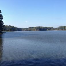
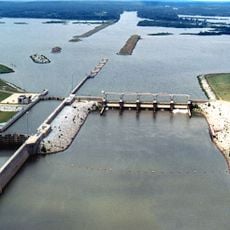
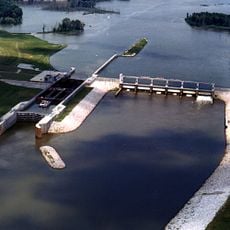
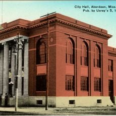
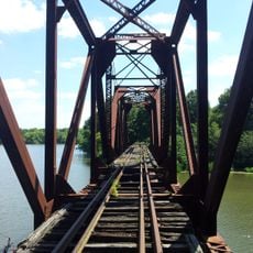
The Golden Triangle is a three-city region in eastern Mississippi comprising Columbus, Starkville, and West Point positioned near the intersection of major waterways. The area spans three counties and serves as an important center for education, military operations, and business activity.

The region received its name during the 1960s as a deliberate marketing effort to attract industrial investment and development. This initiative successfully sparked decades of economic growth and transformation across the three-county area.

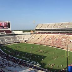
Mississippi State University and Columbus Air Force Base shape how people in this region study, work, and spend their time. Both institutions draw in students and professionals from across the country, creating a diverse community.

The Golden Triangle Regional Airport provides air service and connections throughout the region and beyond. Visitors should plan for warm, humid summers and milder winters when exploring the three cities and surrounding areas.

Since 2008, major manufacturing companies have established facilities here, transforming the region into a significant industrial hub. This modern industrial growth came after decades of strategic planning and targeted economic development efforts.

The community of curious travelers

AroundUs brings together thousands of curated places, local tips, and hidden gems, enriched daily by 60,000 contributors worldwide.

Start exploring
Location
GPS coordinates
33.54219,-88.66083
Latest update
March 5, 2026 18:16
Around this place
Davis Wade Stadium
United States of America

Davis Wade Stadium

15.6 km
Waverley
United States of America

Waverley

14.9 km
Bynum Mound and Village Site
United States of America

Bynum Mound and Village Site

47.6 km
Tombigbee National Forest
United States of America

Tombigbee National Forest

44.1 km
John C. Stennis Lock and Dam
United States of America

John C. Stennis Lock and Dam

16.2 km
Sam D. Hamilton Noxubee National Wildlife Refuge
United States of America

Sam D. Hamilton Noxubee National Wildlife Refuge

29.7 km
Aberdeen Lock and Dam
United States of America

Aberdeen Lock and Dam

34.7 km
Payne Field
United States of America

Payne Field

14 km
Reuben Davis House
United States of America

Reuben Davis House

33 km
Old Fort House
United States of America

Old Fort House

22.3 km
Charles McLaran House
United States of America

Charles McLaran House

22 km
Stephen D. Lee House
United States of America

Stephen D. Lee House

22.4 km
South Columbus Historic District
United States of America

South Columbus Historic District

23.5 km
Brownrigg-Harris-Kennebrew House
United States of America

Brownrigg-Harris-Kennebrew House

22.5 km
Judge Bates House
United States of America

Judge Bates House

50.1 km
The Cedars
United States of America

The Cedars

22.7 km
Houston Carnegie Library
United States of America

Houston Carnegie Library

50.5 km
West Commerce Street Historic District
United States of America

West Commerce Street Historic District

33 km
Aberdeen City Hall
United States of America

Aberdeen City Hall

33.3 km
Cox-Uithoven House
United States of America

Cox-Uithoven House

19.9 km
Yates-Flora House
United States of America

Yates-Flora House

49 km
John Holliday House
United States of America

John Holliday House

32.6 km
Waverly Bridge
United States of America

Waverly Bridge

15.4 km
Weaver Place
United States of America

Weaver Place

22.2 km
Old Homestead
United States of America

Old Homestead

33.1 km
Harris-Banks House
United States of America

Harris-Banks House

22.2 km
Goodwin-Harrison House
United States of America

Goodwin-Harrison House

48.6 km
John M. Stone Cotton Mill
United States of America

John M. Stone Cotton Mill

16.2 km
Show the full map
Reviews
Share your experience

No review yet

Discussions
Start a discussion...

No discussion yet

« Golden Triangle - Economic development region in eastern Mississippi, United States » is provided by Around Us (aroundus.com). Images and texts are derived from Wikimedia project under a Creative Commons license. You are allowed to copy, distribute, and modify copies of this page, under the conditions set by the license, as long as this note is clearly visible.

Discover hidden gems everywhere you go!

From secret cafés to breathtaking viewpoints, skip the crowded tourist spots and find places that match your style. Our app makes it easy with voice search, smart filtering, route optimization, and insider tips from travelers worldwide. Download now for the complete mobile experience.

Around Us App Screenshot

A unique approach to discovering new places

Le Figaro

All the places worth exploring

France Info

A tailor-made excursion in just a few clicks

20 Minutes

Around Us
Travel Guide & Maps
Download

Send to your phone

QR Code
1

Open the camera app on your mobile.

2

Point at the QR code with your camera. A notification will appear.

3

Tap the notification to open the link.