William B. Bankhead National Forest

Log in to your account

AroundUs is a community-driven map of interesting places, built by curious explorers like you. It grows with every review, story, and photo you share.
Connect to save your favorite spots, contribute locations, and create personalized routes.
Continue with Google
Continue with Apple
Continue with X
Continue with Facebook
Continue with email
By continuing, you accept our Terms and Conditions and our Privacy Policy
Create an account

William B. Bankhead National Forest

Add to collection
Map
Suggest a change
Share

William B. Bankhead National Forest, National forest in Walker County, United States.

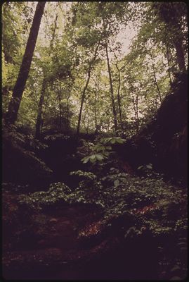
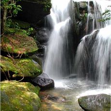
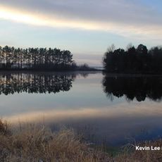
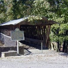
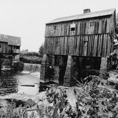
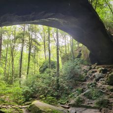
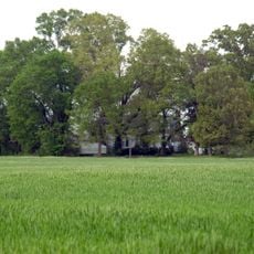
William B. Bankhead National Forest is a large protected woodland area in Alabama with varied natural features. The land contains limestone cliffs, deep valleys, flowing waterfalls, and natural caves scattered throughout.

This forest gained national status in 1918 as a protected woodland area. The name changed twice over the decades before settling on its current title in 1942.

The land holds evidence of ancient peoples who lived here, with rock carvings visible at certain locations within the forest. These marks show how indigenous communities connected with this place over hundreds of years.

The forest is managed by the United States Forest Service with local offices in Double Springs offering visitor information. Multiple entry points and trails allow you to explore different parts of the woodland at your own pace.

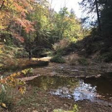
The Sipsey Fork River flowing through the forest holds a special distinction as Alabama's only river designated as a National Wild and Scenic River. This protection ensures the waterway and its surroundings remain in a natural state.

Location: Walker County

Operator: United States Forest Service

GPS coordinates: 34.30186,-87.41407

Latest update: December 7, 2025 20:24

Photos
Around this place
Sipsey Wilderness
United States of America

Sipsey Wilderness

4.3 km
Dismals Canyon
United States of America

Dismals Canyon

33.9 km
Ave Maria Grotto
United States of America

Ave Maria Grotto

56.8 km
Wheeler National Wildlife Refuge
United States of America

Wheeler National Wildlife Refuge

51.1 km
Bankhead House
United States of America

Bankhead House

53.1 km
Bride's Hill
United States of America

Bride's Hill

43.9 km
Joseph Wheeler Plantation
United States of America

Joseph Wheeler Plantation

41.3 km
Clarkson–Legg Covered Bridge
United States of America

Clarkson–Legg Covered Bridge

40.3 km
Boshell's Mill
United States of America

Boshell's Mill

49.9 km
First United Methodist Church
United States of America

First United Methodist Church

53.6 km
Jasper Downtown Historic District
United States of America

Jasper Downtown Historic District

53.8 km
Winston County Courthouse
United States of America

Winston County Courthouse

17.3 km
John McMahon House
United States of America

John McMahon House

42 km
Boxwood Plantation Slave Quarter
United States of America

Boxwood Plantation Slave Quarter

46.1 km
Natural Bridge Park
United States of America

Natural Bridge Park

29.7 km
Thomas Holland House
United States of America

Thomas Holland House

37.9 km
Cullman Historic District
United States of America

Cullman Historic District

55.4 km
Preuit Oaks
United States of America

Preuit Oaks

42.5 km
Ernest Edward Greene House
United States of America

Ernest Edward Greene House

54.8 km
Westview Plantation
United States of America

Westview Plantation

49.6 km
Ice House
United States of America

Ice House

23.1 km
Stiefelmeyer's
United States of America

Stiefelmeyer's

54.4 km
Crane Hill Masonic Lodge
United States of America

Crane Hill Masonic Lodge

41 km
Cullman Downtown Commercial Historic District
United States of America

Cullman Downtown Commercial Historic District

54.7 km
Moulton Courthouse Square Historic District
United States of America

Moulton Courthouse Square Historic District

22.9 km
Clarkson Covered Bridge
United States of America

Clarkson Covered Bridge

40.4 km
Hartselle Downtown Commercial Historic District
United States of America

Hartselle Downtown Commercial Historic District

46.8 km
Historic Downtown Hartselle
United States of America

Historic Downtown Hartselle

46.9 km
Show the full map
Reviews

Visited this place? Tap the stars to rate it and share your experience / photos with the community! Try now! You can cancel it anytime.

« William B. Bankhead National Forest - National forest in Walker County, United States » is provided by Around Us (aroundus.com). Images and texts are derived from Wikimedia project under a Creative Commons license. You are allowed to copy, distribute, and modify copies of this page, under the conditions set by the license, as long as this note is clearly visible.

Discover hidden gems everywhere you go!

From secret cafés to breathtaking viewpoints, skip the crowded tourist spots and find places that match your style. Our app makes it easy with voice search, smart filtering, route optimization, and insider tips from travelers worldwide. Download now for the complete mobile experience.

Around Us App Screenshot

A unique approach to discovering new places

Le Figaro

All the places worth exploring

France Info

A tailor-made excursion in just a few clicks

20 Minutes