Enable Location

We need your location to show you interesting places around you

Discover nearby places

Find interesting locations and hidden gems around you

Precise directions

Get accurate directions and distances to places

Your location is never shared with other users. It's only used when you tap the location button.

Monte Binga

Log in to your account

Start exploring — it's free

Trusted by 63,116 travelers worldwide

Continue with Google
Continue with Apple
or

We will send you a code to connect

By continuing, you accept our Terms and Conditions and our Privacy Policy

Check your inbox

We've sent a pincode in your inbox. Please enter the code below.

Monte Binga
Discussion Reviews 1 Photos 1 Collections
11.3k Popularity

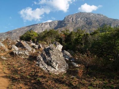
Monte Binga, Mountain summit in Chimanimani National Park, Mozambique.

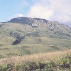
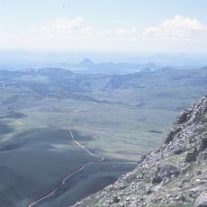
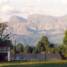
Monte Binga is a mountain in Chimanimani National Park that rises to about 2400 meters and displays steep cliffs on its western face. The eastern side slopes more gradually and offers a less demanding climbing route.

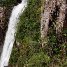
The mountain takes its name from the Binga River, which has long supplied water to the surrounding areas. The river has been an important resource for communities in Sussundenga District for generations.

Local communities living near the mountain maintain traditions closely tied to the land and share their understanding of the environment with visitors during guided hikes. You can experience firsthand how people know and use this region.

Climbing the mountain requires camping gear, sufficient water, and typically a four-wheel-drive vehicle to reach the park entrance via road. Plan for one or two days to complete the route and pace yourself to manage the effort.

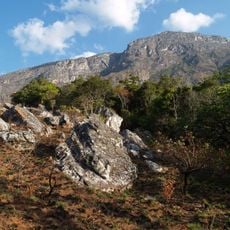
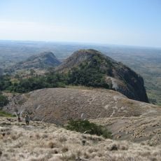
The summit area supports shallow peaty soils that create distinctive vegetation patterns of tussocky grasses and mosses between lichen-covered rock formations. These special conditions exist only at this elevation and make the peak botanically noteworthy.

The community of curious travelers

AroundUs brings together thousands of curated places, local tips, and hidden gems, enriched daily by 60,000 contributors worldwide.

Start exploring
Elevation above the sea
2,436 m
Part of
Chimanimani National Park
GPS coordinates
-19.77623,33.06256
Latest update
December 6, 2025 16:03
Photo spots in Mozambique

Mozambique stretches along the Indian Ocean coast for 1,500 miles (2,400 kilometers) and presents photographers with diverse subjects. The coastal region includes archipelagos such as Bazaruto and Quirimbas with white sand beaches and coral reefs. Along the shore sit historic structures like Macuti...

Reviews
Share your experience

No review yet

Discussions
Start a discussion...

No discussion yet

« Monte Binga - Mountain summit in Chimanimani National Park, Mozambique » is provided by Around Us (aroundus.com). Images and texts are derived from Wikimedia project under a Creative Commons license. You are allowed to copy, distribute, and modify copies of this page, under the conditions set by the license, as long as this note is clearly visible.

Discover hidden gems everywhere you go!

From secret cafés to breathtaking viewpoints, skip the crowded tourist spots and find places that match your style. Our app makes it easy with voice search, smart filtering, route optimization, and insider tips from travelers worldwide. Download now for the complete mobile experience.

Around Us App Screenshot

A unique approach to discovering new places

Le Figaro

All the places worth exploring

France Info

A tailor-made excursion in just a few clicks

20 Minutes

Around Us
Travel Guide & Maps
Download

Send to your phone

QR Code
1

Open the camera app on your mobile.

2

Point at the QR code with your camera. A notification will appear.

3

Tap the notification to open the link.