Chest opened
+${chestReward.xp} XP
Explorer
NOUVEAU ×${chestReward.collectible.quantity}
tapez pour fermer
Chest locked

Open chests in the app

Around Us is built for your phone — chests unlock when you walk, explore and capture nearby places.

Enable Location

We need your location to show you interesting places around you

Discover nearby places

Find interesting locations and hidden gems around you

Precise directions

Get accurate directions and distances to places

Your location is never shared with other users. It's only used when you tap the location button.

Florida Mountains

Log in to your account

Start exploring — it's free

Trusted by 72,884 travelers worldwide

Continue with Google
Continue with Apple
or

We will send you a code to connect

By continuing, you accept our Terms and Conditions and our Privacy Policy

Check your inbox

We've sent a pincode in your inbox. Please enter the code below.

Florida Mountains
Discussion Reviews 1 Photos
10.5k Popularity

Florida Mountains, Mountain range in Luna County, New Mexico, US

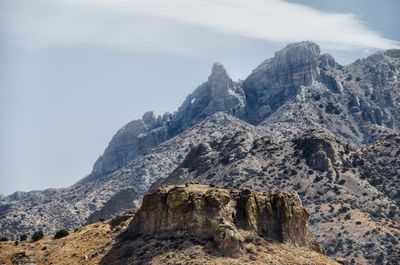
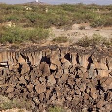
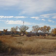
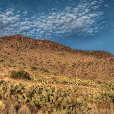
The Florida Mountains form a compact range in southwestern New Mexico with rocky peaks and deep canyons carved into the landscape. The terrain consists of exposed rock formations and sparse desert vegetation typical of this arid region.

The mountains have been traveled through for centuries by various peoples moving across the southwestern desert landscape. In the 1800s, the area attracted miners and settlers seeking mineral deposits and grazing lands.

Native American tribes established their presence in the Florida Mountains area, utilizing the natural resources for their traditional practices.

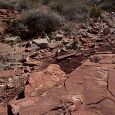
The best time to visit is during cooler months from October through April when desert heat is less intense. Bring plenty of water and prepare for uneven trails and rough rocky surfaces throughout the range.

The range is home to a population of Persian Ibex that have adapted to the harsh desert conditions. These animals descend from individuals introduced in the 1970s and have thrived in this remote location.

The community of curious travelers

AroundUs brings together thousands of curated places, local tips, and hidden gems, enriched daily by 60,000 contributors worldwide.

Start exploring
Location
GPS coordinates
32.09000,-107.62000
Latest update
December 10, 2025 15:53
Around this place
Kilbourne Hole
United States of America

Kilbourne Hole

63.2 km
City of Rocks State Park
United States of America

City of Rocks State Park

65 km
Prehistoric Trackways National Monument
United States of America

Prehistoric Trackways National Monument

74.7 km
Fort Selden
United States of America

Fort Selden

79.2 km
Rockhound State Park
United States of America

Rockhound State Park

6.3 km
Village of Columbus and Camp Furlong
United States of America

Village of Columbus and Camp Furlong

29.2 km
Mesilla Plaza
United States of America

Mesilla Plaza

80.3 km
Rio Grande Theatre
United States of America

Rio Grande Theatre

83 km
Deming Armory
United States of America

Deming Armory

23.5 km
Aden Lava Flow Wilderness
United States of America

Aden Lava Flow Wilderness

58.7 km
Thomas Branigan Memorial Library
United States of America

Thomas Branigan Memorial Library

83.2 km
Wells Fargo Tower
United States of America

Wells Fargo Tower

82.8 km
Alameda-Depot Historic District
United States of America

Alameda-Depot Historic District

82.6 km
Mesilla Park Elementary School
United States of America

Mesilla Park Elementary School

82.7 km
Phillips Chapel CME Church
United States of America

Phillips Chapel CME Church

83.6 km
Downtown Deming Historic District
United States of America

Downtown Deming Historic District

23.7 km
Luna County Courthouse
United States of America

Luna County Courthouse

25.6 km
Rio Grande Bridge at Radium Springs
United States of America

Rio Grande Bridge at Radium Springs

78.9 km
Barela-Reynolds House
United States of America

Barela-Reynolds House

80.4 km
Nestor Armijo House
United States of America

Nestor Armijo House

83 km
Mahoney Building
United States of America

Mahoney Building

23.7 km
Dona Ana Village Historic District
United States of America

Dona Ana Village Historic District

82.7 km
Mesilla Park Historic District
United States of America

Mesilla Park Historic District

82.5 km
Deming Main Post Office
United States of America

Deming Main Post Office

23.8 km
Seaman Field House
United States of America

Seaman Field House

23.6 km
Old Doña Ana County Courthouse
United States of America

Old Doña Ana County Courthouse

82.8 km
Branigan Cultural Center
United States of America

Branigan Cultural Center

82.9 km
Morgan Hall
United States of America

Morgan Hall

23.8 km
Show the full map
Reviews
Share your experience

No review yet

Discussions
Start a discussion...

No discussion yet

« Florida Mountains - Mountain range in Luna County, New Mexico, US » is provided by Around Us (aroundus.com). Images and texts are derived from Wikimedia project under a Creative Commons license. You are allowed to copy, distribute, and modify copies of this page, under the conditions set by the license, as long as this note is clearly visible.

Discover hidden gems everywhere you go!

From secret cafés to breathtaking viewpoints, skip the crowded tourist spots and find places that match your style. Our app makes it easy with voice search, smart filtering, route optimization, and insider tips from travelers worldwide. Download now for the complete mobile experience.

Around Us App Screenshot

A unique approach to discovering new places

Le Figaro

All the places worth exploring

France Info

A tailor-made excursion in just a few clicks

20 Minutes

Around Us
Travel Guide & Maps
Download

Send to your phone

QR Code
1

Open the camera app on your mobile.

2

Point at the QR code with your camera. A notification will appear.

3

Tap the notification to open the link.