Enable Location

We need your location to show you interesting places around you

Discover nearby places

Find interesting locations and hidden gems around you

Precise directions

Get accurate directions and distances to places

Your location is never shared with other users. It's only used when you tap the location button.

Jarabacoa

Log in to your account

Start exploring — it's free

Trusted by 61,556 travelers worldwide

Continue with Google
Continue with Apple
or

We will send you a code to connect

By continuing, you accept our Terms and Conditions and our Privacy Policy

Check your inbox

We've sent a pincode in your inbox. Please enter the code below.

Jarabacoa, Mountain municipality in La Vega Province, Dominican Republic

Description

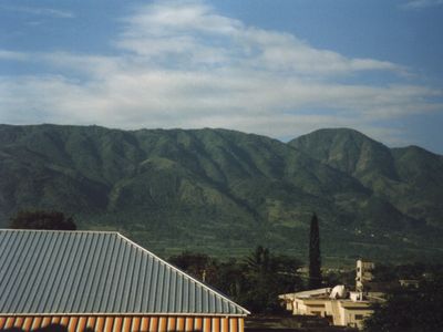
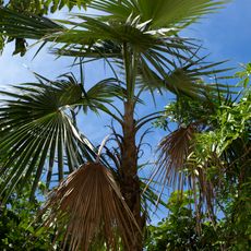
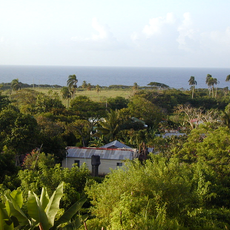
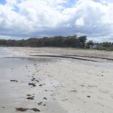
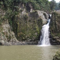
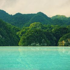
Jarabacoa is a municipality located in the Central Mountain Range at an elevation of 529 meters (1,736 feet), shaped by four major rivers: the Yaque del Norte, Jimenoa, Guanajuma, and Baiguate. These waterways flow through the region and define both the landscape and the daily patterns of life in this mountainous area.

History

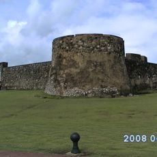
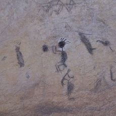
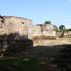
The area was initially inhabited by the Taino people, who named it 'Land of Waters', before Spanish conquistadors arrived searching for gold. These earliest residents shaped the region's identity and place name, while Spanish arrival transformed the territory's development.

Culture

The February Carnival brings together locals and visitors with traditional performances, while the June Flower Festival displays regional blooms. These celebrations shape community life and draw people who want to experience local customs and the connection between residents and their natural surroundings.

Practical

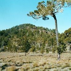
The location sits in the mountains, so expect changing weather and cooler temperatures, especially in early mornings and evenings. Good footwear and weather-appropriate clothing are helpful if you plan to explore rivers or hike in the surrounding area.

Did you know?

Visitors can still discover gold particles in local rivers by using traditional washing methods that have been practiced since colonial times. This hands-on activity connects today's experience directly with the economic activities of earlier centuries.

Location
Elevation above the sea
529 m
GPS coordinates
19.11972,-70.63833
Latest update
December 19, 2025 22:53

AroundUs brings together thousands of curated places, local tips, and hidden gems, enriched daily by 60,000 contributors worldwide. Discover all places nearby (La Vega Province).

Around this place
Pico Duarte
Dominican Republic

Pico Duarte

39.3 km
Monumento de Santiago
Dominican Republic

Monumento de Santiago

37.3 km
Teatro Nacional Eduardo Brito
Dominican Republic

Teatro Nacional Eduardo Brito

105.4 km
Flag Square of Santo Domingo
Dominican Republic

Flag Square of Santo Domingo

102.2 km
Dr. Rafael Ma. Moscoso National Botanical Garden
Dominican Republic

Dr. Rafael Ma. Moscoso National Botanical Garden

100.2 km
Dominican Republic

José Armando Bermúdez National Park

88.7 km
Fortaleza San Felipe
Dominican Republic

Fortaleza San Felipe

76.4 km
Dominican Republic

Pantoja

94.3 km
Pomier Caves
Dominican Republic

Pomier Caves

89.9 km
St. James the Apostle Cathedral, Santiago de los Caballeros
Dominican Republic

St. James the Apostle Cathedral, Santiago de los Caballeros

37.5 km
Winston Churchill Avenue, Dominican Republic
Dominican Republic

Winston Churchill Avenue, Dominican Republic

102.9 km
Santo Domingo Dominican Republic Temple
Dominican Republic

Santo Domingo Dominican Republic Temple

105.2 km
Fortaleza San Luis
Dominican Republic

Fortaleza San Luis

37.2 km
St. Philip the Apostle Cathedral, Puerto Plata
Dominican Republic

St. Philip the Apostle Cathedral, Puerto Plata

75.6 km
Dominican Republic

Museo Bellapart

103.4 km
Centro Israelita de República Dominicana
Dominican Republic

Centro Israelita de República Dominicana

104.7 km
Dominican Republic

Pueblo Viejo National Park

21.7 km
Encuentro Beach, Dominican Republic
Dominican Republic

Encuentro Beach, Dominican Republic

76.4 km
Abreu (distrito municipal)
Dominican Republic

Abreu (distrito municipal)

94.7 km
Puerto Plata Cable Car
Dominican Republic

Puerto Plata Cable Car

72.3 km
Cabarete Beach
Dominican Republic

Cabarete Beach

74.3 km
Casa Caoba (Trujillo)
Dominican Republic

Casa Caoba (Trujillo)

92.7 km
Playa Alicia
Dominican Republic

Playa Alicia

72.9 km
Playa Dorada
Dominican Republic

Playa Dorada

72.2 km
La Vega Vieja national park
Dominican Republic

La Vega Vieja national park

21.7 km
Salto de Jimenoa Uno
Dominican Republic

Salto de Jimenoa Uno

5.5 km
Playa Sosúa
Dominican Republic

Playa Sosúa

72.2 km
Los Haitises
Dominican Republic

Los Haitises

88.5 km
Show the full map
« Jarabacoa - Mountain municipality in La Vega Province, Dominican Republic » is provided by Around Us (aroundus.com). Images and texts are derived from Wikimedia project under a Creative Commons license. You are allowed to copy, distribute, and modify copies of this page, under the conditions set by the license, as long as this note is clearly visible.

Discover hidden gems everywhere you go!

From secret cafés to breathtaking viewpoints, skip the crowded tourist spots and find places that match your style. Our app makes it easy with voice search, smart filtering, route optimization, and insider tips from travelers worldwide. Download now for the complete mobile experience.

Around Us App Screenshot

A unique approach to discovering new places

Le Figaro

All the places worth exploring

France Info

A tailor-made excursion in just a few clicks

20 Minutes

Around Us
Travel Guide & Maps
Download

Send to your phone

QR Code
1

Open the camera app on your mobile.

2

Point at the QR code with your camera. A notification will appear.

3

Tap the notification to open the link.